Most homeowners do not start by thinking about maps. They start by thinking about space. A bigger kitchen. An extra bedroom in the roof. A dropped kerb so parking stops being a nightly negotiation. A garden office, a garage conversion, or a better laid-out driveway. The map question appears later, usually when the council checklist or architect asks for a location plan and a site plan and nobody is quite sure whether those are the same thing.
That confusion is expensive because different home projects trigger slightly different map priorities, but the underlying buying logic is consistent. Councils want to know where the property is, what land is included, and how the proposed works sit within the plot.
This guide is for homeowners trying to match the right planning maps to the right job. If you want the safe default route, use the site location plan and block plan together through the same planning maps workflow, then add CAD only if your designer needs editable files.

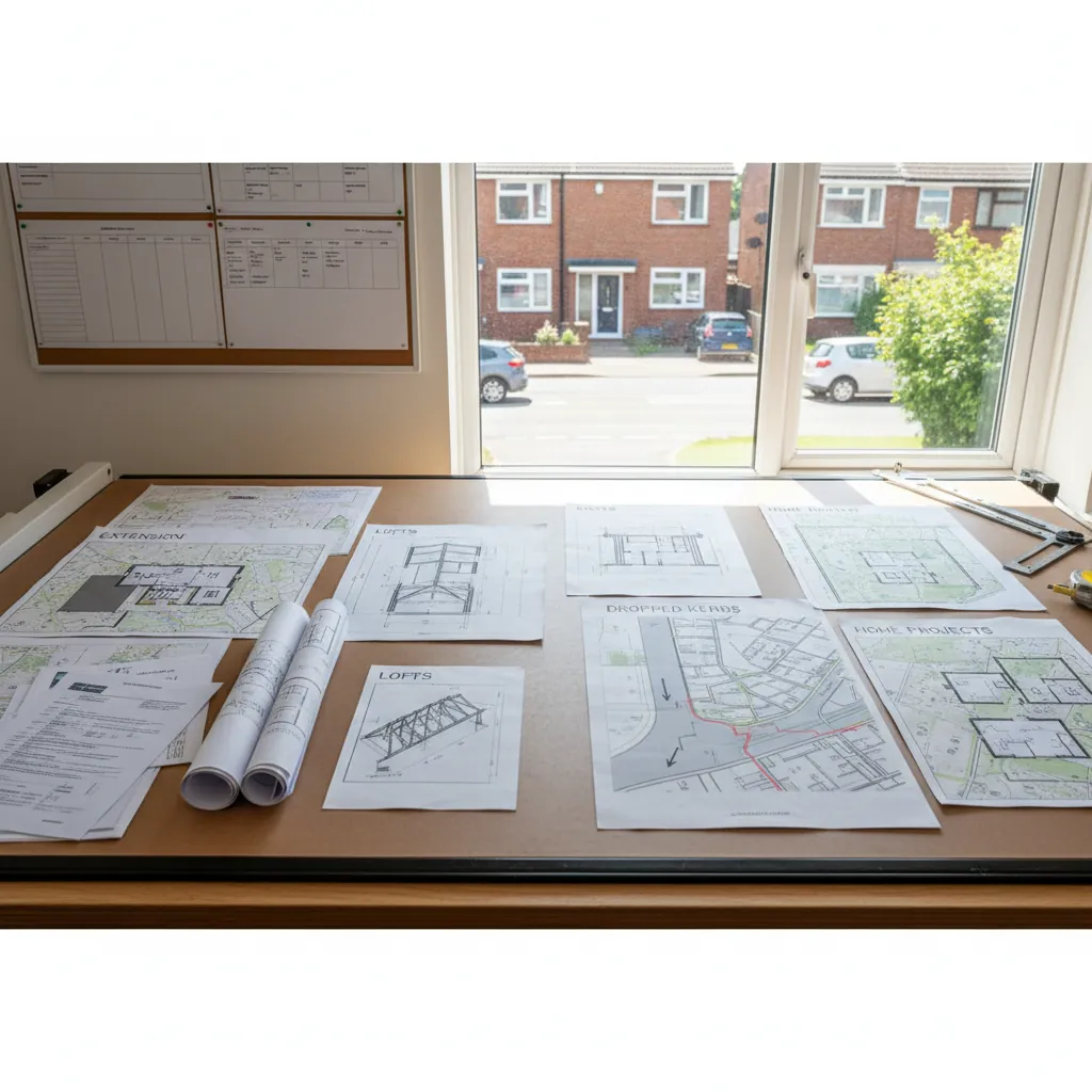
Extensions, loft conversions, dropped kerbs, outbuildings, and garage conversions all need the right planning maps.
Which planning maps do home projects usually need?
The short answer is that most residential projects need the same core pair of maps:
- A site location plan at 1:1250 to identify the property in context
- A block plan / site plan at 1:500 to show the detailed site layout and proposal relationship
That applies not just to extensions and loft conversions, but also to many dropped kerb applications, outbuildings, garage conversions, and Lawful Development Certificate submissions.
What changes from project to project is not usually the existence of the maps. It is the emphasis:
- Some projects are mainly about boundary and site layout
- Some are mainly about access and highway relationship
- Some are design-led and benefit from CAD
- Some need wider context because the site is awkward, rural, or split across multiple areas
Quick matrix: what should you buy for each project?
| Project type | Usual map pack | Why it matters | When to add CAD |
|---|---|---|---|
| Rear or side extension | Site location plan + block plan | Need wider context and detailed proposal layout | Add CAD if architect wants editable base |
| Loft conversion | Site location plan + block plan | Application still needs site identification and site layout context | Add CAD for architect-led drawing sets |
| Dropped kerb / driveway works | Site location plan + block plan | Access to the highway and frontage detail matter | Add CAD rarely, only if the designer asks |
| Garden room / outbuilding | Site location plan + block plan | Boundary position and neighbour relationship matter | Add CAD if producing fuller design packages |
| Garage conversion | Site location plan + block plan | Often still part of a wider planning or LDC pack | Add CAD if the project expands into larger redesign work |
For most domestic buyers, the practical answer is therefore: start with the standard pair, then only add extras if the site or designer demands them.
What every residential project has in common
Even though a loft conversion feels very different from a dropped kerb application, the planning map logic is similar.
The council needs a legal site reference
That is the job of the site location plan. It tells the authority which land the application relates to and shows the site boundary in its wider context.
The council needs a measurable site layout
That is the job of the block plan. It gives enough detail to understand buildings, access, boundary relationships, hardstanding, and the immediate plot arrangement.
The red-line boundary must be consistent
If you draw the red line one way on the location plan and another way on the detailed plan, the pack becomes internally inconsistent. That is why ordering both files from the same planning maps workflow is safer than creating them separately.
Permitted development still often needs maps
Homeowners sometimes assume maps only matter for full planning permission. In practice, if you are applying for a Lawful Development Certificate, the mapping requirement still matters because the authority still needs to identify the site and assess the relationship of the works to the property.
Extensions: the classic two-map project
For a rear extension, side extension, wraparound extension, or kitchen enlargement, the standard buying route is clear:
- Use a site location plan to identify the property and boundary
- Use a block plan to show the proposal on the plot
Why both?
Because extensions are not judged in isolation. The authority is thinking about:
- How the extension sits relative to the boundary
- Whether access or parking is affected
- How much garden remains
- How the site relates to neighbouring plots
The location plan gives the officer the wider site context. The block plan gives the detailed measurement framework. If you only submit the wider map, the extension cannot be assessed clearly. If you only submit the detailed map, the site may not be identified clearly enough at validation.
Loft conversions: why maps still matter even when the footprint barely changes
Loft conversions are where many homeowners get caught out because they think, reasonably enough, "I am building in the roof, not across the garden. Why would the map matter?"
It still matters because the planning submission is not just about internal accommodation. The application still sits on a plot, still needs a clear site reference, and often still involves wider planning drawings that must align to the mapped site boundary.
The typical loft conversion route is:
- Location plan to identify the property in context
- Block plan to show the site relationship and accompany the wider planning pack
- Additional architectural drawings such as elevations or roof plans to show the design specifics
If an architect is preparing the full drawing set, this is one of the situations where CAD planning maps can be helpful because the designer may want editable base mapping for the rest of the documents.
Dropped kerbs and driveway changes: access is the story
Dropped kerb projects are a useful reminder that not every application is about a new building footprint. Sometimes the planning issue is access, frontage, or highway relationship.
For a dropped kerb or major driveway change, the maps matter because they help show:
- The relationship to the public highway
- The width and arrangement of the frontage
- The access route from the property
- Any change to parking or hardstanding
This is also where incomplete red lines regularly cause trouble. If the access strip to the road is left outside the red line, the file can become misleading or incomplete. So even for a project that feels simpler than an extension, the standard mapping pair is still usually the correct place to start.
Quick matrix: what should you buy for each project?
Outbuildings and garden rooms: boundary clarity matters more than people expect
A garden office, studio, workshop, detached garage, or annex can feel like a small project because it sits within land you already own. But from the council's point of view, these are often exactly the kinds of proposals where a clear block plan matters.
The questions tend to be:
- How close is the structure to the boundary?
- Does the building relate sensibly to the existing house?
- Is access clear?
- Is the red-line site boundary properly defined?
That is why a block plan is so often part of the pack even when the building itself is relatively modest.
Garage conversions: simple project, same documentation discipline
Garage conversions sometimes proceed under permitted development, sometimes under full planning, and sometimes as part of a broader redesign. But the document discipline does not disappear just because the project feels straightforward.
If the authority asks for maps, the practical route is still:
- Site location plan for context
- Block plan for the detailed site relationship
- CAD only if the designer is working from editable mapping
This is also where homeowners often benefit from buying through the broader planning maps page because it makes it easier to keep the whole pack aligned if the project later expands beyond the original idea.
6 mistakes homeowners make when buying planning maps
1. Treating every home project as if it needs a different map type
In reality, the standard homeowner pair covers most jobs. The main variable is format and scale, not an entirely different product.
2. Assuming permitted development means no maps
If you want a Lawful Development Certificate, the mapping requirement still matters.
3. Drawing the red line only around the new work
For most residential projects, the boundary usually relates to the whole planning unit, not just the footprint of the extension, kerb, or garden room.
4. Forgetting access to the public highway
This is especially common on dropped kerb and driveway-related submissions, but it can affect any site where access matters.
5. Buying PDF when the architect has already asked for DWG
If a professional is preparing the wider package, ask early whether they want CAD planning maps. Buying the wrong format first often means paying twice.
6. Ordering location and block plans from different sources
That increases the risk of inconsistent boundaries, scale presentation, and general document mismatch.
Real scenarios: what should you order now?
"I am building a rear kitchen extension"
Buy the standard pair: site location plan plus block plan. Add CAD only if the architect asks for editable files.
"I am converting the loft and using an architect"
Buy the standard pair and strongly consider CAD planning maps if the architect is producing the wider set of drawings from the same base.
"I am applying for a dropped kerb"
Buy the standard pair and pay close attention to the frontage and highway access within the red line.
"I want a garden office at the bottom of the plot"
Buy the standard pair. The detailed plan is especially important because the position relative to boundaries is often what matters most.
"I am converting the garage, but the project may expand later"
Start with the planning map pack so the site documentation stays consistent if the application scope grows.
FAQ: planning maps for home projects
Q: Do extensions and loft conversions need the same maps?
A: Usually yes. Both generally need a site location plan for context and a block plan for site detail, even though the architectural drawings that accompany them may differ.
Q: Do I need planning maps for a dropped kerb?
A: In many cases, yes. Access to the highway and detailed frontage layout are exactly the kinds of issues the map documents help explain.
Q: What maps do I need for a Lawful Development Certificate?
A: Typically the same core planning maps as a standard application: the wider location plan and the detailed site plan. The authority still needs to identify the site and understand the relationship of the proposal to the plot.
Q: Is CAD necessary for home projects?
A: Not usually for simple homeowner-led submissions. It becomes useful when an architect or consultant needs editable mapping to build the rest of the drawing pack.
Q: Can I use one map for every type of home project?
A: Not one map, but one map pair covers most residential jobs very well: a 1:1250 site location plan and a 1:500 block plan.
Q: What is the safest way to avoid map mistakes?
A: Generate the site location plan and block plan through the same planning maps workflow so the boundary, base mapping, and overall pack stay aligned.
Conclusion
The easiest mistake homeowners make is assuming every project has its own special map rule. In practice, most extensions, loft conversions, dropped kerbs, outbuildings, and garage conversions start from the same solid foundation: a site location plan for context and a block plan for detail.
That is why the most practical route is to begin with the site location plan, add the matching block plan, and use the broader planning maps pack whenever you want the lowest-risk buying route for the project.
Get the right planning maps for your home project now and keep the council checklist moving in the right direction.