Council reporting
Aggregate any spatial dataset to ward / parish / district.
// 04 - boundaries
Every UK administrative boundary - county, district, ward, parish, parliamentary constituency.

// WHAT'S IN IT
OS Boundary-Line is the definitive set of UK administrative boundaries: countries, counties, districts, wards, parishes, parliamentary constituencies, European electoral regions and unitary authorities. Used everywhere from electoral analysis to council reporting to property aggregations.
We license Boundary-Line under enterprise terms with custom-clipping, full-history versions, and hosting alongside other paid products. Open-data variants exist; partners often prefer enterprise delivery for SLA, support and bundled licensing.
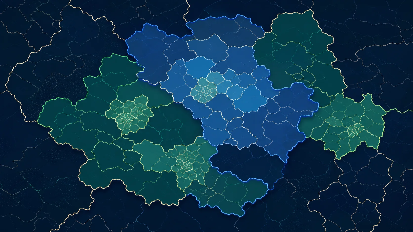
// SAMPLE
A representative render of Boundary-Line - production deliveries are tailored to your styling and area of interest.
// WHO LICENSES THIS
// COMMON USE CASES
Aggregate any spatial dataset to ward / parish / district.
Pricing zones aligned to administrative geography.
Catchment to LA / parish for retail and service planning.
Parliamentary constituency aggregations.
// COVERAGE & LICENSING
Every licence is sized to your actual usage. We'll always recommend the smallest coverage tier that solves your problem - and scale up as you do.
A specific site or property - typical for small consultancies and one-off projects.
A council area, county, region or custom polygon - typical for LAs, utilities and dev firms.
Full GB coverage - for prop-tech, insurance, multi-region utilities and national operators.
Custom AOI, mixed cadence, multi-tenant or co-built licence. We scope under NDA.
// SPECS & TECHNICALS
We can scope licensing at any of the following tiers - speak to us about anything in between.
All vector datasets ship with stable identifiers (TOID/OSID/UPRN) suitable for change-aware joining. Raster datasets ship with full georeferencing metadata. We can supply schema documentation, sample files and ETL guidance on request.
// FAQ
Enterprise customers value SLA-backed delivery, custom historic versions, and bundling with paid products under one contract and one partner.
Yes - every record carries GSS / ONS coding for joining to ONS statistics.
Yes - we can deliver versioned snapshots aligned to specific dates, useful for longitudinal analysis.
// REQUEST A QUOTE
Tell us your scope and use case - we'll come back with delivery options, formats and indicative pricing for Boundary-Line under NDA.
Prefer email? Write to data@planningmapsuk.co.uk.
// YOU MIGHT ALSO LICENSE
Boundaries & admin
Postcode polygons (full unit postcodes) - for joining, segmentation and reporting.
View datasetMasterMap & NGD
Britain's most detailed large-scale topographic map - 470M+ features, every building, road, fence and field.
View dataset