Drainage & SuDS
Surface water and drainage
- Flow paths and catchment delineation
- SuDS basin and swale design
- Pre-application drainage strategies
- Sense-check flood and runoff models
Licensed Ordnance Survey Terrain 5 elevation data with 5m contour intervals and 0.5m vertical accuracy, delivered as a separate DWG or DXF layer alongside your OS MasterMap CAD output.
Loading map...
Search an address to begin
By clicking "Buy & download now", you agree to our terms, refund and corrections policy.
Search an address to begin
By clicking "Buy & download now", you agree to our terms, refund and corrections policy.
OS Terrain 5 height data
Licensed Ordnance Survey Terrain 5 elevation data delivered as a separate contour layer in your DWG or DXF file. National coverage at 5-metre grid spacing with 0.5m typical vertical accuracy, ready to drop into AutoCAD, Civil 3D, Revit or Microstation.
5m
Grid resolution
0.5m
Vertical accuracy
DWG/DXF
Contour delivery
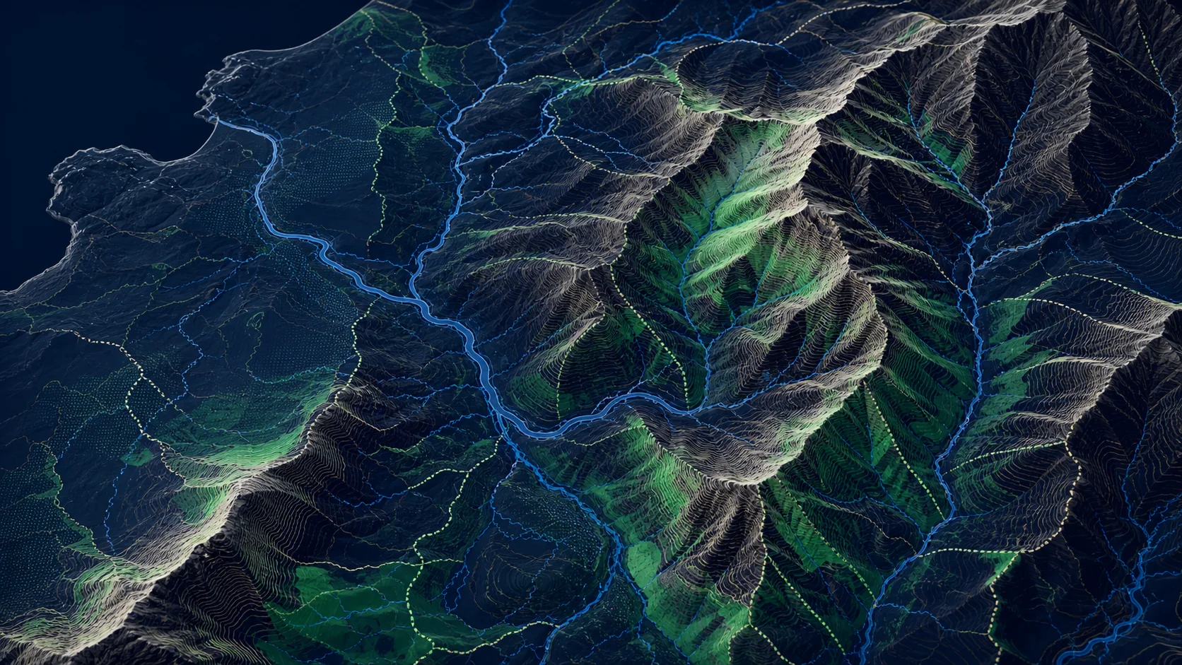
5m contour intervals shown with hillshade. Ordered as a separate layer alongside your CAD output.
Where it's used
5m contours sit in the sweet spot for site-scale work. Detailed enough for drainage runs, slope analysis and earthworks estimation, but fast to license and load compared to full LIDAR datasets.
Drainage & SuDS
Earthworks
Planning & landscape
What you get
Contours come as their own labelled layer inside the same DWG or DXF file as your OS MasterMap CAD output. No reprojecting, no merging, no manual labelling.
01
Search by address or postcode, then refine the boundary or drawn area directly on the map workspace.
02
CAD output is pre-selected with the OS Terrain 5 contour add-on already toggled on. Untoggle it any time if you only need the base mapping.
03
Pricing is based on the area you select, so you see the total cost before checkout. Larger sites scale predictably.
04
Contour layer arrives inside the same DWG and DXF as your OS MasterMap CAD output. Reorder or redownload from your account at any time.
Internal Linking Hub