CV training data
Building, vegetation and road segmentation models.
// 05 - imagery
Aerial imagery for analysis, validation, and CV pipelines - licensed, not scraped.

// WHAT'S IN IT
OS MasterMap Imagery Layer is a national mosaic of aerial imagery, licensed for analytical, derivative and operational use. Resolution varies by area - typically 25cm in urban areas, 50cm rural - captured on regular flying programmes.
Licensing is stricter than vector products because of capture cost, but partner-route licensing (which is what we offer) gives you clear permissions for ML training, derivative analytics and downstream productisation.
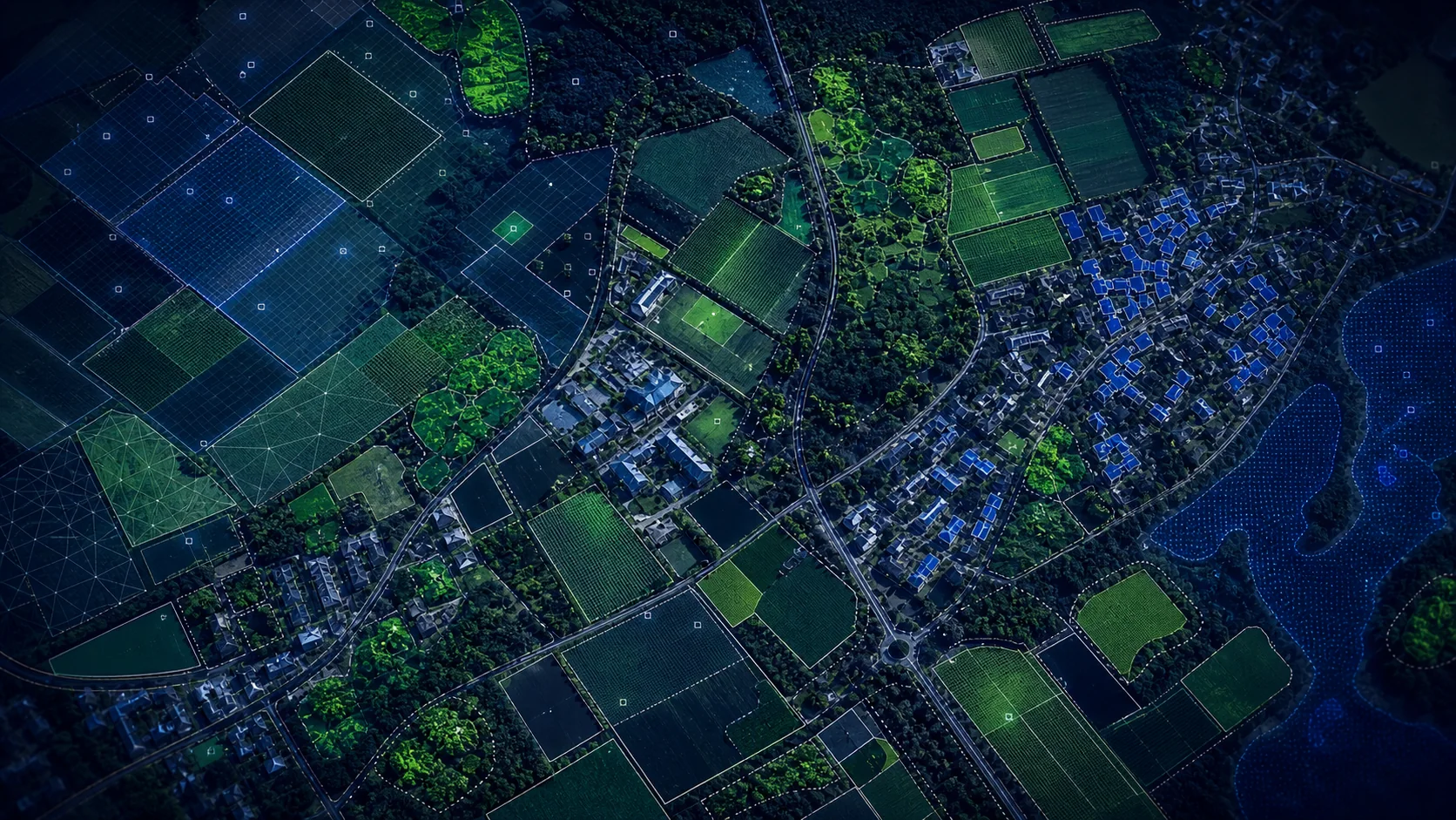
// SAMPLE
A representative render of Imagery Layer - production deliveries are tailored to your styling and area of interest.
// WHO LICENSES THIS
// COMMON USE CASES
Building, vegetation and road segmentation models.
Roof condition, outbuildings, swimming pools.
Canopy and roadside corridor monitoring.
Pre-survey desk validation against current imagery.
// COVERAGE & LICENSING
Every licence is sized to your actual usage. We'll always recommend the smallest coverage tier that solves your problem - and scale up as you do.
A specific site or property - typical for small consultancies and one-off projects.
A council area, county, region or custom polygon - typical for LAs, utilities and dev firms.
Full GB coverage - for prop-tech, insurance, multi-region utilities and national operators.
Custom AOI, mixed cadence, multi-tenant or co-built licence. We scope under NDA.
// SPECS & TECHNICALS
We can scope licensing at any of the following tiers - speak to us about anything in between.
All vector datasets ship with stable identifiers (TOID/OSID/UPRN) suitable for change-aware joining. Raster datasets ship with full georeferencing metadata. We can supply schema documentation, sample files and ETL guidance on request.
// FAQ
Yes - derivative and ML-training use is permitted under partner licensing terms; we will scope these explicitly in your contract.
Typically 25cm urban / 50cm rural. We can confirm exact resolution for your AOI before licensing.
Capture is on a rolling re-fly programme; recency varies by region - usually 1–3 years.
Yes - we can serve as PMTiles from R2 or via a tile API alongside the original GeoTIFF supply.
// REQUEST A QUOTE
Tell us your scope and use case - we'll come back with delivery options, formats and indicative pricing for Imagery Layer under NDA.
Prefer email? Write to data@planningmapsuk.co.uk.
// YOU MIGHT ALSO LICENSE
MasterMap & NGD
Britain's most detailed large-scale topographic map - 470M+ features, every building, road, fence and field.
View datasetMasterMap & NGD
Every building in Britain - geometry, height, age, use class and a stable OSID.
View datasetTerrain & elevation
1m LIDAR-derived terrain - site-level analysis, fine flood, drainage and CV pipelines.
View dataset