Site engineering
Cut-and-fill, drainage and earthworks at design resolution.
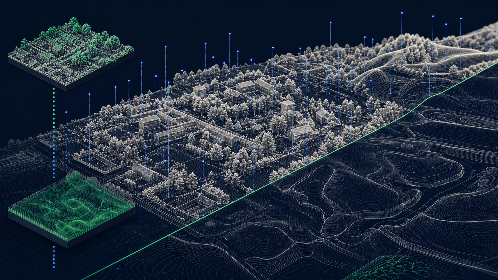
// 03 - terrain
1m LIDAR-derived terrain - site-level analysis, fine flood, drainage and CV pipelines.

// WHAT'S IN IT
OS Terrain 1m is a high-resolution LIDAR-derived terrain product covering most of GB at 1-metre grid spacing. Both DTM (bare earth) and DSM (with surface - buildings, vegetation) are available.
It's the right product for site-level engineering, fine-grained flood modelling, drainage design, solar PV roof analysis, and any computer-vision or analytics pipeline that needs to see terrain detail under a metre.
// SAMPLE
A representative render of Terrain 1m - production deliveries are tailored to your styling and area of interest.
// WHO LICENSES THIS
// COMMON USE CASES
Cut-and-fill, drainage and earthworks at design resolution.
2D hydraulic modelling at sub-metre detail.
Roof slope, aspect and shadowing for PV feasibility.
Building height extraction, vegetation classification.
// COVERAGE & LICENSING
Every licence is sized to your actual usage. We'll always recommend the smallest coverage tier that solves your problem - and scale up as you do.
A specific site or property - typical for small consultancies and one-off projects.
A council area, county, region or custom polygon - typical for LAs, utilities and dev firms.
Full GB coverage - for prop-tech, insurance, multi-region utilities and national operators.
Custom AOI, mixed cadence, multi-tenant or co-built licence. We scope under NDA.
// SPECS & TECHNICALS
We can scope licensing at any of the following tiers - speak to us about anything in between.
All vector datasets ship with stable identifiers (TOID/OSID/UPRN) suitable for change-aware joining. Raster datasets ship with full georeferencing metadata. We can supply schema documentation, sample files and ETL guidance on request.
// FAQ
Coverage is high but not 100% - we will scope your AOI and confirm coverage before licensing.
DTM strips buildings/vegetation (use for hydraulic modelling). DSM keeps them (use for solar PV, shadowing, view analysis). We can deliver both.
A 1km tile is ~1MB; a national delivery is hundreds of GB tiled.
Yes - we can serve elevation queries via API rather than shipping rasters.
// REQUEST A QUOTE
Tell us your scope and use case - we'll come back with delivery options, formats and indicative pricing for Terrain 1m under NDA.
Prefer email? Write to data@planningmapsuk.co.uk.
// YOU MIGHT ALSO LICENSE
Terrain & elevation
5m DTM with 0.5m vertical accuracy - the workhorse for landscape and flood analysis.
View datasetMasterMap & NGD
Connected hydrology - every river, stream, canal and watercourse, source-to-sea.
View datasetImagery
Aerial imagery for analysis, validation, and CV pipelines - licensed, not scraped.
View dataset