Catchment hydraulics
Regional flood and runoff modelling.
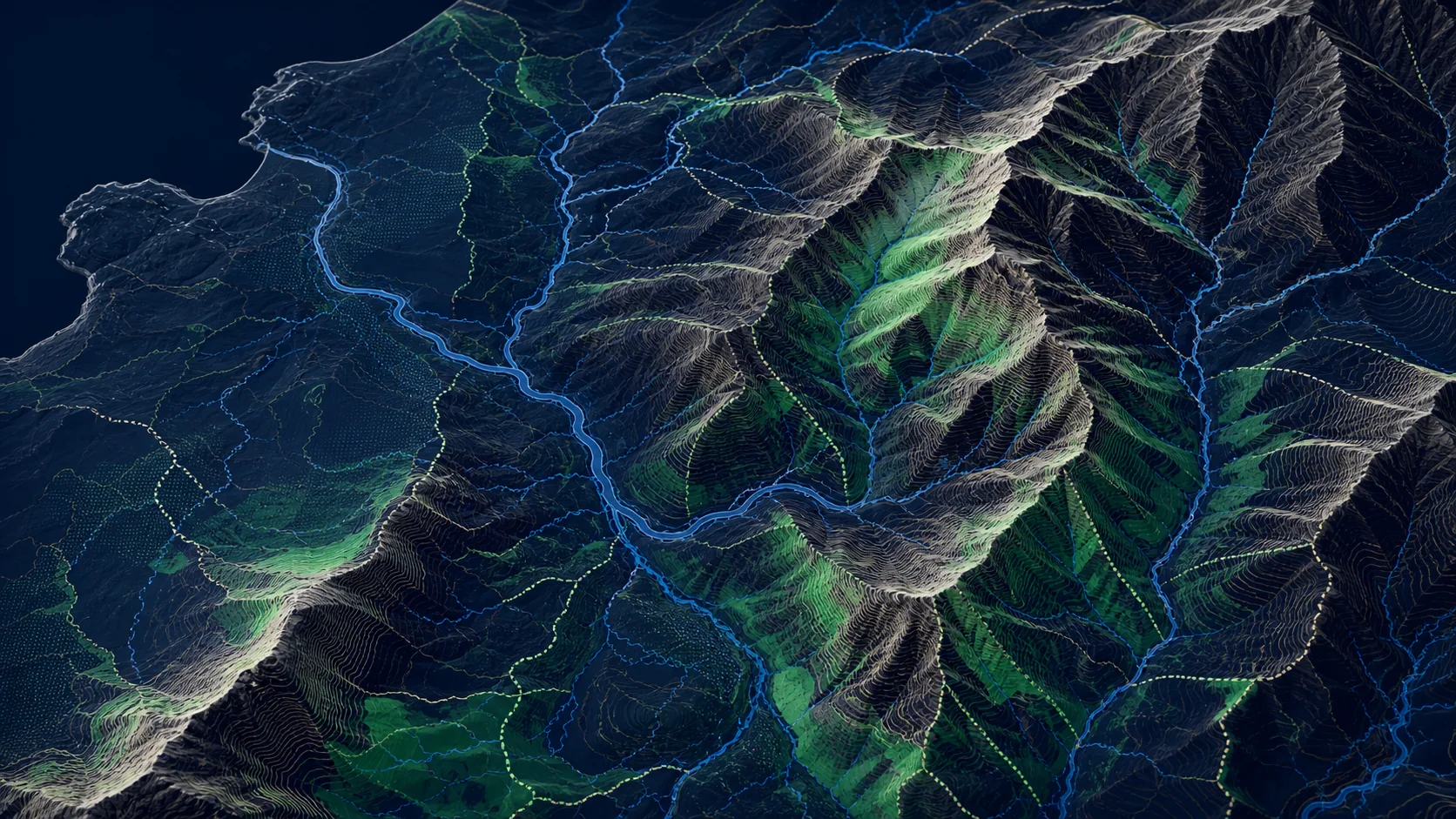
// 03 - terrain
5m DTM with 0.5m vertical accuracy - the workhorse for landscape and flood analysis.

// WHAT'S IN IT
OS Terrain 5 is a Digital Terrain Model at 5-metre grid spacing with 0.5m typical vertical accuracy. It's the standard product for regional landscape, slope and flood analysis where 1m LIDAR is overkill or unavailable.
Delivered as gridded raster (GeoTIFF) or as contours (GML/GeoPackage), it's the most commonly licensed terrain product after open-data Terrain 50.
// SAMPLE
A representative render of Terrain 5 - production deliveries are tailored to your styling and area of interest.
// WHO LICENSES THIS
// COMMON USE CASES
Regional flood and runoff modelling.
Slope, aspect and shadow analysis.
Cost-surface generation for utility corridors.
Viewshed and ZTV studies.
// COVERAGE & LICENSING
Every licence is sized to your actual usage. We'll always recommend the smallest coverage tier that solves your problem - and scale up as you do.
A specific site or property - typical for small consultancies and one-off projects.
A council area, county, region or custom polygon - typical for LAs, utilities and dev firms.
Full GB coverage - for prop-tech, insurance, multi-region utilities and national operators.
Custom AOI, mixed cadence, multi-tenant or co-built licence. We scope under NDA.
// SPECS & TECHNICALS
We can scope licensing at any of the following tiers - speak to us about anything in between.
All vector datasets ship with stable identifiers (TOID/OSID/UPRN) suitable for change-aware joining. Raster datasets ship with full georeferencing metadata. We can supply schema documentation, sample files and ETL guidance on request.
// FAQ
Terrain 5 blends LIDAR-derived data with photogrammetric and surveyed sources to give national coverage at 5m.
Terrain 5 is right for regional/national workloads. Terrain 1m is right when you need fine vertical detail (e.g. roof drainage, micro-flood).
Yes - contours are available as GML or GeoPackage at standard intervals.
A full GB Terrain 5 GeoTIFF is roughly tens of GB. We typically deliver tiled.
// REQUEST A QUOTE
Tell us your scope and use case - we'll come back with delivery options, formats and indicative pricing for Terrain 5 under NDA.
Prefer email? Write to data@planningmapsuk.co.uk.
// YOU MIGHT ALSO LICENSE
Terrain & elevation
National 50m DTM - generous in scale, perfect for context, summaries and dashboards.
View datasetTerrain & elevation
1m LIDAR-derived terrain - site-level analysis, fine flood, drainage and CV pipelines.
View datasetMasterMap & NGD
Connected hydrology - every river, stream, canal and watercourse, source-to-sea.
View dataset