Dashboards & basemaps
Lightweight relief context for national dashboards.
// 03 - terrain
National 50m DTM - generous in scale, perfect for context, summaries and dashboards.

// WHAT'S IN IT
OS Terrain 50 is a 50-metre national DTM. It's the right choice when you need elevation context across a region or the whole country - basemap relief shading, summary statistics, dashboard backdrops - without the storage and compute cost of finer products.
We license Terrain 50 alongside our other products under enterprise terms even though it has open-data variants, because most enterprise buyers want it bundled with bespoke regional cuts and SLA-backed delivery.
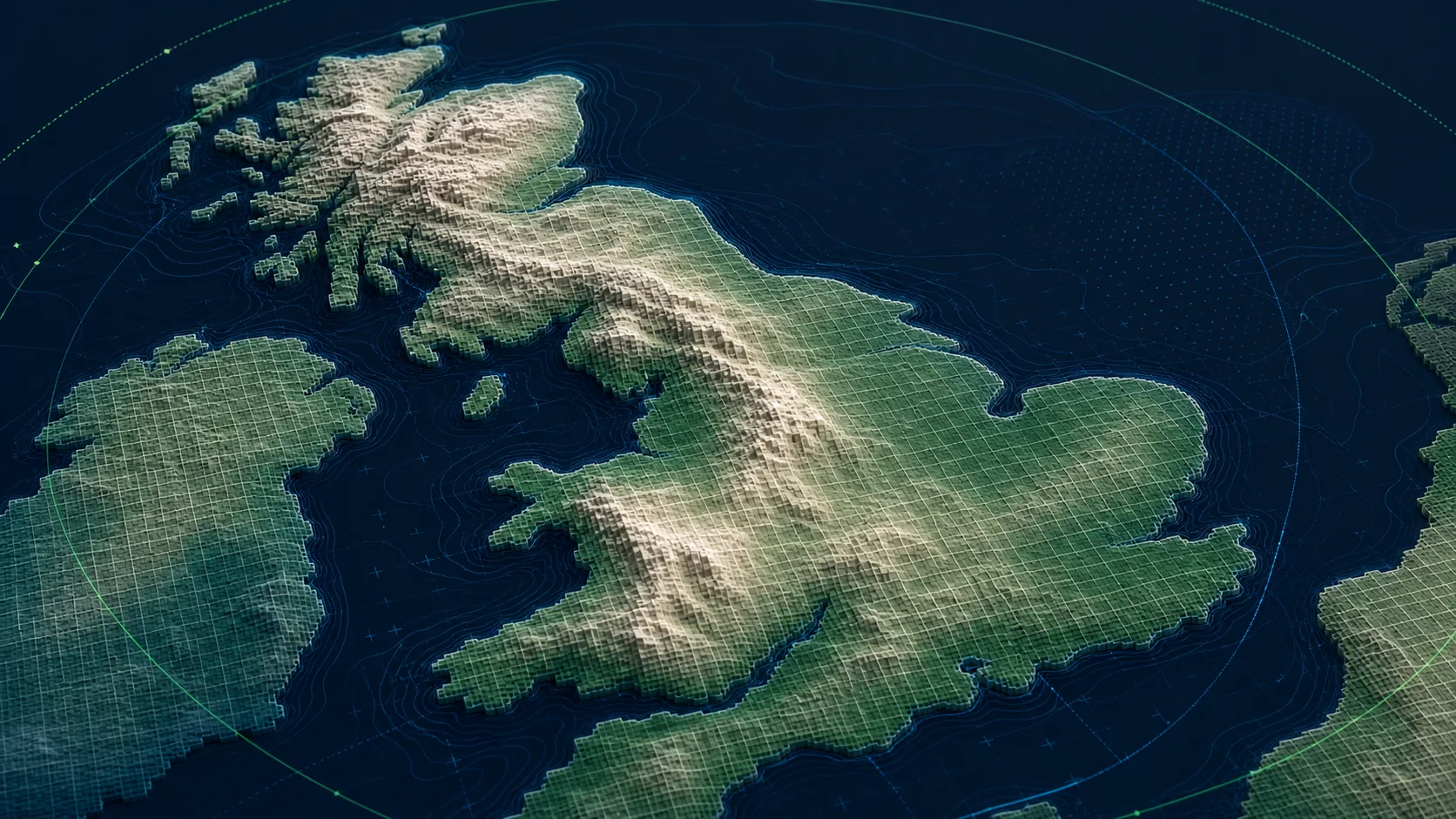
// SAMPLE
A representative render of Terrain 50 - production deliveries are tailored to your styling and area of interest.
// WHO LICENSES THIS
// COMMON USE CASES
Lightweight relief context for national dashboards.
Country-scale terrain analysis at low compute cost.
Hillshade for OS-style basemaps.
// COVERAGE & LICENSING
Every licence is sized to your actual usage. We'll always recommend the smallest coverage tier that solves your problem - and scale up as you do.
A specific site or property - typical for small consultancies and one-off projects.
Not availableA council area, county, region or custom polygon - typical for LAs, utilities and dev firms.
Full GB coverage - for prop-tech, insurance, multi-region utilities and national operators.
Custom AOI, mixed cadence, multi-tenant or co-built licence. We scope under NDA.
// SPECS & TECHNICALS
We can scope licensing at any of the following tiers - speak to us about anything in between.
All vector datasets ship with stable identifiers (TOID/OSID/UPRN) suitable for change-aware joining. Raster datasets ship with full georeferencing metadata. We can supply schema documentation, sample files and ETL guidance on request.
// FAQ
Yes - but enterprise customers often want it delivered alongside paid products under one contract, with bespoke clipping, hosting and SLA. That's what we provide.
50 is for national/regional context; 5 is for engineering work; 1m is for site-level analysis.
Yes - we can serve it from R2 as PMTiles or as raster tiles via our API.
// REQUEST A QUOTE
Tell us your scope and use case - we'll come back with delivery options, formats and indicative pricing for Terrain 50 under NDA.
Prefer email? Write to data@planningmapsuk.co.uk.
// YOU MIGHT ALSO LICENSE