Authoritative basemap
Underlay for every internal GIS app, planning portal, asset map and field tool.
// 01 - mastermap-ngd
Britain's most detailed large-scale topographic map - 470M+ features, every building, road, fence and field.

// WHAT'S IN IT
OS MasterMap Topography Layer is the definitive large-scale vector map of Great Britain. Every real-world feature - buildings, roads, paths, water, vegetation, structures and land parcels - is captured as a polygon, line or point with a persistent TOID identifier. It is the foundation layer underneath most professional GIS workflows in the UK.
We license MasterMap Topography for organisations that need authoritative basemap geometry: planning, asset management, surveying, infrastructure, insurance underwriting and prop-tech. Take the full national dataset, a tile-based regional cut, or a bespoke clip to your area of operations.
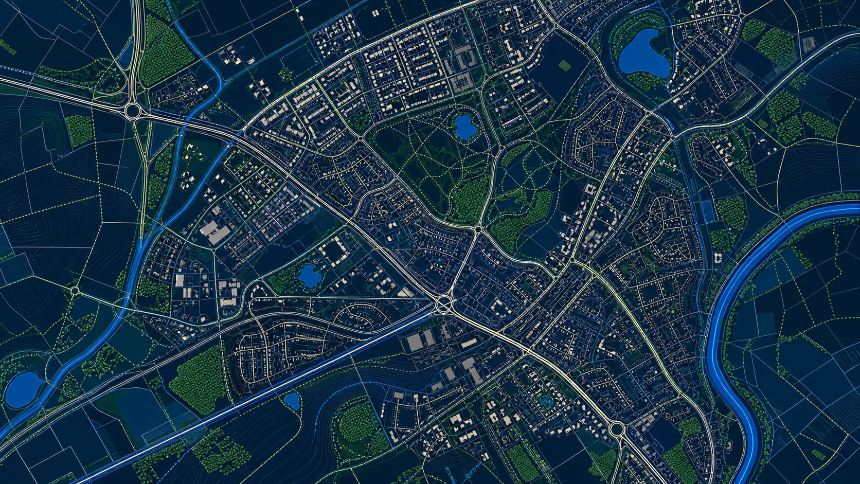
// SAMPLE
A representative render of MasterMap Topography - production deliveries are tailored to your styling and area of interest.
// WHO LICENSES THIS
// COMMON USE CASES
Underlay for every internal GIS app, planning portal, asset map and field tool.
Join your asset records to TOIDs for stable, change-aware referencing across releases.
Boundary derivation, site context, constraints overlays, application drawing.
Per-property attribution at policy inception - proximity, structure, exposure.
// COVERAGE & LICENSING
Every licence is sized to your actual usage. We'll always recommend the smallest coverage tier that solves your problem - and scale up as you do.
A specific site or property - typical for small consultancies and one-off projects.
A council area, county, region or custom polygon - typical for LAs, utilities and dev firms.
Full GB coverage - for prop-tech, insurance, multi-region utilities and national operators.
Custom AOI, mixed cadence, multi-tenant or co-built licence. We scope under NDA.
// SPECS & TECHNICALS
We can scope licensing at any of the following tiers - speak to us about anything in between.
All vector datasets ship with stable identifiers (TOID/OSID/UPRN) suitable for change-aware joining. Raster datasets ship with full georeferencing metadata. We can supply schema documentation, sample files and ETL guidance on request.
// FAQ
A full national release is published every six weeks. Change-only updates (COU) are available daily on appropriate subscription tiers, so your downstream systems only ingest deltas rather than the full dataset.
A TOID is a persistent identifier assigned to every MasterMap feature. It survives across releases, so you can attach your own attributes (asset IDs, inspection records, photos) to a TOID and they remain valid as the geometry is refined.
Yes - we offer single-site, regional, nation-wide and bespoke clips. Most enterprise customers start with a regional licence and scale up.
GeoPackage, GML, Shapefile, vector tiles, hosted WFS, or JSON via our API. Tell us your downstream stack and we will recommend the cleanest path.
Yes - change-only delivery is available as part of subscription tiers and dramatically reduces ingest cost for organisations with continuous data pipelines.
// REQUEST A QUOTE
Tell us your scope and use case - we'll come back with delivery options, formats and indicative pricing for MasterMap Topography under NDA.
Prefer email? Write to data@planningmapsuk.co.uk.
// YOU MIGHT ALSO LICENSE
MasterMap & NGD
Every building in Britain - geometry, height, age, use class and a stable OSID.
View datasetMasterMap & NGD
Land use, vegetation, greenspace, foreshore and natural features - the green and blue layer of GB.
View datasetMasterMap & NGD
A connected, routable national road network - every street, junction, restriction and average-speed segment.
View datasetAddressing & POI
Full address lifecycle - provisional, alternative, historic - for systems of record.
View dataset