Greenspace audits
Statutory greenspace and Open Space accessibility analysis.
// 01 - mastermap-ngd
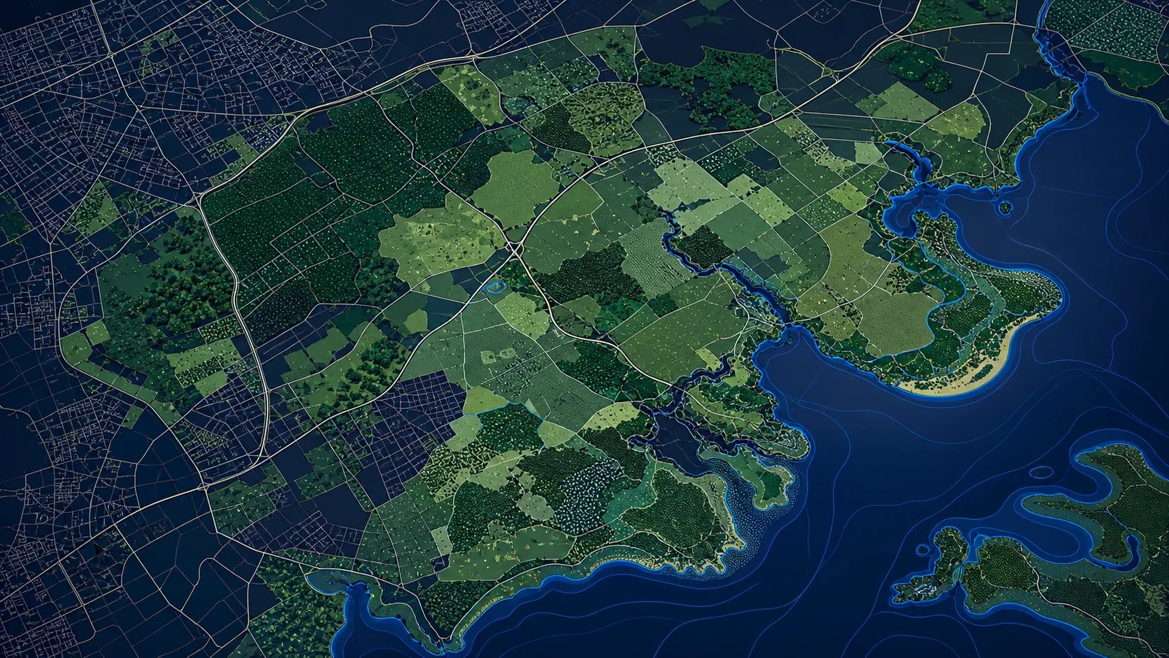
Land use, vegetation, greenspace, foreshore and natural features - the green and blue layer of GB.

// WHAT'S IN IT
The Land Features theme of the OS National Geographic Database covers everything that's not building, road or water-network: vegetation, parks, foreshore, sand, scree, rough grass, scrub, and surface use classifications. It's the layer behind biodiversity reporting, greenspace audits and local-plan evidence bases.
Land Features is structured the same way as the rest of NGD - OSIDs, themed attribution, 6-week refresh - so it composites cleanly onto Buildings, Transport and Water.
// SAMPLE
A representative render of NGD Land Features - production deliveries are tailored to your styling and area of interest.
// WHO LICENSES THIS
// COMMON USE CASES
Statutory greenspace and Open Space accessibility analysis.
Habitat baseline mapping for BNG metric calculation.
Land-use composition by ward, parish or designated area.
Surface-type breakdown around proposed developments.
// COVERAGE & LICENSING
Every licence is sized to your actual usage. We'll always recommend the smallest coverage tier that solves your problem - and scale up as you do.
A specific site or property - typical for small consultancies and one-off projects.
A council area, county, region or custom polygon - typical for LAs, utilities and dev firms.
Full GB coverage - for prop-tech, insurance, multi-region utilities and national operators.
Custom AOI, mixed cadence, multi-tenant or co-built licence. We scope under NDA.
// SPECS & TECHNICALS
We can scope licensing at any of the following tiers - speak to us about anything in between.
All vector datasets ship with stable identifiers (TOID/OSID/UPRN) suitable for change-aware joining. Raster datasets ship with full georeferencing metadata. We can supply schema documentation, sample files and ETL guidance on request.
// FAQ
Yes - NGD Land Features distinguishes private greenspace, public open space, and other vegetation classifications.
Land Features is a strong baseline input for BNG habitat mapping; most BNG workflows combine it with site survey data.
Both are themes of the same NGD database - they composite cleanly with shared geometry rules.
Yes - we can clip to any administrative boundary on request.
// REQUEST A QUOTE
Tell us your scope and use case - we'll come back with delivery options, formats and indicative pricing for NGD Land Features under NDA.
Prefer email? Write to data@planningmapsuk.co.uk.
// YOU MIGHT ALSO LICENSE
MasterMap & NGD
Every building in Britain - geometry, height, age, use class and a stable OSID.
View datasetMasterMap & NGD
Britain's most detailed large-scale topographic map - 470M+ features, every building, road, fence and field.
View datasetTerrain & elevation
5m DTM with 0.5m vertical accuracy - the workhorse for landscape and flood analysis.
View dataset