Flood modelling
Source-to-sea flow routing for catchment hydraulics.
// 01 - mastermap-ngd
Connected hydrology - every river, stream, canal and watercourse, source-to-sea.

// WHAT'S IN IT
OS MasterMap Water Network is a fully connected national hydrological network covering rivers, streams, canals and other watercourses. It models flow direction, source-to-sea connectivity, and links to OS hydrology subtypes.
It underpins flood modelling, environmental compliance, water-utility network operations and any analysis that needs to follow water through the landscape.
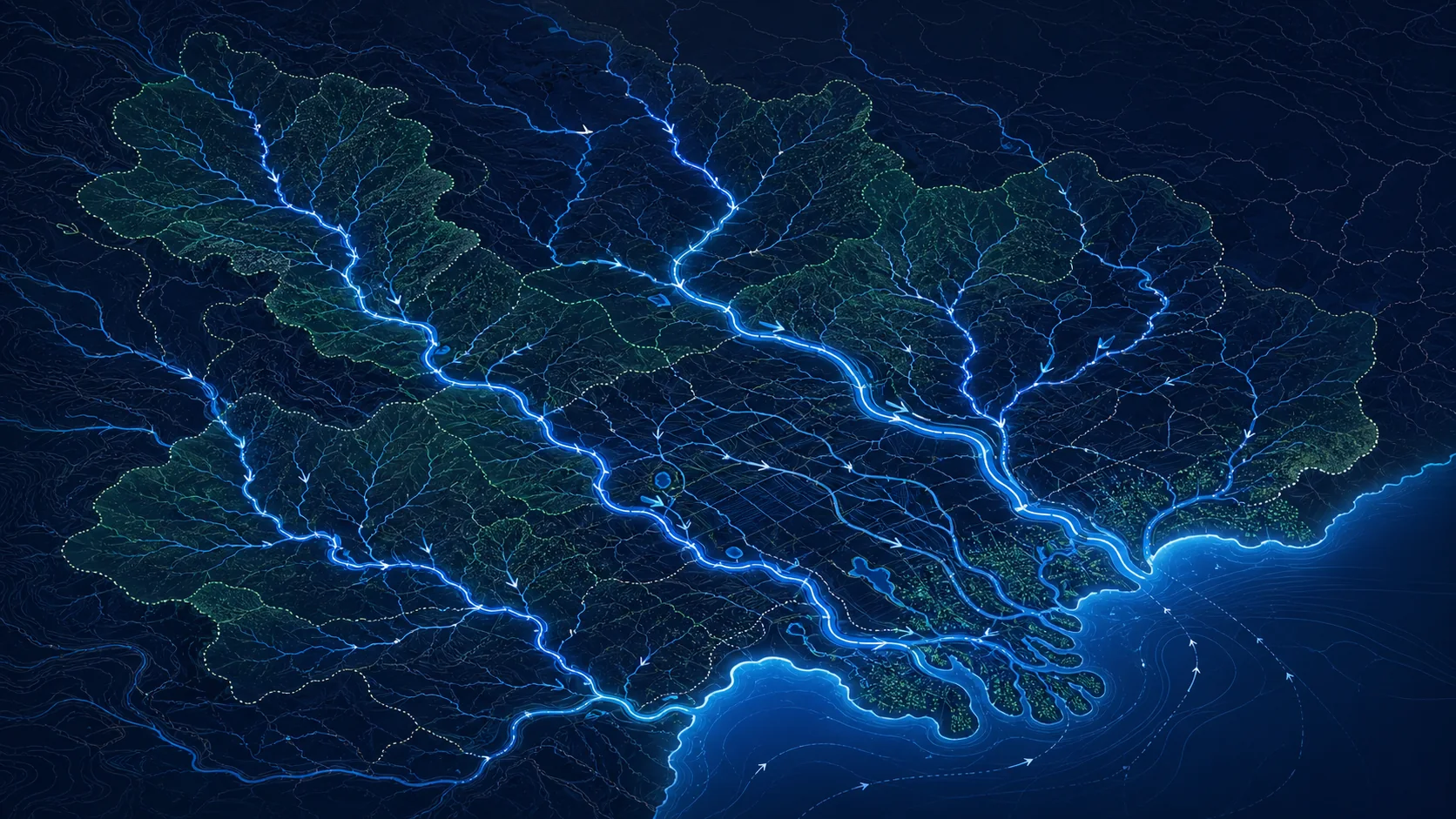
// SAMPLE
A representative render of Water Network - production deliveries are tailored to your styling and area of interest.
// WHO LICENSES THIS
// COMMON USE CASES
Source-to-sea flow routing for catchment hydraulics.
Downstream impact tracing for spills and contamination.
Water-utility network operations and consenting.
Buffer analysis around SACs, SSSIs and SPAs.
// COVERAGE & LICENSING
Every licence is sized to your actual usage. We'll always recommend the smallest coverage tier that solves your problem - and scale up as you do.
A specific site or property - typical for small consultancies and one-off projects.
A council area, county, region or custom polygon - typical for LAs, utilities and dev firms.
Full GB coverage - for prop-tech, insurance, multi-region utilities and national operators.
Custom AOI, mixed cadence, multi-tenant or co-built licence. We scope under NDA.
// SPECS & TECHNICALS
We can scope licensing at any of the following tiers - speak to us about anything in between.
All vector datasets ship with stable identifiers (TOID/OSID/UPRN) suitable for change-aware joining. Raster datasets ship with full georeferencing metadata. We can supply schema documentation, sample files and ETL guidance on request.
// FAQ
Yes - Water Network models directional connectivity and supports source-to-sea routing.
Yes - canals, navigations, drains and culverted sections are covered where surveyed.
Pairs cleanly with OS Terrain 5 / 1m for hydraulic modelling - we often license them together.
Yes - we can clip to a watershed, EA management catchment or any custom polygon.
// REQUEST A QUOTE
Tell us your scope and use case - we'll come back with delivery options, formats and indicative pricing for Water Network under NDA.
Prefer email? Write to data@planningmapsuk.co.uk.
// YOU MIGHT ALSO LICENSE
Terrain & elevation
5m DTM with 0.5m vertical accuracy - the workhorse for landscape and flood analysis.
View datasetTerrain & elevation
1m LIDAR-derived terrain - site-level analysis, fine flood, drainage and CV pipelines.
View datasetMasterMap & NGD
Britain's most detailed large-scale topographic map - 470M+ features, every building, road, fence and field.
View datasetBoundaries & admin
Every UK administrative boundary - county, district, ward, parish, parliamentary constituency.
View dataset