
There is a particular kind of email chain that anyone around planning, surveying or local authority GIS work will recognise.
It starts politely enough:
"Can you send the base map over as a shapefile?"
Then someone sends a PDF. Someone else asks whether the PDF can be "converted". A CAD file appears. A consultant opens it, finds the layers are not what their GIS needs, and the whole job loses a morning before anyone has even looked at the site properly.
That is the small but costly problem we wanted to remove.
PlanningMapsUK has traditionally been known for fast site location plans, block plans, and CAD planning maps in DWG and DXF. Those formats are still essential. Architects and technicians live in CAD. Councils still expect clean PDFs for ordinary planning submissions.
But a growing number of projects need something else: proper GIS-ready OS MasterMap exports. Not a screenshot. Not a flattened drawing. Not a PDF being dragged into QGIS and traced by hand.
So we now offer OS MasterMap CAD and GIS data with output options including:
- GeoPackage
- SHP ZIP (Shapefile package)
- GML
- DWG linework and colour
- DXF linework and colour
This guide explains what those GIS formats are, who needs them, and how to choose the right one without getting buried in file-format folklore.
Need OS MasterMap CAD or GIS data?
Order licensed OS MasterMap cuts for professional workflows, including DWG, DXF, GeoPackage, SHP and GML output options.
- GeoPackage, SHP and GML options
- DWG and DXF CAD outputs
- Built for GIS and design teams
Usually paired with CAD Planning Maps

OS MasterMap CAD and GIS exports turn mapped site data into practical working files for professional teams.
The Short Version
If you already know what you need, here is the quick answer.
| Format | Choose it when | Plain-English reason |
|---|---|---|
| GeoPackage | You use QGIS, ArcGIS or a modern GIS workflow | One tidy file, good support for layers and attributes |
| SHP ZIP | A client, council or older system specifically asks for shapefiles | Old, limited, but still very widely requested |
| GML | The specification asks for OS-style exchange data or XML-based GIS | Familiar in UK data exchange and standards-led workflows |
| DWG / DXF | An architect, surveyor or engineer needs CAD | Best for drawing and design, not database-style GIS analysis |
| You are submitting a normal planning application | Best for fixed, council-readable documents |
The most important thing is not choosing the "cleverest" format. It is choosing the format the next person in the chain can actually use.
That sounds obvious until you have watched a planning consultant try to upload a CAD file to a portal that only wants PDF, or a GIS officer receive a beautifully styled PDF when they asked for attribute data.

GeoPackage, SHP ZIP and GML solve different handover problems, even when they begin with the same mapped site.
What Changed on PlanningMapsUK?
We have added a focused CAD/GIS export workflow for professional OS MasterMap cuts.
The new route is built for users who need to select an area and download licensed Ordnance Survey base mapping in technical formats, rather than only producing a planning-document PDF.
In practical terms, that means you can:
- Search for the site or postcode.
- Refine the area you need on the map.
- Choose a CAD or GIS output.
- Select the scale and coverage area.
- Download the export through a secure order flow.
For everyday applications, the standard Ordnance Survey planning maps route is still the right place to start. For a design team asking for editable base mapping, the DWG maps or CAD route may be enough.
The new GIS options are for the moment when the brief says: "We need the data, not just the drawing."
Why GIS Formats Matter
A PDF map is like a printed page. It is excellent when you need everyone to see the same thing, at the same scale, with the same boundary and title block.
GIS data is different. It is more like a structured filing cabinet. The lines and polygons carry meaning. Roads, buildings, land parcels and water features can sit in separate layers. Attributes can travel with the geometry. The file can be analysed, clipped, joined, styled and checked against other datasets.
That matters when a project involves:
- Site appraisal across a wider area
- Land assembly and boundary comparison
- Constraints mapping
- Ecology or biodiversity work
- Asset registers
- Parish, local authority or estate mapping
- Utilities and infrastructure planning
- Larger residential or commercial developments
- Professional teams working across CAD and GIS software
One simple example: a PDF can show that a stream runs near a site. A GIS file lets a consultant load that water layer, measure distances, style the feature, compare it with flood information, and keep the geometry aligned with the rest of the project data.
The map has stopped being a picture. It has become part of the working dataset.
GeoPackage: The Sensible Modern Default
If nobody has handed you a strict specification and you simply need a good GIS file, GeoPackage is usually the format to look at first.
A GeoPackage is a single .gpkg file. Under the bonnet it is SQLite-based, which means it can hold multiple layers and attribute tables in one portable package. In day-to-day use, the advantage is refreshingly mundane: you are not chasing missing sidecar files across a shared drive.
Open it in QGIS, ArcGIS or another modern GIS tool and you have a clean, compact file that behaves like GIS data should.
GeoPackage is a good fit for:
- QGIS users who want a straightforward OS MasterMap base
- GIS consultants preparing constraints plans
- Planning teams building a project evidence base
- Organisations that want fewer loose files to manage
- Anyone who has been burned by half a shapefile going missing
The last point is not a joke. Shapefile has been around for a long time, and it is still useful, but it is also famous for being several files pretending to be one format. GeoPackage avoids a lot of that mess.
If your team says, "Send us the GIS version and we will take it from there," GeoPackage is often the cleanest answer.
SHP ZIP: Still Here Because Real Workflows Are Messy
Every few years someone announces the death of the shapefile. Then, somewhere in a council office, procurement document, environmental brief or legacy desktop GIS setup, it comes back to life.
That is why we offer SHP ZIP.
Strictly speaking, a shapefile is not one file. It is a bundle of related files: .shp, .shx, .dbf, often .prj, and sometimes others. Remove one piece and the dataset may open badly or not at all.
Packaging it as a ZIP keeps those pieces together.
Choose SHP ZIP when:
- The receiving organisation explicitly asks for SHP or Shapefile
- A legacy GIS system is part of the workflow
- A council, client or framework specification names shapefile as the required format
- You need broad compatibility more than a modern data container
The honest description of shapefile is this: it is old, limited, and still everywhere.
There are technical constraints around field names, data types and file structure, so it is not the format we would pick by default for a fresh modern GIS stack. But if the person receiving the data needs SHP, the "better" format is not better for that job.
Sometimes correct means compatible.
GML: Useful When the Specification Speaks GIS Standards
GML stands for Geography Markup Language. It is XML-based, which means it is often more verbose than the formats people use for daily desktop editing. You would not usually choose it because it is the prettiest file in the folder.
You choose GML because a specification, data exchange process or receiving system expects it.
In UK mapping workflows, GML has a familiar place. It is common in standards-led exchange, public-sector data handling, and workflows where the structure of the data matters as much as the way it looks on screen.
GML is worth considering when:
- A brief asks for OS-native or standards-based exchange
- You are passing data into a defined GIS import process
- The receiving team has asked for GML by name
- You need an XML-based spatial data format for compliance reasons
The best rule is simple: do not choose GML because it sounds official. Choose it because the receiving workflow has asked for it.
CAD vs GIS: They Are Not Competing Jobs
CAD and GIS often sit next to each other on the same project, but they solve different problems.
CAD is drawing-led. It is where an architect refines a layout, draws an extension, sets line weights, adds annotations and produces sheets.
GIS is data-led. It is where a team analyses features, joins layers, checks spatial relationships, maps constraints and manages attributes.
That is why the same site may need more than one output:
- DWG/DXF for the architect preparing drawings
- GeoPackage for a GIS consultant analysing constraints
- SHP ZIP for a local authority or older client system
- GML for a standards-led exchange process
- PDF for the final document uploaded to a planning portal
A useful way to think about it:
- If someone says, "I need to draw on it," think CAD.
- If someone says, "I need to analyse or load the data," think GIS.
- If someone says, "I need to submit it," think PDF.
The trouble starts when those three jobs are treated as the same thing.
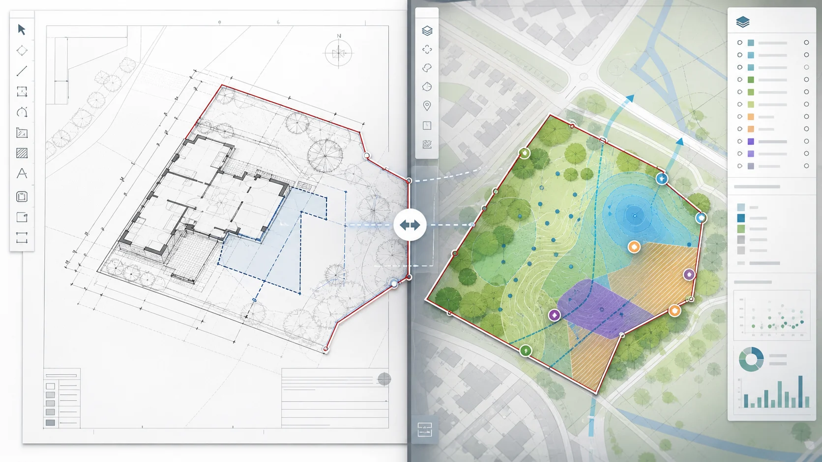
CAD is drawing-led, while GIS is data-led. Many professional projects need both outputs from the same reliable mapping base.
Five Times GIS Beats a PDF
PDF is still the right output for many planning documents. But there are situations where a GIS export will save time and reduce errors.
1. You need to combine the OS base with other datasets
Flood zones, habitat areas, ownership boundaries, utilities, tree constraints and local designations often arrive as spatial data. GIS formats let those layers sit together properly.
2. You need to measure and filter features
A PDF can be measured roughly if it is scaled correctly. GIS lets you query, select, filter and calculate from the geometry itself.
3. You are preparing an evidence base, not just a drawing
Neighbourhood plans, estate reviews, infrastructure studies and land promotion work often need repeatable mapping outputs. The base data becomes part of the record.
4. You need to hand data to another technical team
Consultants do not always want a finished drawing. Sometimes they want the base layer so they can run their own checks.
5. You want fewer manual redraws
Every time a PDF gets traced, there is a chance for small errors to creep in. Good source data keeps the team closer to the original mapping.
A Few Real-World Scenarios
Here are the kinds of jobs where the new GIS options make sense.
The planning consultant with three different specialists
The architect asks for DWG. The ecology consultant asks for GIS. The highways consultant wants context mapping around the access.
Nobody is being difficult. They are each asking for the format that fits their tools.
In that situation, ordering the right OS MasterMap export early avoids the familiar "can you convert this?" loop.
The parish council building a local evidence map
Parish and town councils often need mapping for assets, open spaces, footpaths, consultation areas or neighbourhood planning. A PDF is useful for a report, but not for maintaining the underlying spatial information.
GeoPackage or SHP can be a better fit because the data can be opened, styled and updated inside GIS software.
The land team checking a wider site
For larger plots, a simple 1:1250 location plan may not be enough. A team may need to see buildings, tracks, field boundaries, roads and water features across a broader area, then compare that base with ownership or constraints data.
That is GIS work, not just planning-document work.
How to Choose Between GeoPackage, SHP and GML
If the receiving team has already named a format, use that. It is the shortest route to a quiet inbox.
If nobody has named one, use this order of preference:
- Choose GeoPackage for modern desktop GIS, especially QGIS or ArcGIS.
- Choose SHP ZIP when a client, council or older system asks for shapefiles.
- Choose GML when the specification asks for standards-led or OS-style exchange.
There is no prize for sending the newest format to someone whose system cannot open it. Equally, there is no reason to choose shapefile out of habit when the team is perfectly happy with GeoPackage.
Ask one dull question before you buy:
"What software or import process will this file go into?"
That question prevents most format mistakes.

The right GIS export is the one that fits the receiving software, import process or specification.
What About Coordinate Systems?
For UK site work, professional mapping usually needs to sit in the British National Grid, commonly referenced as OSGB36 / EPSG:27700.
That matters because planning, surveying, local authority GIS and UK infrastructure datasets are often built around the same national grid reference system. If your base mapping arrives in the wrong coordinate system, it may appear in the wrong place, fail to overlay properly, or need extra transformation work before anyone can use it.
PlanningMapsUK's CAD/GIS workflow is designed around professional OS MasterMap use, so the output is intended for teams who expect UK mapping to align in that environment.
If you are not technical, you do not need to memorise EPSG codes. Just ask your consultant whether they need British National Grid GIS data. If they say yes, you are in the right territory.
A Note for Normal Planning Applications
If you are a homeowner applying for a rear extension, dropped kerb or lawful development certificate, you probably do not need GeoPackage, SHP or GML.
Most ordinary applications still need:
- A site location plan at 1:1250 or 1:2500
- A block plan or site plan at 1:500 or similar
- Clear red-line and blue-line boundaries where required
- A fixed PDF upload that the council can validate and publish
GIS exports are for the technical side of the project. They are extremely useful when you need them, but they are not a badge of seriousness for a straightforward householder submission.
That distinction matters. Buying the wrong professional file does not make an application stronger. Buying the right file for the right person does.
How to Order OS MasterMap GIS Data
You can start from the OS MasterMap CAD and GIS data page linked at the beginning and end of this guide.
The workflow is deliberately familiar:
- Open the map workspace.
- Search for the site address or postcode.
- Draw or refine the area you need.
- Select the scale and coverage area.
- Choose the primary output format: CAD or GIS.
- Complete checkout and download the export when ready.
If you are not sure whether you need CAD or GIS, ask the person receiving the file. Their answer is usually more useful than any format guide.
The best requests are short and specific:
- "Please send GeoPackage for QGIS."
- "Our system needs SHP."
- "The specification asks for GML."
- "The architect wants DWG."
Once you have that sentence, the order becomes much easier.
GIS Format FAQ
Can I get OS MasterMap as a GeoPackage?
Yes. PlanningMapsUK now offers OS MasterMap GIS exports including GeoPackage for modern GIS workflows.
Is GeoPackage better than Shapefile?
Often, yes, if you are choosing freely. GeoPackage keeps data in one file and suits current GIS tools well. Shapefile remains useful when a receiving organisation specifically asks for SHP.
What does SHP ZIP mean?
It means the shapefile parts are packaged together as a ZIP download. That helps avoid missing .shp, .shx, .dbf or projection files when the data is shared.
Should I choose GML for a council?
Choose GML if the council or specification asks for it. Do not assume GML is required for every planning job. Many council-facing planning submissions still want PDF documents, while GIS teams may ask for GML only in specific data workflows.
Do architects need GeoPackage?
Usually architects ask for DWG or DXF, because they are working in CAD or BIM software. GIS consultants, local authorities and data teams are more likely to ask for GeoPackage, SHP or GML.
Can I still order DWG and DXF?
Yes. The CAD/GIS workflow includes DWG and DXF options, and the existing CAD planning maps and DWG maps remain available for CAD-led work.
Final Thought
Good mapping is not just about accuracy. It is about sending the right kind of file to the right person at the right point in the project.
A PDF helps a planning officer validate a submission. A DWG helps an architect draw. A GeoPackage helps a GIS consultant analyse. A SHP ZIP keeps older systems happy. A GML file satisfies the brief that asks for structured exchange.
That is why these new GIS options matter. They make PlanningMapsUK more useful beyond the standard planning-map purchase, especially for teams who need OS MasterMap as working spatial data rather than a finished document.
Technical Deep-Dive: Why GeoPackage Outperforms ESRI Shapefiles
While the ESRI Shapefile remains widely requested due to 1990s institutional legacy, GIS professionals overwhelmingly prefer OGC GeoPackage (.gpkg) for robust spatial engineering:
1. The Shapefile dBASE III Limitations
- 10-Character Field Name Truncation: Shapefile attribute tables rely on legacy 1980s dBASE III architecture. Any attribute field longer than 10 characters is brutally truncated. In OS MasterMap, attributes like
descriptiveGroupbecomeDESCRIPTIV, andmakeOrThemebecomeMAKEORTHEM, destroying automated script pipelines. - The 2GB File Size Limit: Individual
.shpand.dbfcomponents cannot exceed 2 Gigabytes. On large infrastructure schemes (such as HS2 or major utility corridors), complex multi-polygon MasterMap datasets crash shapefile exports mid-stream. - The "Sidecar File" Vulnerability: A single Shapefile requires at least 4 to 6 separate physical files (
.shp,.shx,.dbf,.prj,.cpg,.sbn). If an assistant forwards a zip file missing the.prjor.shx, the dataset becomes unprojected and unusable.
2. The GeoPackage SQLite Advantage
- Single-File Container: A GeoPackage is a self-contained, serverless SQLite 3 database file containing all vector tables, raster tiles, and spatial indices.
- Unlimited Attributes and UTF-8 Support: Field names have no artificial length limits and natively support international character sets and metadata schemas.
- Direct Spatial SQL Queries: Analysts can query the
.gpkgdirectly using standard SQL without needing desktop GIS software:SELECT toid, descriptive_group, calculated_area_value FROM os_mastermap_topography WHERE descriptive_group = 'Building' AND calculated_area_value > 500;
The Power of the TOID: Linking Spatial Data to UPRNs and Land Registry
Every geographic feature in OS MasterMap carries a permanent, globally unique 16-digit Topographic Identifier (TOID) (e.g. osgb1000002134567890):
- Data Fusion in QGIS and PostGIS: By ordering your OS MasterMap cut in GeoPackage or GML, you retain raw TOID attributes. Spatial analysts can perform automated joins linking the physical building polygon to:
- AddressBase Premium UPRNs: Identifying the Unique Property Reference Number for every commercial unit or residential flat.
- HM Land Registry INSPIRE Polygons: Cross-referencing registered freehold boundary extents against physical MasterMap kerbs and fences.
- Valuation Office Agency (VOA) Rating Lists: Joining business rates assessments to MasterMap footprint polygons for commercial feasibility studies.
Spatial Coordinate Integrity: The OSTN15 / OSGM15 Transformation
A frequent point of failure in UK spatial analysis is coordinate system drift between global GPS satellites and national mapping:
- The Problem: GPS equipment, aerial drones, and web mapping APIs operate on the global WGS 84 (EPSG:4326) or Web Mercator (EPSG:3857) ellipsoids. British national planning operates exclusively on the British National Grid (OSGB36 / EPSG:27700).
- The Shift: Standard 7-parameter Helmert coordinate transformations produce spatial errors of up to 3.5 metres across the UK due to historic distortions in the 1936 triangulation network.
- The Solution: PlanningMapsUK GIS exports are pre-configured to utilize the definitive OSTN15 (Ordnance Survey National Transformation 2015) grid shift model. When you import our GeoPackage or SHP files into QGIS or ArcGIS Pro, vector geometries snap to true ground positions with absolute millimetre fidelity.
If your next project needs GIS-ready mapping, start with the OS MasterMap CAD and GIS export page and choose the format your team actually uses.