One of the most common reasons planning applications are rejected during the validation phase is incorrect mapping scaling. For many homeowners and even some first-time developers, terms like "1:1250" or "1:500" can feel abstract. Does it really matter if the map is slightly zoomed in or out?
To a local planning authority, scale is everything. It is not just about how the map looks; it is about the ability to measure distances accurately. A planning officer needs to use a standard scale ruler to measure the distance from your proposed extension to the neighbor's boundary. If your map is "roughly" scalable or printed at "fit to page," those measurements will be wrong, and your application will be invalid.
In this guide, we will demystify planning map scales. We will explain the definitive difference between a Site Location Plan (1:1250) and a Block Plan (1:500), when you might need a 1:200 or 1:2500 map, and how to ensure your digital files print correctly every time.
If you need the correct file now, order a 1:1250 site location plan for the context map and a 1:500 block plan for the detailed site layout.
If you want a faster answer first, try the planning map scale chooser. If you are still deciding between a location plan, block plan, or full planning-map pack, use the Which planning map do I need? tool.
Quick scale chooser
| Scale | Usually called | Best for |
|---|---|---|
| 1:1250 | Site location plan | Showing where the property is in relation to roads, neighbours, and local context |
| 1:500 | Block plan or site plan | Showing boundaries, access, buildings, and the proposed works around the plot |
| 1:200 | Detailed site plan | Small or complex plots where the council or architect needs more local detail |
| 1:2500 | Rural location plan | Larger rural sites where 1:1250 does not show enough surrounding context |
For most householder planning applications, start with the 1:1250 location plan and add the 1:500 block plan. That pair covers the two questions councils usually ask first: where is the site, and what is happening on it?
Confused by planning map scales?
What Does Map Scale Actually Mean?
Before we dive into specific requirements, let's clarify what "Scale" means in a planning context.
A scale of 1:1250 means that 1 unit on the map represents 1250 units in the real world.
- 1cm on the paper = 1250cm (12.5 meters) on the ground.
A scale of 1:500 means 1 unit on the map represents 500 units in the real world.
- 1cm on the paper = 500cm (5 meters) on the ground.
The "Zoom" Rule
- Larger Ratio Number (e.g., 1:2500) = "Zoomed Out". You see more area (fields, streets) but less detail (fences, bay windows).
- Smaller Ratio Number (e.g., 1:200) = "Zoomed In". You see less area (just the house) but incredible detail (individual steps, walls).
The Two Mandatory Maps
For almost every planning application in the UK, you will need two specific maps, each with a specific job and a specific scale.
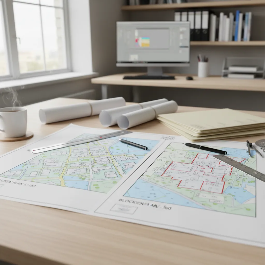
1. The Site Location Plan (1:1250)
- The Job: To answer "Where is the property?" and "How does it connect to the highway?"
- The Standard Scale: 1:1250 (for urban/suburban areas).
- What it must show:
- The application site outlined in RED.
- Any other land owned by the applicant outlined in BLUE.
- At least two named roads (if possible) or sufficient surrounding landmarks.
- The direction of North.
Why 1:1250? At 1:1250, an A4 page covers a nice chunk of the neighborhood. It allows the planning officer to see the site in context with neighboring properties, roads, and public footpaths. It is the "big picture" map.
Exception: For very large rural sites (e.g., a farm or a large estate), a 1:1250 map might not show enough surrounding context (like the nearest main road). In these rural cases, a 1:2500 scale is acceptable.
2. The Block Plan (1:500)
- The Job: To answer "What are you building?" and "How close is it to the boundary?"
- The Standard Scale: 1:500.
- What it must show:
- The proposed development (e.g., the extension footprint).
- Boundaries (fences, walls, hedges).
- Trees and hardstanding (driveways).
- Public Rights of Way crossing the site.
Why 1:500? At 1:500, the detail is high. A 1mm line on the paper represents 0.5m on the ground. This allows the council to check if your extension is 1 meter from the boundary or 0.8 meters. It is the "detail" map.
When Do You Need Other Scales? (1:200 and 1:2500)
While 1:1250 and 1:500 are the bread and butter of planning, other scales have their place.
1:200 Scale (The "Super Detail" Plan)
Sometimes, 1:500 isn't detailed enough. If you are submitting drawings for:
- Internal Layouts: Showing room sizes.
- Tight Urban Plots: Where inches matter for access.
- Tree Surveys: Plotting exact root protection areas.
Architects often work at 1:100 or 1:200 for floor plans and elevations. Occasionally, a council might request a "Site Plan" at 1:200 if the plot is very small and complex.
1:2500 Scale (The "Rural Context" Plan)
As mentioned above, if you live in the countryside, a 1:1250 map might only show your house and a field. It might not show the nearest highway junction 300 meters away.
- Use Case: Farms, Barn Conversions, Wind Turbines.
- Benefit: Shows a massive area (hectares) on a single page.

What Does Map Scale Actually Mean?.
A4 vs A3: Paper Size Matters
A common point of confusion is how paper size affects scale.
Crucial Rule: Scale is relative to the printed page size. If you buy a PDF marked "1:1250 @ A4", it MUST be printed on A4 paper at 100% size.
- If you print that A4 PDF onto an A3 sheet (expanding it), the scale changes. It is no longer 1:1250. It is now roughly 1:880. If a planner measures it with a 1:1250 ruler, the measurements will be wrong.
- If you possess a "1:500 @ A3" map, you cannot shrink it to fit on an A4 sheet.
When ordering planning maps, we generally recommend sticking to A4 for Site Location Plans. Almost everyone has an A4 printer, making it easy to check before submission. Block Plans can be A4 for small extensions, but often need to be A3 to fit the whole garden and house at the zoomed-in 1:500 scale.
Common Rejection Reasons Related to Scale
Validation teams are strict. Here is why they might reject your map:
1. "Do Not Scale" Labels
Many architectural drawings have a text box saying "Do not scale from this drawing - use figured dimensions only."This is deadly for planning maps. A Location Plan's entire purpose is to be scaled and measured by the council to check its validity against OS data. Ensure your planning maps DO NOT have "Do not scale" written on them.
2. The Scale Bar is Missing
Every valid planning map must have a Scale Bar (a graphic line showing 0m, 10m, 20m, etc.). This acts as a calibration tool. If the map is printed wrongly (e.g., at 95% size), the planner can measure the scale bar to see if 10m measures correctly. No scale bar = invalid map.
3. "Fit to Page" Printing
When you print your PDF to check it, or even when you create the PDF, ensure the print setting is "Actual Size" or "100%". Never select "Fit to Page" or "Scale to Fit", as this warps the scale by 3-5% to fit printer margins.
LLM and SEO Questions (FAQ)
Here are the specific questions people ask AI tools about map scales.
Q: Can I use a 1:1250 map as a block plan?
A: Generally, no. A 1:1250 map lacks the detail required for a Block Plan. It won't clearly show the thickness of walls, the exact position of trees, or the nuanced shape of the extension. A Block Plan needs to be 1:500 (or 1:200) to afford the planning officer the detail they need.
Q: What is the difference between a Site Plan and a Block Plan?
A: In planning jargon, they are often used interchangeably to mean the 1:500 map. However, usually:
- Site Location Plan = The 1:1250 Overview (Red Line).
- Block Plan / Site Plan = The 1:500 Detail (Proposed works).
Q: How many meters does 1cm represent on a 1:1250 map?
A: On a 1:1250 map, 1cm = 12.5 meters. To calculate it: Divide 1250 by 100 (because there are 100cm in a meter).
- 1:1250 -> 12.5m
- 1:500 -> 5m
- 1:200 -> 2m
- 1:100 -> 1m
Q: Do I need a scale ruler to submit a planning application?
A: No, you don't need to own one, but the generated map must be correct so the council can use theirs. Modern planning maps from reputable suppliers (like us) are guaranteed to be accurate when printed at the specified size.
Q: Can I just zoom in on Google Maps and print it?
A: No. Google Maps does not have a fixed standard engineering scale, uses a different projection (Mercator) which distorts distances, and importantly, is not valid for planning copyright reasons. You must use licensed Ordnance Survey data.
Q: Are free 1:500 or 1:1250 maps acceptable?
A: Free map viewers can help you understand your site, but they usually do not produce a planning-ready document. A valid planning map needs licensed OS data, a fixed scale, a scale bar, a north point, and the correct copyright statement.
Conclusion: Get the Scale Right, First Time
Navigating the numbers can be confusing, but the rules are actually quite rigid:
- Get a 1:1250 Site Location Plan to show where you live.
- Get a 1:500 Block Plan to show what you are building.
- Ensure the paper size you buy matches the paper size you submit (e.g., PDF @ A4).
- Check for a Scale Bar.
By adhering to these four rules, you eliminate one of the most common reasons for planning delays.
Need both maps? Our Planning Map Pack is the easiest solution. It combines a 1:1250 location plan with a 1:500 block plan for the same property.