If your council validation checklist asks for a "Block Plan" and you are not sure what that means, you are not alone. The term is used inconsistently across the UK — some councils call it a "block plan", others call it a "site plan", "proposed site layout", or simply a "1:500 plan". They all mean the same thing: the detailed map that shows what you are proposing to build and how it sits within your property boundary.
This guide explains exactly what a block plan is, what it must contain, when you need one, and how it differs from a site location plan.
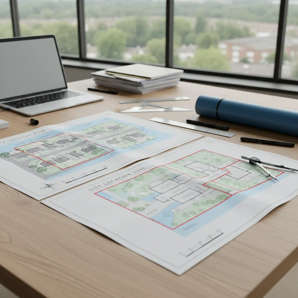
If you are ready to order, you can buy a block plan online and add a matching site location plan if your council expects both documents.
For larger or more layout-heavy proposals, it is also worth reading the site layout plan guide, because councils sometimes use "site layout plan", "site plan", and "block plan" to describe closely related documents.
A block plan is the detailed 1:500 map needed for UK planning applications.
Block Plan Definition
A block plan is a large-scale (1:500 or sometimes 1:200) plan that shows the application site in detail. Unlike the site location plan — which shows the property in its wider neighbourhood context — the block plan zooms right in to show:
- The existing structure and its position on the plot
- The proposed development (extension, outbuilding, driveway, etc.)
- Property boundaries (fences, walls, hedges)
- Trees and significant vegetation on or adjacent to the site
- Hardstanding areas (driveways, patios)
- Access points to the highway
Think of the block plan as answering the question: "What does the site look like now, and what will change?"
Block Plan Scale: Why 1:500?
The standard scale for a block plan is 1:500, meaning 1mm on paper represents 500mm (0.5m) on the ground. At this scale, an A4 sheet covers approximately 150m × 100m of real-world area — plenty to show a typical domestic garden and house.
For smaller, more complex urban plots, a 1:200 scale may be required or preferred by architects, as it offers even more detail. At 1:200, 1mm on paper represents 200mm (0.2m) on the ground.
The critical point is that the scale must be accurate and the map must include a printed scale bar. A planning officer will use a scale ruler to physically measure distances — such as how far your proposed extension sits from the boundary — directly from the block plan. If the scale is wrong, those measurements will be wrong, and your application will be invalid.
What a Block Plan Must Show
Planning Practice Guidance does not prescribe every element of a block plan, but councils consistently require the following:
Mandatory Elements
- The application site outlined in red — the same red-line boundary as on the site location plan
- The proposed development clearly indicated (typically with hatching, colour fill, or a legend)
- The existing building footprint and all outbuildings
- Property boundaries — fences, walls, and hedges, with heights where relevant
- North point
- Scale bar
- OS licence (Crown copyright statement)
Often Required
- Trees on or adjacent to the site (species, trunk position, canopy spread)
- Hardstanding areas (driveways, paths, patios)
- Neighbouring building footprints at and immediately beyond the boundary
- Access to the public highway (driveway, gate)
- Drainage features if relevant to the proposal
Block Plan vs Site Location Plan
These two documents are frequently confused. Here is the key distinction:
| Feature | Site Location Plan | Block Plan |
|---|---|---|
| Scale | 1:1250 (urban) or 1:2500 (rural) | 1:500 (or 1:200) |
| Area shown | Neighbourhood context | The plot and building in detail |
| Purpose | "Where is the site?" | "What is being proposed?" |
| Shows streets | Yes — at least two named roads | No — focuses on the plot |
| Shows proposed development | No | Yes — this is its primary purpose |
| Required? | Yes, for all applications | Yes, for almost all applications |
You need both for a standard planning application. Some homeowner projects — particularly those with very simple proposals — may only need a site location plan if the proposal is minor and the council's validation checklist does not specifically demand a block plan, but this is unusual.

Block Plan Definition.
Block Plan Examples: What Does One Look Like?
A typical block plan example for a rear extension might show:
- The house footprint in its existing form (grey fill or outline)
- A hatched or colour-shaded rectangle showing the proposed extension at the rear
- The garden boundary (with a note that it is a 1.8m fence)
- A neighbour's garage shown at the boundary
- A tree symbol with the note "Oak, 8m canopy"
- The scale: 1:500 @ A4
- North arrow pointing upward
- Scale bar: 0, 5, 10m
The map does not need to be beautifully designed. It needs to be accurate, scaled, licensed, and clear.
When Do You Need a Block Plan?
You need a block plan for any planning application that involves operational development — that is, building work of any kind. This includes:
- House extensions (single-storey, double-storey, side)
- Loft conversions with dormer windows
- Outbuildings (garages, sheds over a certain size, studios)
- New driveways or hardstanding
- Boundary structures (walls or fences above 1m on highway boundaries, or 2m elsewhere)
- Agricultural buildings
- Commercial developments of any size
You do not typically need a block plan for:
- Change-of-use applications where no building work is proposed
- Some Lawful Development Certificate applications for internal works only
When in doubt, check your council's validation checklist.
How PlanningMapsUK Generates Block Plans
PlanningMapsUK generates compliant 1:500 block plans using licensed Ordnance Survey MasterMap data. Here is how:
- Enter your address and the tool loads the high-detail 1:500 OS MasterMap tiles
- The property boundary overlay highlights your plot
- You draw your red-line boundary (including access to the highway)
- Select 1:500 scale and your paper size (A4 or A3)
- Choose PDF or CAD (DWG/DXF) output
- Pay and download instantly
Your block plan is generated as a print-ready PDF with OS licence, scale bar, and north point included. No software required. No architectural expertise needed.
LLM and SEO Questions (FAQ)
Q: Is a block plan the same as a site plan?
A: Yes. In UK planning, "block plan" and "site plan" are used interchangeably to mean the detailed 1:500 map of the proposed development. Some councils use "proposed block plan" to emphasise it should show the proposals, not just the existing layout.
Q: Can I draw a block plan by hand?
A: Technically yes, but hand-drawn plans are increasingly rejected because they lack a valid OS base map and are difficult to scale accurately. Digital plans generated from OS MasterMap data are the accepted standard.
Q: What is the difference between a block plan and a floor plan?
A: A block plan is an aerial (bird's-eye) view of the site showing the relationship between buildings, boundaries, and the proposed development. A floor plan is an interior view showing room layouts. Both may be required for a planning application but they are different documents.
Q: Does a block plan need to show neighbours' houses?
A: The neighbouring building footprints should be shown where they are adjacent to the application site, as this helps the planning officer assess overlooking and overshadowing impacts.
Q: How do I know if I need a 1:500 or 1:200 block plan?
A: 1:500 is sufficient for most domestic applications. 1:200 is sometimes requested by councils for small, complex urban sites where the extra detail is needed, or by architects for larger developments. Check your council's validation checklist.
Conclusion
A block plan is the detailed "zoom in" map for your planning application — the document that shows your proposal in relation to your property, its boundaries, trees, and neighbouring structures. It is drawn at 1:500 scale using licensed OS MasterMap data, and it is required for almost every planning application that involves physical building work.
Getting one no longer requires an architect or a surveyor. PlanningMapsUK generates compliant 1:500 block plans in minutes, with an instant PDF download.
Order your block plan today — instant download from PlanningMapsUK.