A dropped kerb sounds like a small project.
There is no new room. No roof. No extension wall. Just a lower kerb, a driveway, and a better way to get the car off the road.
But from a planning and highways point of view, a dropped kerb is all about access. Where does the property meet the road? What land is being used? Is the frontage clear? How does the proposed crossing relate to the public highway?
That is why maps matter.
If your dropped kerb or driveway access needs a planning application, certificate, or council approval package, the map cannot be an afterthought. It needs to show the site, the frontage, and the access relationship clearly.
Use this checklist before you submit.

Applying for a dropped kerb or driveway access?
First, check whether planning permission is needed
Not every dropped kerb project follows the same route.
You may need permission or approval depending on:
- Whether the road is classified
- Whether you are creating or changing access
- Whether hardstanding is being added
- Drainage and surfacing
- Local council rules
- Highway authority requirements
- Whether the property is listed or in a sensitive area
Some homeowners need planning permission. Some need separate highway approval. Some need both. Some may not need planning permission but still need a licensed contractor and council consent for work to the public highway.
The map requirement depends on the route you are told to follow.
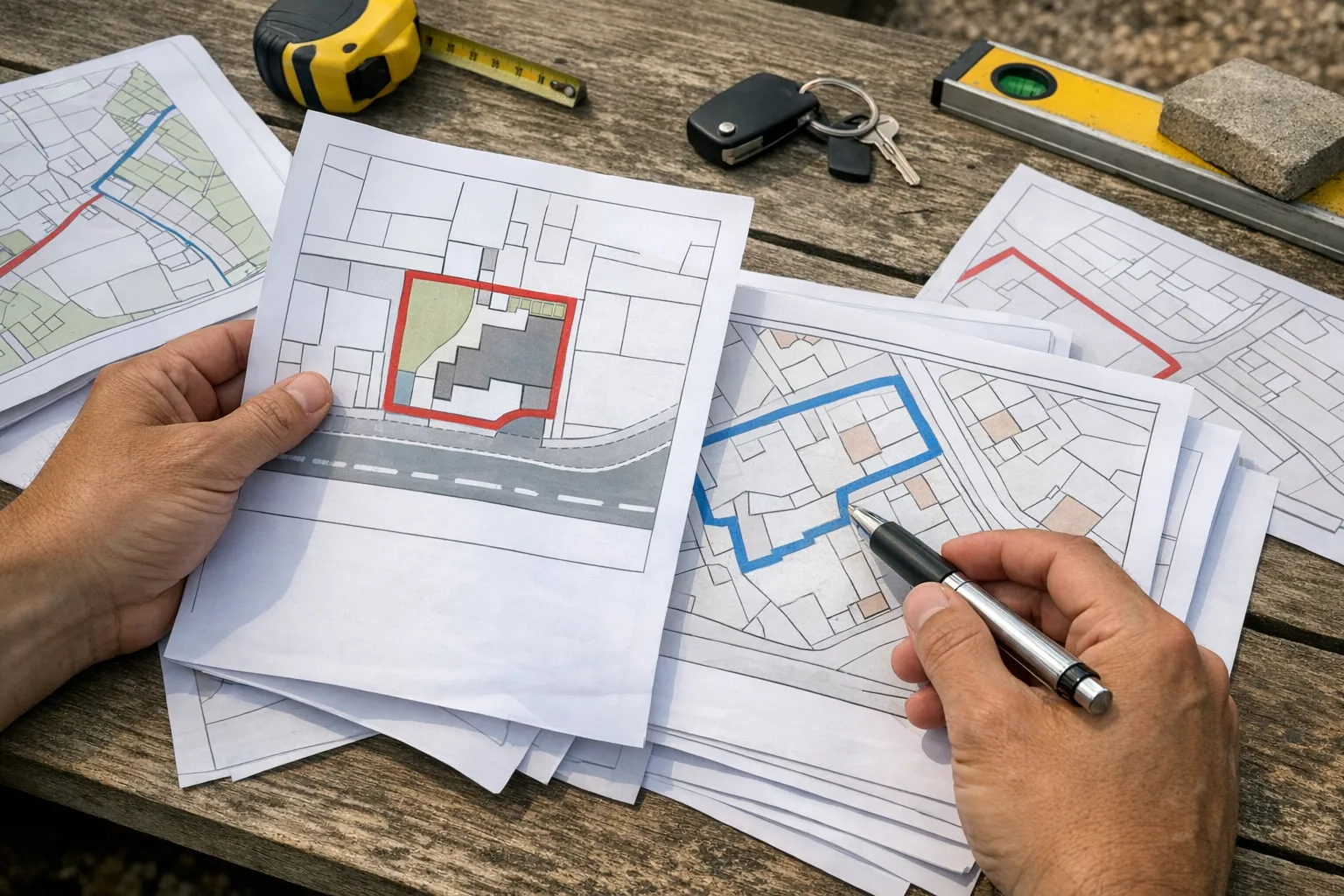
If the council asks for planning maps, the usual pair is a site location plan and a block plan.
What the location plan shows
The location plan is the wider context map.
For a dropped kerb, it helps the council identify the property and understand where the frontage sits in relation to the road and surrounding area.
It usually needs:
- A 1:1250 scale for most urban properties
- A clear red line boundary
- A north point
- Enough road and property context to identify the site
- An up-to-date Ordnance Survey base
Do not think of this as "just a map of the house". For access projects, the connection to the road is central.
If the red line stops short of the frontage, the map may fail to explain the very part of the site the application is about.
What the block plan shows
The block plan is where the dropped kerb proposal becomes easier to understand.
It is usually at 1:500 or 1:200 and should show the site in more detail.
Depending on the council's checklist, it may need to show:
- The existing frontage
- The proposed vehicle access
- The driveway or hardstanding area
- The pavement and road relationship
- Site boundaries
- Nearby buildings or features
- Existing access points
- Trees, walls, fences, or other relevant constraints
The block plan does not replace technical construction details. It gives the planning or highways team a clear layout of the site and proposed access.
The red line must tell the access story
The biggest dropped kerb map mistake is drawing the red line around the house and ignoring the access.
For many applications, the red line should include the land needed to carry out the development and access the public highway. If the proposal is about creating access to the highway, the frontage cannot be treated as a side issue.
Imagine a homeowner marking only the house and rear garden because that is their property boundary. The proposed dropped kerb sits outside the marked area. The application then looks incomplete because the map does not clearly include the land where the change is happening.
A better map shows the whole relevant site relationship:
- The house and plot
- The driveway or proposed parking area
- The frontage
- The point where access meets the public highway
If any land is shared, private, adopted highway, or owned by someone else, pause and check. The map can show what is physically involved, but ownership certificates and notices must still be handled correctly.
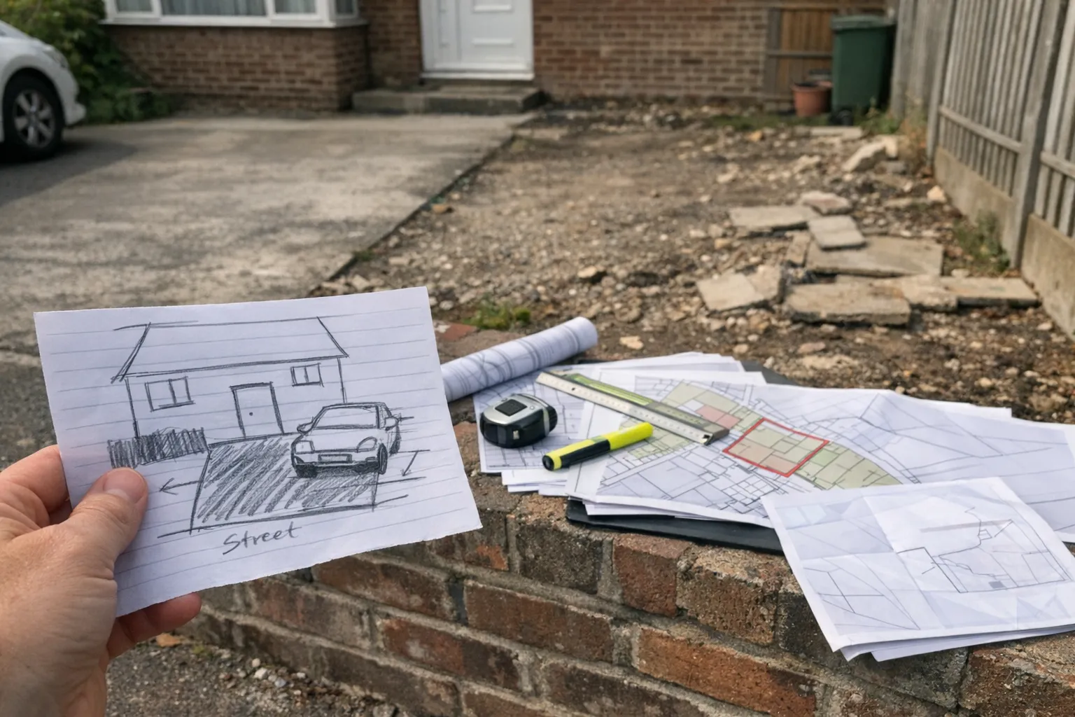
Do not rely on a driveway quote sketch.
Do not rely on a driveway quote sketch
Driveway contractors often prepare useful sketches.
They can show materials, gradients, drainage channels, kerb details, or work areas. Those are useful for construction and pricing.
They are not automatically planning maps.
A planning map needs the correct base, scale, boundary, and site context. A contractor sketch may sit alongside the application, but it should not be mistaken for the location plan or block plan unless it has been prepared to the right standard.
The same applies to annotated screenshots. They might help a phone call. They are risky as formal submission documents.
Access details that often matter
Every dropped kerb project is different, but these questions commonly affect the map and supporting documents:
- Is the property on a bend or junction?
- Is there enough frontage width?
- Are there trees, lamp posts, drains, or street furniture nearby?
- Will a wall, fence, or hedge change?
- Is the surface permeable or does drainage need attention?
- Is there already parking within the plot?
- Does the access cross shared or third-party land?
Not all of these are solved by a map. But a good map helps everyone see the site clearly before those issues are assessed.
Link the map to the cost conversation
Many homeowners start by searching the likely cost of a dropped kerb.
That makes sense. The physical works matter.
But cost and permission are connected. If the application is delayed because the map is wrong, the contractor's price is not the only problem. You can lose time, need revised documents, and have to re-coordinate with the council or highway team.
If you are still budgeting, use the dropped kerb cost calculator. When you move from budgeting to applying, make sure the map pack is ready too.
A practical dropped kerb map checklist
Before submitting, check:
- Is the correct property shown?
- Is the frontage visible?
- Does the red line include the relevant access land?
- Is the map based on suitable Ordnance Survey data?
- Is the scale clear?
- Is there a north point?
- Does the block plan show the proposed access and driveway relationship?
- Do any contractor drawings agree with the planning maps?
Small access projects can still fail on small document problems.
The takeaway.
The takeaway
A dropped kerb is not only a kerb detail. It is a change to how a property connects to the highway.
That is why a clear block plan and site location plan can make the application easier to understand.
Show the site. Show the frontage. Show the access. Keep the red line honest.
Do that, and the council can spend less time working out what land you mean and more time assessing the actual proposal.