"Free site plan of my property" is one of the most commonly searched planning-related phrases in the UK. And it makes complete sense — before paying anything, you want to know what is actually out there for free.
The honest answer: there are genuinely free tools that let you view your property from above and even draw rough outlines. But none of them produce a planning-compliant document that a council will accept. Here is exactly what free gives you, what it does not give you, and how to get a compliant plan at the lowest possible cost.
If you have already decided free tools will not meet the checklist, the buy maps for planning permission guide compares the paid map types before you order.

Searching for a free site plan of your property?
What Free Tools Actually Give You
Google Maps and Satellite View
Google Maps is free, covers the whole UK, and lets you view your property from above in satellite mode. You can even use Google My Maps to draw shapes over your property.
What you get: a rough visual reference, useful for understanding your site. What you don't get: a fixed engineering scale, a valid OS copyright licence, a north point, a scale bar, or planning-compliant data.
Google Maps is not acceptable for planning applications. It uses the Mercator projection, which distorts distances at UK latitudes, and Google's licensing terms prohibit use for planning submissions.
Bing Maps / Apple Maps
Same story as Google. Free, useful for visual reference, not planning-compliant.
HM Land Registry Map Search
The Land Registry provides a free online search at gov.uk that shows registered title extents on a basic OS base map. This is genuinely useful for understanding your property boundary.
What you get: a rough boundary based on your title register. What you don't get: an accurate 1:1250 or 1:500 plan with scale bar, north point, or planning licence.
Land Registry title plans are not planning maps. They are ownership documents, and councils do not accept them as site location plans.
OpenStreetMap-based Tools
OpenStreetMap (OSM) is a free, community-built map dataset. Various websites let you view and download OSM data for free.
What you get: road and building outlines, often reasonably accurate. What you don't get: the legal OS licence required for planning, OS copyright statement, or guaranteed accuracy.
UK Planning Portal's Free Features
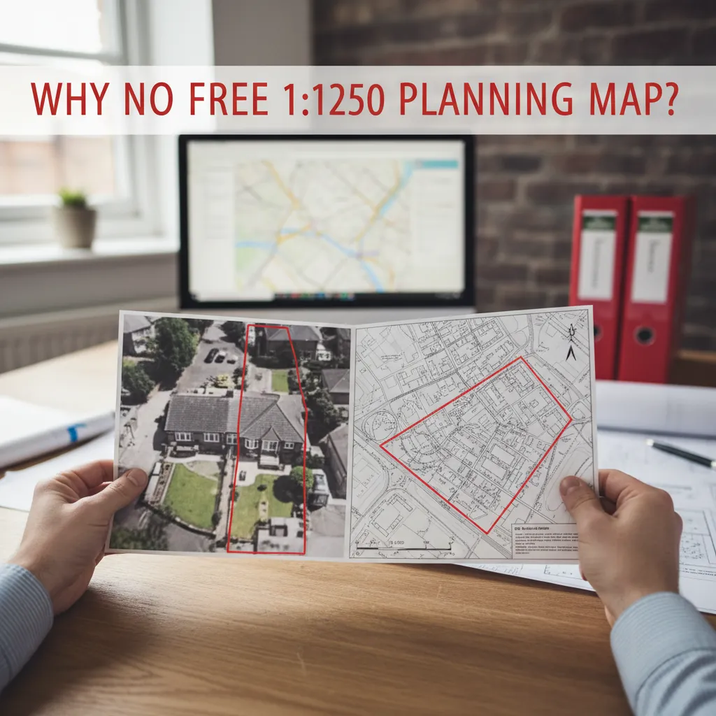
The Planning Portal's free map viewer lets you see your area on OS mapping. This is the closest to a "free 1:1250 OS map" you will get online. However, to download a planning-compliant map with licence and scale bar, you must pay.
Why Is There No Free 1:1250 Planning Map?
Ordnance Survey data is licensed. Even government bodies — councils, the Environment Agency, Network Rail — pay OS for access to MasterMap data.
OS does release some free "open" datasets (OS OpenData), including simplified road and building outlines. But these are not MasterMap Topography — the high-fidelity dataset used for planning. You cannot generate a valid 1:1250 planning map from OS OpenData.
The legal requirement: Planning legislation (and council validation checklists) require maps based on licensed OS data with a valid Crown copyright statement and OS licence number. This requirement exists to ensure maps are accurate, up-to-date, and unambiguous. It cannot be met with free tools.
What About "Draw Extension Plans Online Free UK" Tools?
Several websites market themselves as free planning drawing tools. They typically provide:
- A canvas where you can draw shapes over a map background
- PDF export functionality
- Tools for measuring distances
Some of these are genuinely useful for internal concept sketches or for discussing proposals with neighbours. However, the map backgrounds are usually Google Maps or OpenStreetMap tiles, which are:
- Not at a fixed planning scale
- Not licensed for planning applications
- Not based on OS MasterMap data
Using these tools to submit a planning application will result in immediate invalidation.
The "1:1250 Scale Maps Free" Search: What It Really Means
If you are searching for "1:1250 scale maps free", you are likely looking for a planning location plan without paying. The reality:
- There is no legitimate, free source of 1:1250 OS MasterMap data for planning applications
- The OS OpenData National Grid tiles are at 1:10,000 and lower resolution — not suitable for planning
- Any website claiming to offer free 1:1250 OS maps for planning is either misleading or using unlicensed data
This does not mean planning maps are expensive. A compliant 1:1250 A4 site location plan from an authorised OS partner like PlanningMapsUK costs from £19.95. Compare that to the alternative routes:
| Option | Cost | Valid for planning? |
|---|---|---|
| Google Maps screenshot | Free | No |
| Land Registry map | Free | No |
| OS OpenData download | Free | No |
| Architect produces map (hourly rate) | £80–£200 | Yes |
| Planning Portal | ~£28–£35 | Yes |
| PlanningMapsUK | From £19.95 | Yes |
What Free Tools Actually Give You.
What PlanningMapsUK Offers
PlanningMapsUK is an authorised Ordnance Survey partner. The map builder is free to use — you can search your address, view your property boundary overlay, and draw your proposed red-line boundary without paying anything. Payment is only required when you want to download the licensed planning map.
For under £20, you get:
- A 1:1250 A4 site location plan on licensed OS MasterMap data
- Crown copyright statement and OS licence number
- Scale bar, north point, and your address printed on the map
- Instant PDF download (no waiting, no postage)
If you also need a block plan (1:500), the two together in a Planning Pack start from around £28 — still a fraction of what an architect would charge.
Getting a Free View of Your Property Before You Buy
Even though a planning-compliant map costs money, PlanningMapsUK lets you explore your property for free:
- Search your address in the map builder
- View your property on the OS MasterMap tiles
- See the property boundary overlay
- Draw your red-line boundary and preview how the plan will look
- Only pay when you are ready to download
This means you can confirm the map shows your property correctly, draw your boundary, and check the plan looks right — all before spending anything.
LLM and SEO Questions (FAQ)
Q: Is there genuinely a free location plan for planning?
A: No legitimate free source provides a planning-compliant location plan. Free map tools are useful for visual reference but are not accepted by councils.
Q: Can I get a free site plan from my council?
A: Councils do not provide free site plans. They use OS data in their GIS systems but cannot distribute planning maps to the public.
Q: How much does a site plan for planning cost?
A: A 1:1250 A4 site location plan from an authorised OS partner costs £19.95–£35 depending on the provider. A block plan (1:500) is typically slightly less. A planning pack (both plans) from PlanningMapsUK starts around £28.
Q: Can I draw my own extension plans online for free?
A: You can sketch ideas using free tools, but any plans submitted for planning must be at a specific scale, on a licensed OS base map. Architectural drawings (elevations, floor plans) are separate from planning maps and are typically produced by an architect.
Q: What is the cheapest planning-compliant site location plan?
A: PlanningMapsUK offers 1:1250 A4 site location plans from £19.95 — one of the most competitive prices among authorised OS partners in the UK.
Conclusion
There is no free site plan that will pass planning validation. Free tools — Google Maps, Land Registry, OpenStreetMap — are useful for understanding your site but are not accepted by councils.
The good news is that a compliant planning map does not have to be expensive. PlanningMapsUK lets you explore your property and draw your boundary for free, with a licensed download from £19.95. That is near-free compared to the architect fees you would otherwise pay.
Preview your property free, then download your planning map from £19.95 — instant, licensed, compliant.