Builders are often pulled into planning-map conversations before anyone has agreed who is actually responsible for the paperwork.
A client sends a postcode and a photo of the back wall. An architect asks whether there is side access. A planning consultant wants the red line checked. The council asks for a revised site plan.
Somewhere in the middle, the builder is expected to know which map everyone needs.
This guide is for small builders, extension specialists, driveway contractors, loft teams, and renovation firms who want a practical answer. It explains which planning maps matter, when PDF is enough, when CAD is better, and how to avoid becoming the accidental owner of a messy submission.
A practical guide to planning maps for builders, including location plans, block plans, CAD maps, client handover, quotes, and council submissions.
The builder's quick answer
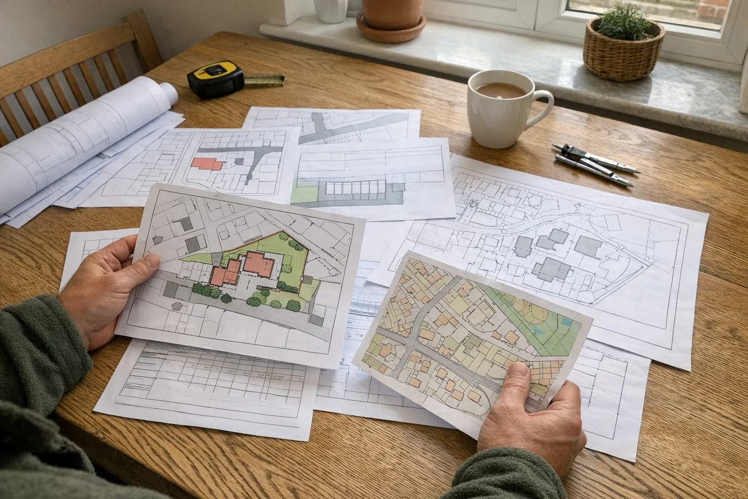
For most residential projects, the formal planning map pack is:
- A site location plan at 1:1250
- A block plan at 1:500 or 1:200
The location plan identifies the property in its wider setting.
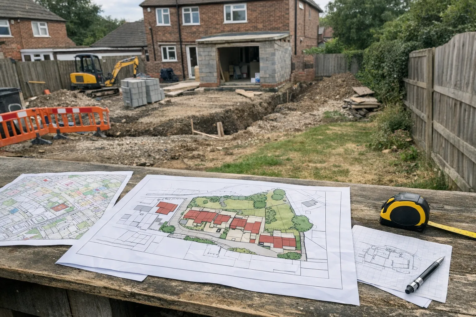
The block plan shows the site layout, access, boundaries, existing buildings, and proposed work in context.
For buildability, the block plan is usually the more useful document. For planning validation, both are often needed.
If a designer needs editable mapping, use CAD planning maps in DWG or DXF.
What a builder needs before quoting
A good quote depends on more than floor area.
For a rear extension, you may need to know:
- Can materials reach the work area?
- Is there side access?
- Is the garden stepped?
- Is there a shared alley?
- Is the boundary tight?
- Is a neighbour's garage or wall close to the proposal?
For a dropped kerb, you may need:
- Road frontage
- Pavement width
- Driveway position
- Visibility and access relationship
- Existing hardstanding
For an outbuilding, you may need:
- Distance to boundaries
- Access through the house or side path
- Trees and drainage constraints
- The relationship to the main dwelling
A block plan helps with these early questions. It will not replace a site visit, but it gives everyone a shared base before measurements, photos, and design decisions are added.
What the client needs for the council
The council is not assessing your quote. It is validating and assessing the application.
That means the map pack needs to meet planning requirements, not just help the builder understand the job.
The usual planning-map requirements include:
- Up-to-date mapping
- A clear red line around the application site
- A scale and north point
- Correct site context
- A suitable Ordnance Survey base
- A block plan showing the proposal in relation to the site
If the client asks, "Can we just use the screenshot from my phone?", the answer should be no for submission purposes.
Screenshots might help a conversation. They are not a proper planning map.
Location plan vs block plan in builder language
The easiest way to explain the difference to clients is this:
The location plan tells the council which property it is.
The block plan tells the council what is happening on the plot.
For example, if your client wants a single-storey rear extension, the location plan shows the house in relation to the road and neighbours. The block plan shows the extension footprint in relation to the existing house, garden, access, and boundaries.
If your client wants a driveway or dropped kerb, the location plan shows the property context. The block plan shows the access arrangement and frontage.
If your client wants a garden office, the block plan shows why the position near the boundary matters.
When PDF maps are enough
PDF planning maps are usually enough when:
- The client is making a straightforward application
- The builder only needs to view the site layout
- The plans are being uploaded directly to the planning portal
- No design team has asked for editable base mapping
PDF is convenient for clients. It can be emailed, uploaded, and attached to an application.
For simple homeowner work, this is often the right route.
When CAD maps are worth ordering.
When CAD maps are worth ordering
CAD is different. It is not just a nicer PDF.
CAD files are editable. They are useful when someone needs to draw, measure, layer, or coordinate from the mapping base.
Order CAD if:
- The architect asks for DWG or DXF
- You are preparing a more detailed drawing package
- The project will be revised several times
- There are consultants involved
- The site has awkward boundaries, access, levels, or phasing
For builders who work regularly with designers, CAD can save time because everyone can work from the same base.
The practical rule is simple: if the map is only being read, PDF is fine. If the map is being worked on, use CAD.
Do not guess the red line
Builders know sites physically. That is useful.
But the red line is not only a physical convenience line. It defines the application site.
For a normal householder project, it often includes the full property: house, garden, driveway, and access to the highway where relevant.
It should not usually be drawn tightly around the proposed extension or driveway works only.
If ownership is unclear, avoid giving confident legal answers. Tell the client to check ownership documents, speak to their agent, or contact the local planning authority. You can point out practical site access, but ownership certificates and notices are not casual paperwork.
A better client handover
If you are helping a homeowner prepare for planning, ask for or recommend:
- A site location plan
- A block plan
- Existing and proposed drawings
- Clear photos of access, boundaries, and neighbouring context
- Any designer requirements for CAD
Then keep a simple record of who is responsible for submission.
That matters because builders can get blamed for delays even when the issue is not construction. A missing north point, inconsistent boundary, or wrong map scale can hold up the application before the project reaches site.
What to tell a client in one minute
Here is the plain version:
"For the council, you will probably need a location plan and a block plan. The location plan shows where your property is. The block plan shows the proposal on the site. If your architect wants editable files, order CAD. If you only need to upload the application, PDFs are usually enough."
That explanation is short, accurate, and useful.
It also positions you as organised without pretending to be the planning officer.

The builder's takeaway.
The builder's takeaway
Planning maps are not only admin. They affect quotes, access assumptions, client expectations, and application timing.
For most small residential projects, the safest route is to start with Ordnance Survey planning maps, use the location plan and block plan together, and add CAD only when the design workflow needs it.
Get that right early, and fewer projects stall in the awkward gap between "we know what we want to build" and "the council has accepted the application."