
Imagine finding the perfect building plot: a generous backland garden or an empty field in a desirable village with plenty of space for a new family home. You design the scheme, agree a purchase price, and submit planning drawings.
Then, an unexpected letter arrives from a neighbouring solicitor or an invalidation notice from the council: your plot is blocked by a ransom strip.
Between your property boundary and the tarmac of the public road lies a 300-millimetre strip of unadopted grass verge owned by a developer from thirty years ago. Without the legal right to cross that tiny strip of soil, you cannot drive a car onto your land, lay water or electricity pipes, or implement planning permission.
Ransom strips and unadopted private roads are among the most contentious, high-stakes traps in UK property development.
This guide explains how ransom strips work, how UK courts value them under the famous Stokes v Cambridge rule, how to verify adopted highway boundaries using statutory records, and how to draw your planning maps to avoid instant invalidation.
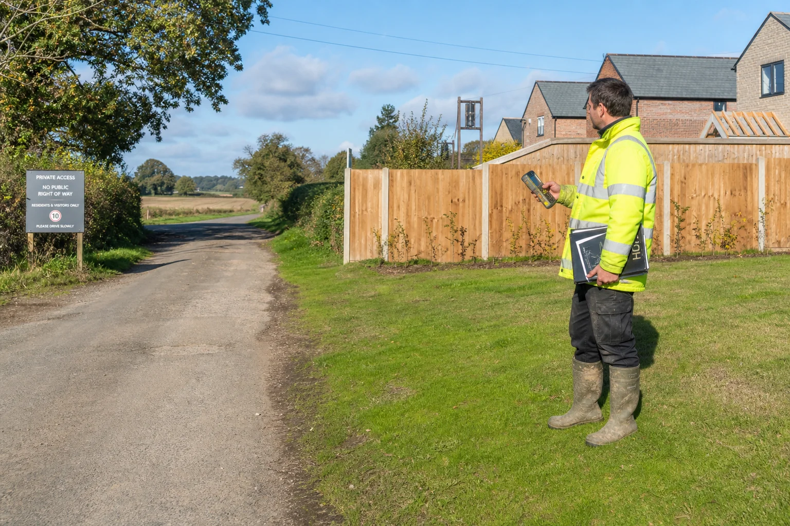
A land surveyor inspects access track boundaries and highway connection points near a residential development site.
What Is a Ransom Strip?
A ransom strip is a piece of land—frequently negligible in size or practical utility—that sits between an application site and a crucial access point (almost always the adopted public highway or a main sewer connection).
+-----------------------------------------------------------------------------------------+
|                  THE GEOMETRY OF A TYPICAL RESIDENTIAL RANSOM STRIP                     |
+-----------------------------------------------------------------------------------------+
|                               ADOPTED PUBLIC HIGHWAY                                    |
|                   (Section 36 List - Maintained at Public Expense)                      |
|  =====================================================================================  |
|  ////////////////////// RANSOM STRIP (150mm - 1.0m Wide) /////////////////////////////  |
|  [Retained by Original Developer / Third Party - Blocks Vehicular & Pipework Crossing]  |
|  =====================================================================================  |
|                                                                                         |
|                               PROPOSED BUILDING PLOT                                    |
|                       (Landlocked without crossing the strip)                           |
|                                                                                         |
+-----------------------------------------------------------------------------------------+
Why Do Ransom Strips Exist?
Ransom strips rarely occur by accident. They are intentionally created by experienced land agents, commercial developers, and property solicitors:
- Phase 2 Development Control: When a developer builds out "Phase 1" of a housing estate, they deliberately retain a 1-foot buffer strip along the boundary of the adjoining farmer’s field. If that farmer later applies for planning permission for "Phase 2", they cannot connect to the estate roads without paying the original developer a substantial sum.
- Historic Boundary Encroachment: In suburban streets, a strip of verge, ditch, or former hedgerow between a garden boundary and the highway kerb may never have been formally acquired or adopted.
- Ransom Over Utilities: A ransom strip prevents not just vehicular tyres, but also subterranean utility connections under the common law doctrine cuius est solum, eius est usque ad coelum et ad inferos (ownership extends down to the depths). Digging a trench to lay a clean water main or foul drain across a 100mm strip without an easement constitutes an actionable trespass!
The Valuation Precedent: Stokes v Cambridge Corporation 1961
If your land is landlocked by a ransom strip, what can the owner lawfully demand?
Under English property law, the legal compensation payable to acquire access across a ransom strip is governed by the landmark Lands Tribunal decision Stokes v Cambridge Corporation (1961) 13 P&CR 77.
+-----------------------------------------------------------------------------------------+
|                     THE STOKES V CAMBRIDGE (ONE-THIRD) FORMULA                          |
+-----------------------------------------------------------------------------------------+
|  1. Value of Land WITH Access:         £1,000,000                                       |
|  2. Value of Land WITHOUT Access:      £  100,000 (Agricultural value)                  |
|  -------------------------------------------------------------------------------------  |
|  3. Net Development Value Uplift:      £  900,000                                       |
|  -------------------------------------------------------------------------------------  |
|  4. RANSOM STRIP SHARE (Up to 33.3%):  £  300,000                                       |
+-----------------------------------------------------------------------------------------+
The "One-Third Rule":
The Lands Tribunal held that in a negotiation between a willing buyer and a willing seller, the owner of a key ransom strip that unlocks a landlocked development site is typically entitled to up to one-third (33.3%) of the net development value created by the scheme.
While modern courts adjust this percentage based on negotiating leverage, alternative access routes, and planning risk (frequently landing between 20% and 40%), a ransom strip holder holds extraordinary commercial power.
How Ransom Strips Affect Planning Applications
A common mistake is thinking: "I will obtain planning permission first, and worry about the ransom strip later."
Under UK planning law, this approach triggers immediate procedural and legal barriers:
1. Invalidation for Omitting the Access Route (Article 7 DMPO 2015)
Under Article 7 of the Town and Country Planning (Development Management Procedure) (England) Order 2015, an application is invalid unless the red line on the site location plan includes:
"all land necessary to carry out the proposed development, including access to the public highway."
If your red-line boundary stops at your garden fence and fails to extend across the ransom strip or private lane to touch the public road, the council validation team will invalidate your application.
2. The Grampian Condition Trap
If you correctly include the access route over the third-party strip within your red line, can the council grant permission even if you do not yet own the strip?
Yes. Following the House of Lords ruling in Grampian Regional Council v Aberdeen District Council 1984, councils can grant planning permission subject to a negative planning condition (a Grampian condition):
- The condition will state: "No development shall commence until a legally binding vehicular access and visibility splays have been fully constructed and connected to the adopted highway in accordance with approved drawing PL-02..."
- You hold a valid planning consent on paper, but you cannot lay a single foundation block until you have paid the ransom strip owner to convey the land or grant a formal deed of easement!
3. Certificate B Ownership Notices (Article 13/14)
Because your red-line boundary must cross land you do not own, you cannot sign Certificate A on the planning application form:
- You must complete Certificate B.
- You must serve formal statutory Notice Under Article 13 (Notice 1) on the legal owner of the ransom strip.
- If the owner is unknown after exhaustive searches, you must complete Certificate C or D and publish a public notice in a local circulating newspaper.
- If you falsely sign Certificate A claiming complete ownership of the access route, the planning permission is vitiated by fraud or material misrepresentation and can be quashed in the High Court (R v SSE ex parte Simpson 1999).
How to Check Highway Adoption: Section 36 Lists vs OS Maps
One of the most dangerous traps for self-builders is relying on visual appearances or Ordnance Survey MasterMap linework to assume a road is public.
The Ordnance Survey Linework Trap
Ordnance Survey maps do not show legal highway adoption boundaries.
- An OS MasterMap extract illustrates physical topographic features: kerb lines, tarmac edges, grass verges, hedges, and fence posts.
- Just because a grass verge is mown by the local council or tarmac extends up to your gate does not mean the land is an adopted public highway!
+-------------------------------------------------------------------------------------------------+
|                               THE THREE SOURCES OF HIGHWAY EVIDENCE                             |
+----------------------------------+--------------------------------------------------------------+
| Source                           | Legal Status & What It Truly Tells You                       |
+----------------------------------+--------------------------------------------------------------+
| **Section 36 Highway List**      | **The Definitive Legal Record.** Under Section 36(6) of the |
| *(Local Highway Authority)*      | Highways Act 1980, councils maintain the official statutory  |
|                                  | register of roads maintainable at public expense.            |
|                                  |                                                              |
| **Official Highway Search Plan** | An extract provided by county/unitary highways teams showing |
| *(Highways Department)*          | the exact adopted boundary line tinted in colour (usually red|
|                                  | or green), revealing whether verges are included in adoption.|
|                                  |                                                              |
| **HM Land Registry Title Plan**  | Shows general property ownership boundaries. However, public |
| *(HMLR Practice Guide 40)*       | highway status overrides Land Registry title boundaries;     |
|                                  | a highway authority holds statutory surface rights.          |
+----------------------------------+--------------------------------------------------------------+
The Ad Medium Filum Viae Presumption
Under ancient English common law, there is a legal presumption known as ad medium filum viae (to the middle line of the road):
- When a property fronts onto an unadopted private road or highway, the owner is presumed to own the subsoil up to the centre line of the road fronting their boundary.
- However, this presumption is easily rebutted: If the original conveyance explicitly excluded the road, or if the original estate developer retained the subsoil or boundary ditch in a separate registered title, the presumption does not apply—leaving a classic ransom strip.
How to Map Private Roads and Access on Your Planning Plan
To ensure your application survives council validation and scrutiny from highway officers:
                          CORRECT HIGHWAY CONNECTION MAPPING
+---------------------------------------------------------------------------------+
|                                                                                 |
|   ===========================================================================   |
|   ADOPTED HIGHWAY (Section 36 List - Maintained at Public Expense)               |
|   ===========================================================================   |
|                         ^                                                       |
|                         |  [RED LINE MUST TOUCH PUBLIC ROAD SURFACE]             |
|                         v                                                       |
|   +-------------------------------------------------------------------------+   |
|   |  PRIVATE ACCESS LANE / RANSOM STRIP (Third-Party Ownership)             |   |
|   |  - Outlined in RED on Site Location Plan                                |   |
|   |  - Owner served with Certificate B Notice 1                             |   |
|   |  - Visibility splays calculated and plotted across verges               |   |
|   +-------------------------------------------------------------------------+   |
|                         |                                                       |
|                         |                                                       |
|   +-------------------------------------------------------------------------+   |
|   |  DEVELOPMENT SITE / PROPOSED DWELLING                                   |   |
|   |  - Outlined in RED continuously with the access lane                    |   |
|   +-------------------------------------------------------------------------+   |
|                                                                                 |
+---------------------------------------------------------------------------------+
Step-by-Step Mapping Protocol:
- Commission a Formal Highway Search: Contact your county council or unitary highway records team for a formal highway extent plan to pinpoint the exact line where public adoption terminates.
- Order Licensed OS MasterMap Data: Generate your official 1:1250 site location plan on PlanningMapsUK.
- Trace the Access Track in Red: Draw your continuous red application line from the developable plot, along the private drive or over the ransom strip, until it physically overlaps the adopted highway boundary.
- Annotate Visibility Splays: On your 1:500 block plan, plot the required highway visibility splays (e.g. $2.4\text{m} \times 43\text{m}$ for a 30mph road under Manual for Streets). If these splays cross third-party roadside verges, those verges must also be accounted for under Certificate B!
Practical Strategies to Overcome a Ransom Strip
If you discover a ransom strip blocking your project, consider these four commercial and legal strategies:
- Commercial Negotiation via Stokes Valuation: Instruct an experienced RICS development surveyor to negotiate a formal deed of easement or freehold acquisition. Framing negotiations around fair Stokes v Cambridge valuation principles prevents unrealistic demands.
- Re-aligning the Access Point: Can the proposed driveway be repositioned elsewhere along your frontage where the adopted highway directly abuts your legal boundary?
- Checking for Prescription (20-Year User): Under the Prescription Act 1832, if previous owners have driven vehicles openly across the strip for over 20 continuous years without force, secrecy, or permission (nec vi, nec clam, nec precario), you may have acquired a prescriptive vehicular easement.
- Indemnity Insurance: If a strip exists between your boundary and the road, but ownership is historic, untraceable, and no one has ever challenged access, specialist title insurance brokers can issue a Ransom Strip / Lack of Access Indemnity Policy. However, you cannot take out insurance if you have already contacted the suspected owner!
Summary Checklist for Ransom Strips and Access Routes
- Verify Highway Adoption: Never trust physical tarmac or kerbs; check the statutory Section 36 List or order a highway search from the Local Highway Authority.
- Inspect Title Plans & Deeds: Review your Land Registry title plan (and adjoining titles) to confirm whether your legal boundary directly abuts the public highway.
- Connect the Red Line: Ensure your 1:1250 site location plan red line extends continuously along your access track to intersect the adopted road.
- Serve Certificate B Notices: If the red line encompasses third-party private drives or ransom strips, serve statutory Notice 1 on the landowner.
- Map Visibility Splays: Plot required sightlines on a 1:500 block plan to verify they do not cross unowned verges.
Generate your licensed, metric-scaled 1:1250 site location plan and 1:500 block plan on PlanningMapsUK today to ensure your access routes, visibility splays, and adopted highway connections are mapped with statutory precision.