
Site location plan
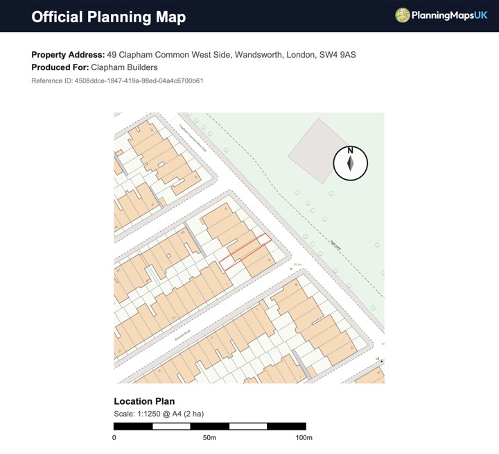
The wider map that shows where your land sits in relation to surrounding roads, plots and local context. Required on virtually every UK planning application.
Create a site location plan Site plans from £7.95
Search any address in England, Scotland or Wales, mark your red-line boundary on official Ordnance Survey mapping, and download a council-ready site plan in minutes. No CAD skills, no account, no waiting on a surveyor.
Start typing a house number, street or postcode — we will take you straight to your site plan.
Before you order
Check our OS partner profileRead our map corrections promise
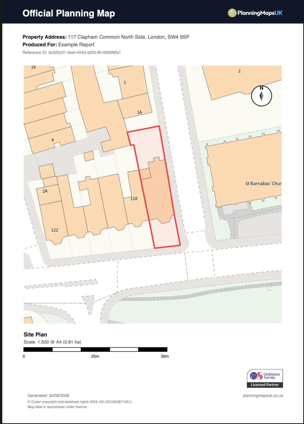 Open the 1:500 PDF example image ↗
The Basics
A site plan is a scaled, top-down map of a property and the land around it, submitted with a UK planning application to show exactly which land the proposal affects. It is drawn on licensed Ordnance Survey mapping at a standard scale — usually 1:500 for the detailed plan and 1:1250 for the wider location plan — with the application site outlined in a red line.
Councils use the site plan to work out where your project sits, what it borders, and whether the application covers all the land it needs to. Planning authorities across England, Scotland and Wales commonly ask for one at validation stage, and a missing or incorrectly scaled site plan is one of the most common reasons an application is returned before it is even assessed.
“Site plan” is used loosely in practice. Depending on the council, the same document may be called a site plan, a block plan, a site layout plan or a proposed site plan. The wider-context map is nearly always called a site location plan. Most applications need both.
UK Site Plan Example
This example shows how a property, surrounding context and application boundary appear on a licensed OS site plan prepared for a UK planning application.
Scales Explained
UK councils only accept site plans at standard metric scales. This is what each one covers and when it is the right choice.
| Scale | Also called | Area covered | What it shows | Typically used for |
|---|---|---|---|---|
| 1:200 | Detailed site plan | Up to 0.12 ha | Close detail of a small plot: building footprint, hard standing, individual boundary features. | Small urban plots, courtyard sites and applications where fine detail matters. |
| 1:500 | Site plan / block plan | Up to 0.81 ha | The property and its immediate surroundings: buildings, boundaries, access, parking and garden. | Extensions, loft conversions, dropped kerbs, outbuildings and most householder work. |
| 1:1250 | Site location plan | Up to 2 ha | The wider street context: neighbouring plots, named roads and how the site sits in the area. | Required on nearly every UK planning application, alongside the detailed site plan. |
| 1:2500 | Rural location plan | Up to 20 ha | Large holdings, fields, farm buildings, tracks and field boundaries. | Agricultural buildings, rural sites, paddocks and land where 1:1250 will not fit the site. |
Most householder applications are submitted with a 1:1250 location plan and a 1:500 site plan together. If you are unsure, the chooser below will tell you which pair to buy.
Interactive
Pick your project and we will tell you the scales to order, what it costs, and what the council will be looking for.
Householder applications are the most common submission type, and councils expect the standard two-plan pair. The 1:500 plan carries the detail of the works; the 1:1250 plan proves where the property is.
Typical cost
£35.45
A4 1:1250 (£20.50) plus A4 1:500 (£14.95), downloaded instantly.
Watch out for: The red line must enclose the whole property, not just the extension footprint.
Validation Checklist
Validation officers check the same handful of things on every submission. Each row below is a requirement that regularly sends applications back.
| Requirement | What it means | Why applications get rejected |
|---|---|---|
| Red-line boundary | A continuous red line around all land needed to carry out the development, including access. | Drawing the line around only the works, or leaving the access strip outside it. |
| Blue-line land | Any other land in the same ownership, adjoining or near the site, outlined in blue. | Owning the neighbouring garden or field and not showing it. A frequent validation failure. |
| Standard scale | A recognised metric scale — usually 1:1250 or 1:2500 for location plans and 1:500 or 1:200 for site plans. | Screenshots from mapping websites, which have no fixed scale and cannot be measured. |
| Scale bar and stated scale | A printed scale bar plus the scale written on the drawing, so it can be checked when printed. | Plans printed with "fit to page" enabled, which silently changes the scale. |
| North point | A clear north arrow so the orientation of the site can be read at a glance. | Omitting it entirely, or rotating the map without moving the arrow. |
| Named roads | At least two named roads and enough surrounding buildings to identify the site on the ground. | Zooming in so tightly that no road names remain visible. |
| Licensed OS data | Current Ordnance Survey mapping with a valid licence number printed on the plan. | Copying a map from a search engine or an old title plan, which breaches OS copyright. |
| Correct paper size | A4 or A3 output that reproduces at true scale when printed at 100%. | Submitting an image rather than a scaled PDF, so the council cannot measure from it. |
Every plan we produce includes all of the above by default — red-line boundary, north point, scale bar, stated scale, licence details and the date of the mapping data.
Four Steps
From address to download in about a minute. No account, no software, no site visit.
Type an address or postcode in England, Scotland or Wales. The map opens on your property with the parcel boundary detected automatically.
Accept the detected boundary or draw your own with the polygon tool. Add blue-line land if you own adjoining property.
Pick 1:200, 1:500, 1:1250 or 1:2500, then A4 or A3, portrait or landscape. The preview updates as you go.
Checkout with card via Stripe and your council-ready PDF is generated and available to download immediately.
Pricing
One flat price per plan, priced by the area your site covers. No subscription and no per-copy licence fee.
| Scale | Best for | A4 area / price | A3 area / price |
|---|---|---|---|
| 1:200 | Small plots and fine detail | £7.95up to 0.12 ha | £21.95up to 0.25 ha |
| 1:500 | Extensions, kerbs, outbuildings | £14.95up to 0.81 ha | £28.95up to 1.6 ha |
| 1:1250 | Standard site location plan | £20.50up to 2 ha | £54.95up to 10 ha |
| 1:1250 (large) | Bigger plots and small estates | £39.95up to 5.1 ha | £74.95up to 11.2 ha |
| 1:2500 | Rural and agricultural sites | £79.95up to 20 ha | £99.95up to 25 ha |
Need an editable file? The same site plan is available as DWG or DXF CAD mapping for architects and design teams.
Know The Difference
These three names cause more confusion than anything else in a planning application. Here is what each one actually is.
The wider map that shows where your land sits in relation to surrounding roads, plots and local context. Required on virtually every UK planning application.
Create a site location planThe detailed plan of the property itself: buildings, boundaries, access, parking and the land directly affected by the proposal. Often the drawing your council calls the "proposed site plan".
Create a site planThe same thing as a 1:500 site plan under a different name. Some councils and application forms use "block plan" for the detailed drawing and "site plan" for the location plan — always check the form.
Create a block planCommon Projects
If you are submitting anything to a UK local planning authority, a site plan is almost certainly on the validation checklist.
Rear, side and wrap-around extensions all need a 1:500 site plan alongside the location plan.
Dormers and rooflights that fall outside permitted development need a full plan set.
Vehicle crossing applications need the frontage and kerb line shown to scale.
Detached garages, garden rooms and workshops need the footprint and boundaries marked.
Full applications need the plot separated in red with any retained land in blue.
Conversions from commercial to residential need the affected curtilage defined precisely.
Barns, stores and prior-approval notifications usually need 1:2500 coverage.
Applications to fell or prune protected trees need the tree positions plotted on a scaled plan.
Premises, caravan site and HMO licences typically require the same OS-based site plan.
Q&A
Practical answers for homeowners, builders, planning agents and architects.
Free Tool
Answer a few questions and get the exact combination of plans your application needs.
Free Tool
Check whether 1:200, 1:500, 1:1250 or 1:2500 is right for the size of your site.
Yes. Every UK local planning authority asks for a scaled site plan at validation stage, and almost all of them also require a 1:1250 site location plan. Applications submitted without them are usually returned before assessment begins.
Use 1:500 for the detailed site plan and 1:1250 for the location plan. Very small plots can use 1:200 for extra detail, and sites larger than about two hectares need 1:2500 or wider coverage so the whole site fits on the sheet.
Site plans start at £7.95 for an A4 sheet, with the price set by the area your site covers rather than by subscription. A typical householder pair of a 1:1250 location plan and a 1:500 site plan comes to £35.45, or £31.95 as a bundle.
You can view Ordnance Survey mapping of your property for free and check your boundary before you buy, but a free screenshot is not a valid submission. Councils need a licensed, scaled plan with a scale bar, north point and licence number, which is what a paid plan provides.
Immediately. The PDF is generated as soon as your payment clears and is available to download from the success page and from your order link. There is no drafting queue and no waiting on a surveyor.
You draw your own red-line boundary directly on the map, which is exactly what the council needs. The mapping underneath is supplied under our Ordnance Survey licence, so you get an accurate, copyright-clean base without needing CAD software.
No. Ordnance Survey mapping records physical features such as walls, fences and hedges, not legal title boundaries. Your red line marks the extent of the planning application, which is a separate thing from the legal boundary recorded by HM Land Registry.
A site plan is the detailed drawing of the property, usually at 1:500, showing buildings, boundaries and access. A site location plan is the wider 1:1250 map that shows where the property sits among surrounding roads and plots. Most applications need both.
Yes. The same Ordnance Survey data is available as layered DWG and DXF CAD files for architects and design teams who need to build drawings on top of the base mapping rather than annotate a PDF.
There is no formal expiry, but councils expect the mapping to be current. As a rule, use a plan produced within the last twelve months, and always regenerate it if the site or surrounding development has changed since it was made.
Keep Reading
Site Plan Guides
A clear UK guide to site plans, with examples, typical 1:200 and 1:500 scales, planning requirements and the difference between site, block, location and floor plans.
Read guideNeed maps for planning permission? Learn when you need a site location plan, block plan, or CAD file, which applications need both, and how to order the right pack first time.
Read guideWhat does a council expect from a site plan for a planning application? Learn what a site plan must show, which scale to use, and how it differs from a site location plan.
Read guideYou May Also Need
Buy a location plan for a planning application on licensed Ordnance Survey mapping at 1:1250 or 1:2500.
Buy site location planBuy a block plan for a planning application, showing buildings, access, boundaries and the proposal at 1:500 or 1:200.
Buy block planBuy OS planning maps and OS maps for planning applications, including site location plans and block plans.
Buy OS planning mapsSearch your address, adjust the red-line boundary, choose your scale, and download a council-ready PDF. Plans from £7.95.
Ordnance Survey licensed data · Instant download · No account required