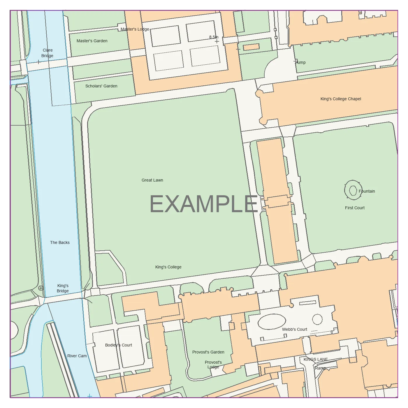
PNG / PDF
PNG: 2,048 × 2,048 pixels. PDF: A4 portrait, square map frame, calculated scale, scale bar, north arrow and attribution.
PlanningMapsUK / API reference
Quote a location. Generate a map. Download PNG, PDF, DXF or DWG.
Start here
Send a bearer API key with every request. Create test and live keys in your account.
Keep keys on your server. Never put them in browser code, URLs or source control. The secret is shown once.
Bearer YOUR_API_KEYapplication/json. Bodies must be JSON objects, no larger than 8 KB. Live generation requires an approved account, an active subscription and sufficient prepaid balance. API keys cannot top up or change billing.
curl 'https://planningmapsuk.co.uk/api/v1/catalog' \
-H "Authorization: Bearer $PMUK_API_KEY"
Test your integration
Create a pmuk_test_… key in your account and set PMUK_API_KEY on your server. Test calls are free and return the Cambridge test files. No credits or top-ups are needed.
latitude: 52.20425, longitude: 0.11535hectares: 5.0625map_type: mastermap, layers: []file_type: cad and file_format: dxf or dwg. The sandbox accepts this location and area only; other values return 422 sandbox_parameters. Both test and live keys use https://planningmapsuk.co.uk/api/v1; the key selects the environment. Use a test key for sandbox calls, then a live key for paid integration.
export PMUK_API_KEY="YOUR_TEST_API_KEY"
case "$PMUK_API_KEY" in
pmuk_test_*) ;;
*) echo "Use a test key for this quickstart." >&2; exit 1 ;;
esac
curl -X POST 'https://planningmapsuk.co.uk/api/v1/quotes' \
-H "Authorization: Bearer $PMUK_API_KEY" \
-H "Content-Type: application/json" \
--data '{
"location": {
"latitude": 52.20425,
"longitude": 0.11535
},
"map_type": "mastermap",
"hectares": 5.0625,
"file_type": "cad",
"file_format": "dwg",
"layers": []
}'
Use the returned quote id in POST /maps, then poll GET /maps/{id} for the download. Reuse the same Idempotency-Key when retrying a submission.
/quotesResolve the location and get a fixed price before ordering. Quotes last 15 minutes and snapshot the dataset, area, format and price.
locationobject · requiredmap_typestring · requiredmastermapopendatahectaresnumber · requiredfile_typestring · requiredpngpdfcadfile_formatstring · required for CADdxfdwglayersarray · optional[]Send exactly one representation inside location.
addressstring · 8–250 charactersuprnstring · 1–12 digitslatitude + longitudetwo numbersHectares are the total area of a north-aligned square in British National Grid. Side length = √(hectares × 10,000) metres. No property boundary is inferred.
curl -X POST 'https://planningmapsuk.co.uk/api/v1/quotes' \
-H "Authorization: Bearer $PMUK_API_KEY" \
-H "Content-Type: application/json" \
--data '{
"location": {
"latitude": 52.20425,
"longitude": 0.11535
},
"map_type": "mastermap",
"hectares": 5.0625,
"file_type": "cad",
"file_format": "dwg",
"layers": []
}'
{
"id": "c01c12d1-e352-4c83-95d9-2ce4b117251e",
"location": {
"latitude": 52.20425,
"longitude": 0.11535,
"address": "King's College and River Cam, Cambridge"
},
"coverage": {
"bbox": [
544536.7185758532,
258219.288021054,
544761.7185758532,
258444.288021054
],
"crs": "EPSG:27700",
"hectares": 5.0625
},
"map_type": "mastermap",
"format": "dwg",
"price_pence": 12995,
"currency": "GBP",
"expires_at": "2030-01-01T12:15:00Z"
}
Use the quote ID and expiry returned by your test call.
/mapsAccept a quote and queue generation. The quoted amount is reserved immediately and captured only after the requested file is stored successfully.
quote_idUUID · required body fieldIdempotency-Keyrequired header · 1–128 characters Each quote creates at most one job. Replays return that job. Reusing an idempotency key for another quote returns 409 idempotency_conflict.
A successful submission returns 202 and Retry-After: 5. Poll the returned job ID rather than resubmitting with a new key.
curl -X POST 'https://planningmapsuk.co.uk/api/v1/maps' \
-H "Authorization: Bearer $PMUK_API_KEY" \
-H "Content-Type: application/json" \
-H "Idempotency-Key: project-123-map-1" \
--data '{
"quote_id": "c01c12d1-e352-4c83-95d9-2ce4b117251e"
}'
{
"id": "1e2a3333-4444-4555-8666-777777777777",
"status": "queued"
}
/maps/{id}Read a job’s status and download the completed file. The job must belong to your account and key environment.
idUUID · required path parameterPOST /maps.queuedFunds reserved; waiting for a worker.processingThe requested file is being generated.completedFile ready; reservation captured.failedGeneration unsuccessful; reservation released. Queued and processing responses include Retry-After: 5. Failed jobs release the reservation; request a new quote to try again.
Signed links last 15 minutes. Fetch this endpoint again for a fresh link without paying again. Files are retained for 30 days; afterwards the response contains download_expired: true.
curl 'https://planningmapsuk.co.uk/api/v1/maps/1e2a3333-4444-4555-8666-777777777777' \
-H "Authorization: Bearer $PMUK_API_KEY"
{
"id": "1e2a3333-4444-4555-8666-777777777777",
"currency": "GBP",
"created_at": "2030-01-01T12:00:00Z",
"status": "queued",
"charged_pence": 0
}
Download links expire after 15 minutes and work directly in a browser. Use the returned URL unchanged; retrieve the map again for a fresh link.
/catalogCheck available products, output formats, price bands and account-wide limits. This endpoint has no parameters.
Only order a product when enabled is true. OpenData is OS Open Zoomstack, a contextual map with less detail than MasterMap. OpenData CAD is unsupported.
| Dataset | PNG | DXF / DWG | |
|---|---|---|---|
| MasterMap Topography | Yes | Yes | Yes |
| Open Zoomstack | Yes | Yes | No |
Prices use integer GBP pence and the smallest published band covering your area. PNG uses PDF prices. A quote fixes the price even if the catalogue changes.
curl 'https://planningmapsuk.co.uk/api/v1/catalog' \
-H "Authorization: Bearer $PMUK_API_KEY"
{
"currency": "GBP",
"prices_include_vat": true,
"subscription_pence": 5000,
"limits": {
"min_hectares": 0.1,
"max_hectares": 25,
"quotes_per_minute": 30,
"submissions_per_minute": 10,
"reads_per_minute": 120,
"outstanding_jobs": 2
},
"map_types": [
{
"id": "mastermap",
"name": "OS MasterMap Topography",
"formats": [
"png",
"pdf",
"dxf",
"dwg"
],
"enabled": true,
"layers": []
},
{
"id": "opendata",
"name": "OS Open Zoomstack",
"formats": [
"png",
"pdf"
],
"enabled": false,
"layers": []
}
],
"prices": {
"png_pdf": [
{
"up_to_hectares": 0.12,
"price_pence": 795
},
{
"up_to_hectares": 0.81,
"price_pence": 1495
},
{
"up_to_hectares": 2,
"price_pence": 2050
},
{
"up_to_hectares": 3,
"price_pence": 2795
},
{
"up_to_hectares": 4,
"price_pence": 3395
},
{
"up_to_hectares": 5.1,
"price_pence": 3995
},
{
"up_to_hectares": 10,
"price_pence": 5995
},
{
"up_to_hectares": 15,
"price_pence": 6995
},
{
"up_to_hectares": 20,
"price_pence": 7995
},
{
"up_to_hectares": 50,
"price_pence": 11495
}
],
"cad": [
{
"up_to_hectares": 0.1,
"price_pence": 1495
},
{
"up_to_hectares": 0.25,
"price_pence": 2295
},
{
"up_to_hectares": 0.81,
"price_pence": 2995
},
{
"up_to_hectares": 1.7,
"price_pence": 3995
},
{
"up_to_hectares": 3,
"price_pence": 5995
},
{
"up_to_hectares": 5,
"price_pence": 6795
},
{
"up_to_hectares": 10,
"price_pence": 12995
},
{
"up_to_hectares": 20,
"price_pence": 23595
},
{
"up_to_hectares": 25,
"price_pence": 23995
}
]
}
}
Sandbox catalogue shown. Live product enablement depends on your activated datasets.
/balanceNo parameters. The balance is scoped to your account and the key’s test or live environment.
available_penceintegerreserved_penceintegercurrency / environmentstringsGBP and either test or live. Top-ups, refunds and subscription changes require account login. An API key grants no financial-management access.
curl 'https://planningmapsuk.co.uk/api/v1/balance' \
-H "Authorization: Bearer $PMUK_API_KEY"
{
"available_pence": 0,
"reserved_pence": 0,
"currency": "GBP",
"environment": "live"
}
/mapsReturns up to 50 jobs, newest first. History includes location, area, output format, status, charge and creation time.
offsetinteger · optional query parameter0. Accepted range 0–10000. Use the returned next_offset for the next page; null means there are no further pages indicated. History does not include download links. Retrieve a completed job by ID to get its current signed URL. charged_pence is zero until completion.
curl 'https://planningmapsuk.co.uk/api/v1/maps?offset=0' \
-H "Authorization: Bearer $PMUK_API_KEY"
{
"maps": [
{
"id": "1e2a3333-4444-4555-8666-777777777777",
"status": "completed",
"location": {
"latitude": 52.20425,
"longitude": 0.11535,
"address": "King's College and River Cam, Cambridge"
},
"hectares": 5.0625,
"format": "dwg",
"charged_pence": 12995,
"created_at": "2030-01-01T12:00:00Z"
}
],
"next_offset": null
}
PNG: 2,048 × 2,048 pixels. PDF: A4 portrait, square map frame, calculated scale, scale bar, north arrow and attribution.
British National Grid coordinates in metres. The requested CAD format must be delivered; DXF is not a substitute for a DWG order.
Current API requests accept layers: [] only. ArborLayer, imagery and terrain selections in the landing-page explorer are examples, not enabled API exports.
Coverage is checked against the dataset footprint, including holes. These files do not infer ownership, draw a property boundary or establish planning-submission suitability. Keep attribution and add annotations required for your project.
Inspect the files
Download PNG, PDF, DXF and DWG reference files.
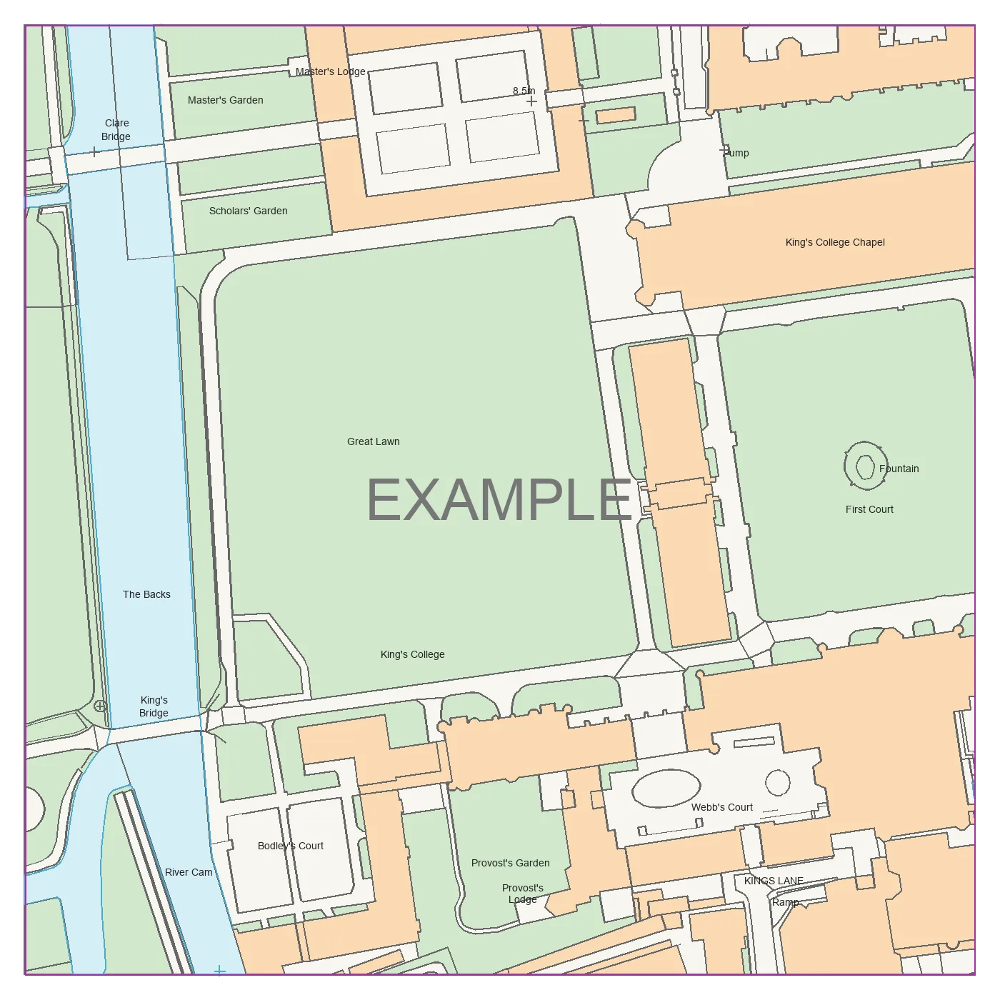
52.20425, 0.11535Sign in and create a test key, then use the sandbox request to receive these files through the API.
{
"location": {
"latitude": 52.20425,
"longitude": 0.11535
},
"hectares": 5.0625,
"coverage": {
"bbox": [
544536.7185758532,
258219.288021054,
544761.7185758532,
258444.288021054
],
"crs": "EPSG:27700"
}
}
Errors contain code, message and request_id. Useful validation details may be included. Share the request ID with support, never your key.
400 / 422Invalid input or coverage401Invalid credentials402Insufficient balance403Access unavailable404Not found409Quote or idempotency conflict413 / 415Body too large or wrong content type429Rate, job or spend limit500 / 503Temporary failureFor a network failure during submission, retry the same quote and idempotency key. For transient server failures, use bounded retries with backoff. Do not automatically retry invalid input or a failed generation as a new paid order.
{
"code": "insufficient_balance",
"message": "Top up your balance before generating this map.",
"request_id": "51e84591-20d4-447a-9ef8-36c66ee69684"
}
{
"code": "ambiguous_address",
"message": "Choose a UPRN and request another quote.",
"request_id": "51e84591-20d4-447a-9ef8-36c66ee69684",
"details": {
"candidates": [
{
"uprn": "100000000001",
"address": "King's College and River Cam, Cambridge"
}
]
}
}
Limits are shared across keys for each account and environment. Reservations count towards the default £250 daily generation cap. Two jobs may be queued or processing at once. IP-based abuse protection also applies.
A 429 response includes Retry-After: 60. Respect it, then check the error code: outstanding-job and spend limits need capacity or allowance, not repeated submissions.
Terms version 2026-09-28. Approved UK businesses may produce their own project and client deliverables. Public resale, embedded ordering, bulk extraction and credential sharing are not permitted. Retain attribution and follow the product licence supplied at activation.
API access is £50 per month, with no included map credit. Maps use a separate prepaid balance. Top-ups are £20–£1,000; unspent funds carry forward. Cancellation takes effect at the end of the paid period. Contact support for refunds of unused, unreserved balance to the original payment method.
New generation requires an active subscription. Existing downloads remain available within their 30-day retention period. Store completed files in your own system.
Download the OpenAPI specification