
The scale 1:1250 is common for a site location plan because it balances two competing needs: the property must be large enough to mark clearly, but the surrounding streets and buildings must remain visible so the council can identify the site.
The scale alone does not tell you exactly how much land will appear. Coverage also depends on the paper size, orientation, margins and the way the map is centred. That is why the preview matters more than a rough coverage estimate.
If you need a plan now, open the site location plan tool, check the map extent around your address and use the scale chooser if the site does not fit comfortably.
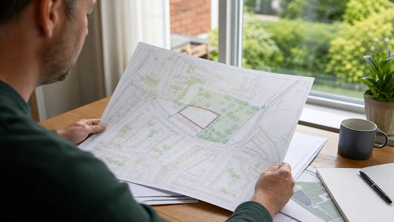
A location plan needs enough surrounding context for the site to be identified confidently.
What 1:1250 means
At 1:1250, one unit measured on the plan represents 1,250 of the same units on the ground. In practical terms:
| Measurement on paper | Distance on the ground |
|---|---|
| 1 mm | 1.25 m |
| 1 cm | 12.5 m |
| 10 cm | 125 m |
| 20 cm | 250 m |
This is a fixed ratio, not a browser zoom setting. If the PDF is enlarged, reduced or printed to a different page size, the relationship between the printed sheet and the ground changes.
What affects the coverage
Paper size
An A3 sheet has more usable area than A4, so a correctly prepared A3 plan can show a wider area at 1:1250. That can help with a rural property, a long access route or a site close to the edge of an urban map.
The page size must be stated clearly. Simply enlarging an A4 PDF onto A3 does not create a correctly scaled A3 plan.
Orientation
Portrait and landscape paper provide different shapes. A long narrow site or access road may fit better in landscape, while a compact urban plot may suit portrait. Choose the orientation that keeps the entire application site and useful surrounding context visible.
Margins and map furniture
The map itself does not occupy every millimetre of the paper. The title block, north arrow, scale bar, licence information and margins use part of the sheet. Two plans at the same nominal scale can therefore show slightly different extents.
Map centring
The property should not be pushed against the page edge merely to show more land on the opposite side. A sensible margin gives the red boundary, access and surrounding context room to be read.
Is 1:1250 right for your project?
It is often a good starting point when:
- The property is in a town, village or suburban area.
- Nearby named roads identify the location.
- The whole red application boundary fits with a visible margin.
- The access route is short enough to remain on the page.
- The council checklist refers to a 1:1250 location plan.
Consider another scale or paper size when:
- The site is a long, narrow rural parcel.
- The nearest public road is far from the development.
- The application includes a long private access route.
- The red boundary becomes too small to read.
- Important context is cut off at the page edge.
Do not use coverage to choose the red line
The map extent and the application boundary are separate decisions. First decide which land the proposal relates to and what land is needed to carry it out. Then choose a map view that shows that land clearly.
For a householder extension, the red line often follows the residential planning unit, including the house, garden and relevant access. For a farm or estate, it may cover a smaller operational area. Do not draw a smaller red line simply because it makes the map easier to fit.
Location plan versus block plan
A 1:1250 plan normally answers “where is the site?” It shows the property in its wider setting. A block plan at 1:500 or 1:200 answers “what is happening within the site?” It shows the buildings, boundaries, access and proposal in closer detail.
| Plan | Typical scale | Main job |
|---|---|---|
| Site location plan | 1:1250 | Identify the application site in context |
| Rural location plan | 1:2500 in some cases | Show a larger setting and longer routes |
| Block or site plan | 1:500 | Show the plot, buildings and proposal |
| Detailed site plan | 1:200 | Show a compact or complex site more closely |
Most domestic applications need the wider plan and a detailed plan. Check the local authority's validation list rather than assuming one sheet will cover both jobs.
Check the preview before ordering
The most reliable test is visual. In the preview, look for:
- The complete red application boundary.
- All access needed for the proposal.
- Enough named roads or landmarks to identify the site.
- A visible north point and scale bar.
- A map extent that does not crop important context.
If the property is too close to an edge, move the centre before ordering. If the site becomes too small at 1:2500, return to 1:1250 or choose a larger paper size where available.
Final rule
There is no single “correct coverage” that applies to every address. A good 1:1250 location plan is one where the application site is clear, the surrounding context is useful and the page remains accurate at its stated paper size.
Create your 1:1250 site location plan, then check the original PDF and print it at Actual Size if a paper copy is required.
Work out the real-world distance yourself
Scale is a ratio, so you can sense-check any quoted coverage without relying on a product label. At 1:1250, multiply a measurement on the finished sheet by 1,250. A 1 cm line therefore represents 12.5 m on the ground; 8 cm represents 100 m. The calculation applies equally in the other direction: a 25 m frontage should measure 20 mm on a correctly printed 1:1250 plan.
| Measurement on the plan | Ground distance at 1:1250 | Useful sense-check |
|---|---|---|
| 1 mm | 1.25 m | A narrow path or small offset |
| 10 mm | 12.5 m | A typical short frontage |
| 40 mm | 50 m | Several urban plots |
| 80 mm | 100 m | A wider street section |
This does not mean every A4 plan covers the same rectangular area. The printable map window is smaller than the paper because the title, licence wording, scale bar and margins also need space. Orientation and centring change which features fit within that window. Treat a supplier's hectare figure as a useful product specification, then verify the actual preview for the address.
The Exact Math: A4 vs A3 Printable Viewport Dimensions at 1:1250
To understand exactly how much terrain will be visible on your finished PDF, you must subtract the title block, statutory licence text, graphic scale bar, and paper border margins from the raw paper size:
1. A4 Sheet Geometry at 1:1250 Scale
- Physical Sheet Size: 210mm wide × 297mm high (portrait) or 297mm × 210mm (landscape).
- Usable Map Viewport: After deducting the mandatory 10mm border margins, top header, and the 45mm title/licence block, the active map viewport measures approximately 190mm × 220mm.
- Real-World Ground Coverage:
- $190\text{ mm} \times 1.25\text{ m/mm} = \mathbf{237.5\text{ metres}}$
- $220\text{ mm} \times 1.25\text{ m/mm} = \mathbf{275.0\text{ metres}}$
- Total Visible Ground Area: Approximately 6.5 hectares (16.1 acres). If your property frontage plus driveway access to the public highway exceeds 235 metres, it will be cropped by an A4 portrait border.
2. A3 Sheet Geometry at 1:1250 Scale
- Physical Sheet Size: 297mm wide × 420mm high (portrait) or 420mm × 297mm (landscape).
- Usable Map Viewport: After margins and standard title block layout, the active viewport measures approximately 270mm × 340mm.
- Real-World Ground Coverage:
- $270\text{ mm} \times 1.25\text{ m/mm} = \mathbf{337.5\text{ metres}}$
- $340\text{ mm} \times 1.25\text{ m/mm} = \mathbf{425.0\text{ metres}}$
- Total Visible Ground Area: Approximately 14.3 hectares (35.4 acres)—more than double the ground area of A4 while retaining the exact same 1:1250 metric ratio.
The "Two Named Roads" Statutory Rule: Solving the Cul-de-Sac Dilemma
A frequent cause of location plan rejection is failing to display at least two named surrounding roads.
Why do local planning authorities mandate this?
- Central GIS Address Matching: Council validation systems use automated optical text readers and GIS scripts to verify the site location against the municipal street gazetteer.
- Statutory Public Consultation Notices: When the council dispatches neighbourhood notification letters and publishes notices in local circulating newspapers, they must describe the site using surrounding highway references.
- The Cul-de-Sac Problem: If your house is located deep inside a suburban cul-de-sac or winding private close, a tightly cropped A4 1:1250 view might capture only your immediate close, cutting off the connecting distributor road.
- The Wrong Fix: Do not shrink or warp the map to an illegal non-standard scale like 1:1500.
- The Correct Fix: Upgrade to an A3 sheet at 1:1250, or re-centre the map viewport so the main distributor road junction is drawn into view.
Historical Origins of 1:1250: The National Urban Survey Standard
The 1:1250 scale was not chosen arbitrarily by modern planning portals. It has a distinguished history as the backbone of British urban cartography:
- The Post-War National Survey: Following the recommendations of the 1938 Davidson Committee and the landmark Town and Country Planning Act 1947, Ordnance Survey adopted 1:1250 (50.688 inches to one mile) as the national survey scale for all urban areas in Great Britain with populations exceeding 2,000.
- The 500m × 500m National Grid Sheets: Original paper 1:1250 maps were surveyed in perfect $500\text{m} \times 500\text{m}$ grid squares tied to the National Grid.
- Sub-Metre Accuracy: Today's digital OS MasterMap retains this historic benchmark, engineered to an absolute positional accuracy of ±0.4 metres RMSE. When you purchase a 1:1250 plan on PlanningMapsUK, you are licensing data that directly continues this gold-standard statutory lineage.
The official requirements are about clarity, not a magic hectare number
The Planning Portal’s location-plan guidance says a location plan should use an up-to-date map at an identified standard metric scale, typically 1:1250 or 1:2500. Its more detailed location-plan review criteria also emphasise north, standard paper sizes, an OS licence number and enough identifying context.
That leads to a better buying question than “how many hectares do I get?” Ask whether the complete red-line site, its route to the public highway and enough recognisable context remain visible on the final page. Two plans with the same nominal ground area can perform very differently if one places the site against an edge or sacrifices useful road names.
Three examples where the same scale behaves differently
An urban terrace: 1:1250 may show multiple named streets and plenty of neighbouring buildings. The design challenge is not coverage but drawing a clear red line around a narrow plot without obscuring it.
A backland site: the developable parcel might fit easily, yet the access passes between other properties. Centre the view so the relationship with the public road can be understood. If the red line legitimately includes the access, it must remain complete.
A rural dwelling: the building may be visible at 1:1250 but the nearest named road may sit outside the page. A 1:2500 view can provide better identification, with a separate 1:500 or 1:200 plan supplying detail. The wider scale is not “less accurate”; it is performing a different communication job.
An expert pre-order check
Before committing to the map, reduce the preview to approximately the size at which an officer will first see it. Can you identify the site in a few seconds? Then zoom in. Is the red line still traceable and are labels unobstructed? Finally, imagine the PDF printed in greyscale: does the boundary remain understandable?
These three views—overview, detail and print—test the plan more realistically than a coverage number alone. If one fails, adjust the centre, orientation, paper size or scale before ordering rather than trying to repair a poor crop later.