
Loft conversions can feel like an upper-floor project, but the planning map still describes the property and land to which the application relates. The location plan identifies the house in its surroundings; the detailed plan helps show the plot, access and relationship to neighbouring properties.
For a typical application, start with a site location plan and check whether the council also asks for a block plan.
For attached or terraced homes in England and Wales, also check the separate Party Wall etc. Act process. Planning approval does not remove the need for appropriate party wall notices.
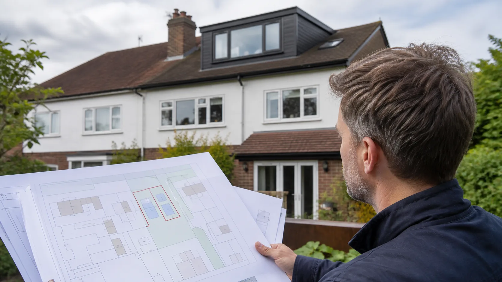
Even an upper-floor project needs a consistent map reference for the property and plot.
The map does not replace the roof drawings
The planning map is not the document that proves the dormer height, roof pitch or internal arrangement. Those details belong in the architectural drawings and supporting information.
The map provides the geographic context needed to answer:
- Which property is being changed?
- Which land forms the application site?
- How does the property relate to its neighbours and road?
- Where are the access, garden and boundaries?
Keeping that distinction clear helps you avoid ordering the wrong document.
What the location plan should show
A location plan at 1:1250 commonly shows the house, surrounding roads, neighbouring buildings and the red application boundary. It should include enough context for the authority to identify the correct property without relying on the application description alone.
Check the address, road names, north point, scale bar and OS licence details. If the house is in a terrace or a group of similar properties, make sure the map is centred on the correct unit.
What the detailed plan should show
A block or site plan at 1:500 can show the house and plot in closer detail. Depending on the proposal and local checklist, useful features include:
- Existing building footprint.
- Garden and plot boundaries.
- Driveway and access.
- Nearby buildings.
- Trees, walls and hedges.
- The relationship between the house and neighbouring properties.
The dormer itself may be shown mainly on the proposed elevations and roof plans, but the block plan should still identify the site and surrounding relationships the authority needs to assess.
The red line normally describes the ground site
Do not draw the red line around the roof or loft room. A planning application site is land, not an isolated internal space. For a typical householder application, the boundary often follows the house, garden and access relevant to the project.
If the work involves a separate garage, access alteration, parking change or garden structure, consider whether those areas form part of the application. Then make the red line agree across the application form, location plan and detailed plan.
Permitted development and certificates
Some loft conversions may be pursued under permitted-development rules, while others need full planning permission or a Lawful Development Certificate. The map requirement depends on the application route and authority checklist.
Do not assume that no planning permission means no location information is required. A certificate application still needs the authority to identify the property and assess the evidence.
Common mistakes
- Marking only the new dormer footprint in red.
- Using a screenshot instead of an OS-licensed planning map.
- Omitting the access or garden when the application concerns the wider property.
- Treating the location plan as a substitute for roof elevations.
- Using a block plan that does not match the location plan.
- Printing the map at Fit to Page and changing the scale.
Final check
Before submission, compare the map pack with the architectural drawings. The property address, red boundary, access and proposal description should be consistent. Check the authority's current validation requirements and use the planning map scale chooser if the site is unusually compact or constrained.
An aligned planning map pack gives you the wider location view and detailed site view from the same ordering workflow.
Why a roof project still needs site context
The visible change may be above the existing walls, but the planning decision is still made in relation to the building and its surroundings. The map helps the reader understand the property's position, neighbouring plots, access and the relationship between the roof work and the existing footprint.
For a rear dormer, the detailed plan should make the rear garden and side boundaries easy to identify. For a rooflight or front roof alteration, the frontage and surrounding street pattern may be more relevant. If the work is part of a wider extension or access project, the red line should describe the whole application rather than just the roof area.
Coordinate roof drawings with the plan
Compare the map with the proposed floor plan and elevations. Check the side of the house, the position of the stairs or dormer where it affects the footprint, and any roof extension that changes the building outline. A plan that shows a rear projection on the wrong side can make an otherwise good drawing set look unreliable.
The location plan does not need to show roof geometry. Its job is to place the property. The block plan gives the building footprint and site context. The elevations and roof plans then explain the three-dimensional change. Keeping those roles separate avoids clutter and makes each sheet more useful.
Neighbour and boundary checks
Roof projects often raise questions about overlooking, separation and the relationship to neighbouring homes. The map cannot answer every design question, but it should show the boundaries and nearby buildings that the drawings refer to. Where a side passage, shared drive or close neighbour is important, do not crop it out to make the property larger on the page.
Start with the property’s planning constraints
Loft conversions can fall under permitted development in some circumstances, but limits and conditions apply. Rights may be different or restricted for flats, maisonettes, listed buildings, designated land, homes affected by Article 4 directions or properties whose earlier permission removed rights. For England, use the Government’s householder permitted-development technical guidance as a starting point and check the site-specific position.
The map helps identify the property and its context; it does not itself confirm that a dormer is lawful. If certainty is important, the applicant may choose a lawful development certificate supported by precise plans and dimensions.
Coordinate the three-dimensional evidence
| Question | Best drawing or evidence |
|---|---|
| Which property is affected? | Location plan |
| Where is the house within the plot? | Block/site plan |
| How does the roof change? | Existing and proposed roof plans/elevations |
| What is the height and volume? | Dimensioned elevations, sections and calculations |
| How does it face neighbours? | Context plan, elevations and design explanation |
This hierarchy keeps the block plan honest. It should not be stretched into a roof elevation, yet it must show enough neighbouring context for the specialist drawings to make sense.
Watch for terraced and semi-detached errors
Mirrored house types are easy to confuse. Confirm the application property’s handedness, party-wall side, rear projection and street orientation against site photographs. A technically neat plan of the wrong half of a pair is still wrong.
Check whether eaves, gutters, steps, rooflights or access scaffolding affect land outside the assumed site. Construction access does not always change the application boundary, but any land needed for the proposed development should be considered deliberately and the ownership certificate must remain accurate.
Keep planning and private rights separate
Planning permission or an LDC does not remove the need to consider building regulations, the Party Wall etc. Act, covenants or access rights. GOV.UK’s LDC guidance explicitly notes that a certificate concerns lawfulness under planning legislation, not every other legal requirement.
Likewise, do not measure a tight roof or wall relationship from the thickness of a title-plan line. HM Land Registry says most title plans show general boundaries only. Use an appropriate measured survey where a dimension matters.
A strong loft-conversion pack therefore feels simple: one unmistakable property, one consistent orientation and a clear chain from site context to precise roof geometry.
Worked example: rear dormer on a semi-detached house
Begin by confirming which half of the pair is the application property and whether the rear elevation in the photographs matches the drawn handedness. The location plan identifies the address; the block plan shows the plot, shared boundary and nearby homes; the roof plan and elevations show the actual dormer.
Record the roof geometry from an appropriate measured survey. Show the existing and proposed ridge, eaves and roof slopes clearly, and explain how any volume calculation was derived. If a hip-to-gable change or roof extension affects the side nearest the attached neighbour, make that relationship unmistakable on the proposed drawings.
Then check the external consequences. Are new windows facing neighbours? Is scaffolding access assumed across land outside the applicant’s control? Does a raised platform or external stair form part of the scheme? These matters may require their own planning or private-rights consideration even though the project is called a loft conversion.
Final coordination questions
- Does every sheet use the same front, rear and side labels?
- Are existing and proposed roof outlines visually different?
- Do dimensions come from the survey rather than the OS base?
- Is the application route—permission or LDC—named correctly?
- Have property-specific restrictions and planning history been checked?
- Does the red line describe the site without pretending to fix the exact legal boundary?
Answering those questions is more valuable than adding roof detail to a map that was designed only to locate the site.
The Statutory Class B Rulebook: Permitted Development Loft Limits
When applying for a Lawful Development Certificate (LDC) or preparing planning drawings for a roof alteration, the scheme is assessed against Schedule 2, Part 1, Class B of the GPDO 2015:
1. Volumetric Cubic Allowances
Under Paragraph B.1(d), any roof enlargement cannot exceed the following cumulative volume limits over the original roof space:
- 40 cubic metres for terraced houses (including end-of-terrace properties).
- 50 cubic metres for semi-detached and detached houses.
- Cumulative Rule: The volume calculation must include any previous roof extensions or additions built since 1 July 1948 by current or former owners.
2. The 200mm Eaves Setback Condition
Under Condition B.2(b), the face of a rear dormer enlargement must be set back at least 200 millimetres from the eaves of the original roof, measured along the roof slope. A dormer built flush with the external brick wall or overhanging the eaves is unlawful under Permitted Development and requires full planning permission.
3. Ridge Height and Highway Frontages
- No Higher Than Existing Ridge: Under Paragraph B.1(b), no part of the dormer or roof extension can exceed the height of the highest part of the existing roof.
- The Principal Elevation Ban: Under Paragraph B.1(c), no roof enlargement can extend beyond the plane of any roof slope forming the principal elevation of the house fronting a highway. Front box dormers always require full planning permission.
Class C Rooflights: Obscure Glazing and 150mm Projection
Where roof alterations incorporate Velux rooflights or side dormer windows under Class C:
- The 150mm Projection Rule: Rooflights cannot project more than 150 millimetres beyond the plane of the existing roof slope.
- Side-Facing Glazing Conditions: Any side-facing window (including dormers or rooflights on flank roof slopes) must be:
- Glazed with obscure glass to minimum privacy Level 3; and
- Non-opening, unless the parts which can be opened are at least 1.7 metres above the finished floor level of the room.
The Party Wall etc. Act 1996: Structural Wall Insertion
Planning permission deals exclusively with the public interest. Constructing a loft conversion on a semi-detached or terraced home invariably triggers private statutory procedures under the Party Wall etc. Act 1996:
- Section 2(2)(f) Party Structure Notices: Inserting structural steel universal beams (UBs) into the shared party wall to support new loft floor joists requires serving a formal Party Structure Notice on your adjoining neighbour at least two months before works commence.
- Raising the Party Parapet: If you are building a rear dormer that extends to the party line, you will need to raise the party wall or parapet under Section 2(2)(a).
- Party Wall Surveyors: If the neighbour does not consent in writing within 14 days, a statutory dispute arises, requiring the appointment of an Agreed Surveyor or two independent party wall surveyors to agree an enforceable Party Wall Award.