
An agricultural, forestry or rural storage shed may sit in an open field with a long track between it and the public road. The map must show more than the building footprint: it should explain where the site is, how it is reached and which land is involved.
Use a site location plan for the wider setting and a block plan for the building, access and immediate site detail.
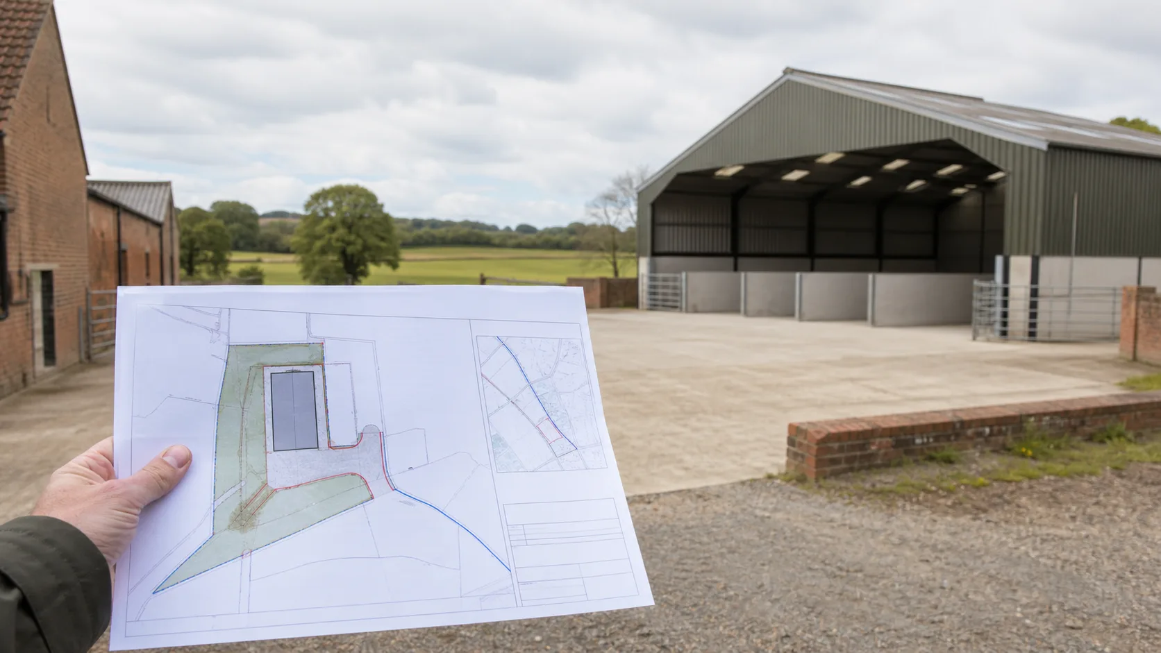
Rural shed applications often need the building, yard and route to the public road to be understood together.
Identify the actual application site
The red application boundary should cover the proposed shed and the land needed to carry out and use the development. Depending on the project, that may include:
- The building footprint.
- A construction or operational area.
- Access from the public road.
- Turning and loading space.
- Hardstanding or drainage.
- Fencing, landscaping or visibility areas.
It does not automatically need to include the whole farm or every field owned by the applicant. Define the proposal first, then set the boundary around the relevant land.
Choose a wider location view when needed
A 1:1250 plan may work for a small rural site near a recognisable road. A larger field or isolated building may need 1:2500 or a larger sheet to show the road connection and surrounding context.
Do not choose the widest possible map by default. The shed and red boundary must remain visible. Review:
- Public highway connection.
- Access track.
- Nearby buildings or landmarks.
- Field and parcel context.
- Complete red boundary.
- North point and scale bar.
If the access is too long for one useful view, ask whether the authority expects a wider location plan, an inset or another supporting drawing.
Detailed site information
The closer site plan should help the authority understand:
- The existing and proposed building.
- Shed orientation and position.
- Track and turning area.
- Nearby buildings or sensitive boundaries.
- Hardstanding and drainage.
- Trees, hedges, walls or watercourses.
- Any relationship to a public right of way.
The map is part of the application pack, not a substitute for agricultural justification, ecology, flood, highways or landscape information where those are required.
Ownership and access
An access track may be needed for the planning application even if another person owns it. Include the relevant land where appropriate, then deal with ownership, certificates and notices correctly.
Do not use a blue line as a shortcut for a complicated ownership position. Red defines the application site; blue may identify other relevant nearby land owned by the applicant.
Frequent problems
- The red boundary surrounds the shed but stops before the public road.
- The map shows the field but not the access track.
- The location plan is too close to identify the rural setting.
- The detailed plan omits turning or servicing space.
- Different plans show different field or access extents.
- The PDF is printed at the wrong size.
Final review
Compare the map with the application description, ownership information and site layout. Check that the full route and operational land are treated consistently, then verify the scale and paper size.
For a coordinated output, use the OS planning map pack and compare alternatives with the scale chooser.
Separate the planning map from the farm plan
An agricultural business may already have a farm plan, field record or estate drawing. Those documents can be useful supporting evidence, but they do not automatically replace a current planning location plan. The planning map identifies the application site in a recognised wider setting; the farm plan can explain operations, ownership, field numbers or land management.
Use each document for the question it answers. A farm plan might show several fields and grazing areas, while the location plan focuses on the building site and access. If the planning authority asks for both, make their relationship clear with matching labels and a short explanation in the supporting statement.
Show the existing arrangement honestly
If there are already barns, hardstandings, silos, tracks or yards close to the shed, show the features that help explain the proposal. This is particularly important where the new structure will extend an established group of buildings or change how vehicles move around the site.
Do not use the map to imply that an existing structure is authorised or that a track has a particular legal status. Those are separate planning, ownership and highway questions. The map should show what is physically relevant, while the application statement provides the factual explanation.
A simple operational test
Read the proposal description, then trace the operation on the map. Where does a vehicle enter? Where would it turn or load? Which building is existing and which is proposed? Does the red boundary include the land needed for the works? If any answer requires guesswork, the map extent or annotations need attention.
For large rural sites, a coordinated wider location plan and detailed site plan are often more useful than one overloaded sheet. Keep the scale bar and north point visible on each output.
Start with the consent route, not the building label
“Agricultural shed” can describe proposals with very different planning routes: a full application, an agricultural prior-approval process, or work that falls outside the relevant permitted development rights. The farm’s size, the building’s use, dimensions, siting and surrounding constraints can all matter. Mapping should support the route actually being used, not assume that an agricultural description settles it.
The Government’s permitted development rights collection is a useful national starting point, but it is not a substitute for the current legislation, local constraints or professional advice. Confirm the procedure with the local planning authority before deciding how much supporting information to prepare.
Map the operation around the shed
An isolated rectangle does not explain an agricultural building. Show enough context for the reviewer to understand how the proposal relates to the holding and the claimed use.
| Operational question | Mapping evidence that may help |
|---|---|
| What will use the building? | Existing farm buildings, yards and relevant fields |
| How will vehicles reach it? | Track, gate, public-road junction and turning area |
| Why this position? | Relationship to the farm group, boundaries and terrain |
| What could be affected? | Nearby homes, rights of way, trees, watercourses or habitats |
| How is the site drained? | Relevant falls, ditches and drainage features on the proper plan |
Do not add unverified contours, rights-of-way status or ownership claims to make the plan look comprehensive. Use the correct specialist dataset or report and state its source and date.
Use a hierarchy of plans
A 1:2500 location plan may be best for identifying a rural holding and its connection to named roads. A 1:500 site plan can then show the shed, apron, access, boundaries and neighbouring features. Larger or more complex schemes may also need a surveyed layout, elevations, drainage information and landscape or ecological plans.
The Planning Portal explains that location plans and site plans answer different questions. Trying to replace both with a single mid-scale farm sketch usually produces a page that is neither easy to locate nor detailed enough to assess.
Rural due diligence before issue
Walk the access if it is safe and you have permission. Compare the map with gates, bends, surface changes, bridges, overhead constraints and neighbouring entrances. Confirm whether the public-road connection shown on the plan is the route the proposal will actually use.
Then review ownership separately. A title plan may help identify registered land, but HM Land Registry cautions that it normally shows general boundaries rather than exact legal lines. Rights to use a track may also come from deeds or agreements and cannot be inferred from the base map.
The result should be a restrained, truthful set: a location plan that finds the site, a detailed plan that explains the operation and supporting evidence that deals with the questions the map cannot answer.
Worked map check: a grain store beside an existing yard
Show the proposed store in relation to the established building group, yard and vehicle route, not as an isolated footprint. Label existing and proposed buildings separately. If the justification relies on grain moving from particular land, the planning statement can explain that agricultural relationship while the wider plan identifies the holding proportionately.
Test the largest realistic vehicle journey from the public road to unloading and back out. Any vehicle-tracking drawing should use surveyed geometry and state its assumptions; it should not be traced casually over a small-scale location plan. Check whether a new apron, drainage work, earth movement or landscape mitigation extends beyond the obvious building rectangle.
Finally, compare the stated building use with its internal and external layout. Doors, hardstanding and access should tell a coherent operational story. A map cannot prove agricultural need, but it can prevent the submission from undermining that case through inconsistent siting or unexplained land.
The Statutory Framework: Part 6 Class A Permitted Development
Most agricultural sheds are erected under the 28-Day Prior Notification procedure governed by Schedule 2, Part 6 of The Town and Country Planning (General Permitted Development) (England) Order 2015 (GPDO):
1. Class A Agricultural Holdings (5 Hectares or More)
For agricultural units of 5 hectares (12.35 acres) or larger:
- Maximum Ground Area: Following recent legislative updates, the maximum cumulative ground area for any new agricultural building erected under Class A was expanded to 1,500 square metres (16,146 sq ft).
- Height Restrictions: Maximum height is 12 metres if situated within 3 kilometres of an aerodrome, or 12 metres generally unless within 25 metres of a classified road.
- The Prior Notification Submission: The applicant must submit a 28-day Prior Notification to the local planning authority accompanied by a certified 1:2500 or 1:1250 Site Location Plan and a 1:500 Block Plan demonstrating siting, design, and external appearance.
2. Class B Agricultural Holdings (Between 0.4 and 5 Hectares)
For smaller rural holdings between 0.4 and 5 hectares:
- Extensions to existing buildings and new structures are strictly capped at 1,000 square metres.
- No new separate building can be erected under Class B if the holding is under 5 hectares; works are restricted primarily to extensions and alterations.
Siting Rules: The 400-Metre and 25-Metre Buffers
When a planning officer examines your agricultural site location plan, their GIS system automatically plots two statutory buffer zones:
1. The 400-Metre "Protected Building" Exclusion Zone
Under Paragraph A.1(i) of Part 6, no building housing livestock, slurry storage, or sewage sludge can be erected under Permitted Development if any part of it falls within 400 metres of the curtilage of a "protected building":
- A protected building includes any dwellinghouse, hospital, school, or residential home not occupied by someone employed in agriculture on the holding.
- If your proposed livestock barn sits 390 metres from a neighbour's farmhouse, Part 6 rights are completely void, requiring a full planning application with odour, ammonia, and bio-aerosol assessments.
2. The 25-Metre Classified Road Setback
Under Paragraph A.1(j), no agricultural building or excavation can be sited within 25 metres of the metalled portion of a trunk road or classified road (A-road or B-road). Your 1:500 block plan must annotate the exact metric distance from the building face to the road edge.
Heavy Farm Vehicle Tracking and Highways Access
Agricultural machinery imposes unique demands on rural junctions that must be reflected on your detailed plans:
- Articulated Grain Lorry and Silage Trailer Swept Paths: Modern agricultural tractors towing 16-tonne triple-axle trailers or articulated bulk grain artics require a minimum 10.5m kerb-to-kerb turning radius. A narrow 4-metre field gate is inadequate.
- Bellmouth Geometry: Highway authorities expect the access junction onto the public road to feature a minimum 6.0m throat width with 10.0m radius bellmouth curves surfaced in tarmac or concrete for the first 15 metres to prevent mud and gravel being dragged onto the public highway.
- Rural Visibility Splays: On a 60mph rural national-speed-limit road, highway engineers demand minimum visibility splays of $2.4\text{m} \times 215\text{m}$ in both directions along the public carriageway.
SSAFO Drainage Compliance on the Block Plan
Under the Water Resources (Control of Pollution) (Silage, Slurry and Agricultural Fuel Oil) (England) Regulations 2010 (SSAFO Regulations):
- All runoff from animal housing, manure storage aprons, or agricultural machinery wash-down areas must drain into an impermeable effluent tank or slurry lagoon.
- Your block plan must show clean rainwater gutters diverted into clean soakaways or ditches, while separating contaminated yard water to prevent illegal pollution of local watercourses.