
Work in a conservation area is judged in a more sensitive setting, so a planning map needs to do more than identify a postcode. It should help the planning officer understand the relationship between the proposal, the building, the plot, public routes, trees, neighbouring properties and the wider character of the area.
The mapping itself is not a substitute for a heritage statement, design-and-access statement or specialist tree report. It is the reliable spatial framework that allows those documents and the architectural drawings to be read together.
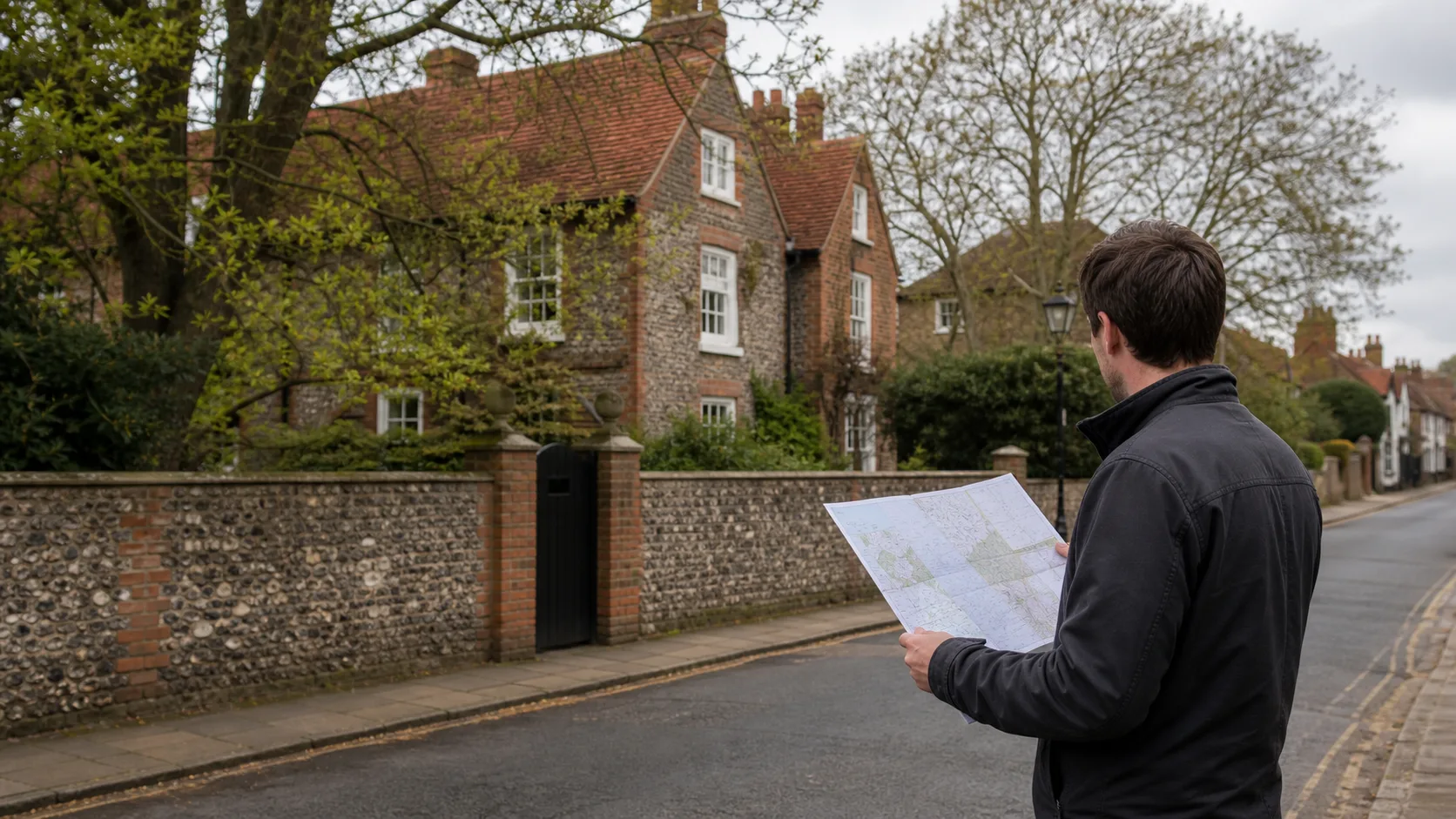
The surrounding street, trees, walls and buildings can be important context for a conservation-area application.
Start by confirming the planning context
Before ordering a map, check the council's conservation-area information and the application checklist. A conservation-area designation does not automatically mean that every project needs the same documents. A rear extension, roof alteration, tree work, demolition proposal and new access can all raise different questions.
Write down the facts that the map must communicate:
| Question | Why it matters |
|---|---|
| Where is the application site? | The red boundary must match the form and every drawing. |
| What is changing? | The proposal needs to be distinguishable from existing buildings and features. |
| Are trees or hedges relevant? | Vegetation can be important to character and may affect visibility or construction. |
| Is access changing? | New openings, parking and hardstanding may affect the street scene. |
| Is demolition involved? | The plan should make the existing and proposed arrangement easy to compare. |
This short fact-finding stage prevents a common mistake: buying a generic location plan and only later discovering that the important issue is the detailed relationship between the proposal and the street, boundary or protected tree.
The wider location plan
The location plan normally identifies the property among surrounding roads and buildings. Use it to make the site unambiguous. Include a clear red application boundary, enough surrounding features for orientation, a north point, a scale bar and the required licence or copyright information.
In a conservation area, avoid a crop so tight that the officer cannot see the site's relationship with the surrounding street pattern. Equally, avoid an unnecessarily wide map that makes the property tiny. The right view is the smallest extent that still gives confident orientation.
Check the red line carefully. If the application includes a driveway, garden, access route or land needed for the works, the boundary may need to include more than the building footprint. If ownership and application boundaries are different, deal with that distinction consistently across the form and plans.
The detailed block plan
The block plan gives the proposal a practical site context. It commonly shows the house, outbuildings, boundaries, access, parking, hard surfaces, nearby buildings and the position of the proposed work. Where relevant, show trees, walls, hedges, gates and other features that affect character or the proposal's visibility.
The plan should not try to become an architectural drawing. Dimensions, materials and elevations belong in the drawing set. The map's job is to show where those drawings apply.
For a small extension, the most useful detail may be the distance to the side boundary and the relationship to a neighbouring wall. For a roof alteration, the plan may need to show the building footprint and nearby public viewpoints. For a new access, the key issue may be the position of the gate, visibility area, footway and parking.
Trees and landscape features
Do not add invented tree symbols simply to make a plan look detailed. Show identifiable trees and landscape features where they are present and relevant, then use the appropriate arboricultural or landscape document for measurements and assessments.
Useful checks include:
- Does the proposed footprint overlap the root protection area of a tree?
- Is a tree being removed, pruned or protected during construction?
- Could a new wall, driveway or outbuilding change the setting of a mature tree?
- Are hedges or walls part of the character of the street?
- Does the application include landscaping that should appear on a separate plan?
The map should support these questions without claiming to provide a survey that has not been undertaken.
Matching the map to the design drawings
Coordination is particularly important where the authority will be considering visual impact. Compare the map with the proposed floor plan, roof plan, elevations and any streetscape or heritage views.
Use this simple cross-check:
| Map item | Compare against |
|---|---|
| Red-line boundary | Application form and ownership information |
| Building footprint | Proposed floor plan and site plan |
| Roof or storey changes | Elevations and roof plan |
| Access and parking | Highway, transport or access notes |
| Trees and hedges | Arboricultural and landscape information |
| Existing structures | Existing-site drawings and photographs |
If one document shows a garage, wall or tree that another omits, decide whether the difference is intentional. Unexplained inconsistencies create avoidable validation questions.
Common mistakes in sensitive areas
The most frequent problems are not exotic mapping errors. They are small inconsistencies that make the application harder to trust:
- The red line follows a different boundary on the location plan and block plan.
- A proposed extension is shown in a slightly different position from the architectural drawings.
- A shared access is cropped out even though it is used to reach the site.
- Trees or important walls are absent from the detailed plan.
- The map is printed at the wrong size and its scale bar no longer works.
- A screenshot is used without the required mapping licence and plan information.
- The plan contains too much decorative annotation and hides the base mapping.
A practical submission checklist
Before uploading, confirm that the map:
- identifies the correct property and conservation-area setting;
- has a legible red boundary;
- shows enough roads and neighbouring features for orientation;
- includes a north point and usable scale bar;
- distinguishes existing and proposed features where appropriate;
- shows relevant access, boundaries, trees and structures;
- matches the architectural drawings and application form; and
- is exported as a clear, correctly sized PDF.
If you need both the wider location plan and detailed block plan, prepare them from the same site information through the planning maps workflow. Use the block plan guide when the proposal depends on distances, access or boundary relationships.
Start with the site location plan when the first question is where the property sits in its surrounding street or landscape context.
Final thought
A conservation-area application benefits from calm, precise presentation. The map should make the site easy to understand, leave specialist conclusions to the relevant reports and give every other document a consistent spatial reference. That clarity is a competitive advantage because it helps reviewers spend their time on the design rather than resolving avoidable mapping questions.
Map significance before adding decoration
Conservation-area work is not simply ordinary planning with more labels. Government guidance defines a conservation area by its special architectural or historic interest and explains that assessment should consider the significance of affected heritage assets, including the contribution made by their setting. Read the GOV.UK historic-environment guidance alongside the council’s conservation-area appraisal and local policies.
That research should change what the plan communicates. If the appraisal identifies an important view, building line, boundary wall, tree group or historic route, make sure the relevant submitted drawing shows the physical relationship clearly. Do not copy policy designations onto a plan without checking the current official source and legend.
Create an evidence chain
| Source | What to extract | Where it belongs |
|---|---|---|
| Conservation-area appraisal | Character areas, views and contributing features | Heritage statement and context plan |
| Historic Environment Record | Relevant known assets and archaeology | Heritage assessment |
| Listed-building entries | Official extent and significance information | Heritage assessment and site identification |
| Current site survey/photos | Materials, condition and actual features | Existing drawings and photo sheet |
| OS mapping | Dependable geographic context | Location and block plans |
The National Planning Policy Framework’s historic-environment section expects proportionate information about significance. A map contributes by locating the evidence, not by replacing the written assessment.
Show the setting at the right scale
A tight 1:200 plan can explain a rear extension’s relationship to boundaries and trees but may omit the street rhythm that makes the conservation area special. A 1:1250 plan identifies the site but may be too broad for a key view. Use an additional context or street-scene drawing where the heritage question genuinely needs it.
Think in nested views:
- the designated area and the site’s place within it;
- the street, space or landscape that contributes to significance;
- the plot and the proposed physical change.
Each view should have a defined purpose. Avoid enlarging a small raster image or loading every designation onto one unreadable sheet.
Do not overstate what the map establishes
OS mapping records topographic features, not heritage significance or exact ownership. A title plan does not prove a wall’s precise legal position. A conservation-area boundary does not mean every feature inside it contributes equally. Attribute every overlay and separate observation from professional judgment.
Before issue, compare the proposed plan, elevations, heritage statement and arboricultural information. If a tree, wall or outbuilding is described as important, the reader should be able to find it consistently. That quiet coordination is more persuasive than ornamental graphics or unsupported claims.
Statutory Duty: Section 72 of the Listed Buildings & Conservation Areas Act 1990
When assessing any planning application within a designated conservation area, the local authority is bound by a strict statutory duty under Section 72(1) of the Planning (Listed Buildings and Conservation Areas) Act 1990:
"Special attention shall be paid to the desirability of
preserving or enhancing the character or appearance of that area."
Case officers evaluate "character and appearance" directly through spatial evidence on your site maps:
- The Historic Building Line: In historic market towns and Victorian suburbs, houses often sit along a strict, uniform building setback line. Your 1:500 block plan must demonstrate that a proposed front porch or bay window does not project forward of the prevailing historic building line.
- Plot Grain and Density: Conservation area appraisals frequently identify low-density open garden spaces as essential contributors to area character. A block plan showing excessive garden infill, overbearing building footprints, or loss of green space gives the conservation officer clear spatial grounds for refusal.
Permitted Development Restrictions: Article 2(3) Designated Land
Under Schedule 1, Part 1 of the GPDO 2015, conservation areas are legally classified as Article 2(3) Land. This designation severely restricts standard homeowner Permitted Development rights:
- Roof Extensions Completely Withdrawn (Class B): Homeowners cannot build rear box dormers, hip-to-gable roof extensions, or side dormers under Permitted Development in a conservation area. A full planning application supported by an official 1:1250 location plan is legally mandatory.
- Side Extensions Barred: No side extensions (single or multi-storey) are permitted under PD on Article 2(3) land.
- No Multi-Storey Rear Extensions: Permitted Development only allows single-storey rear extensions up to 3 metres deep. Any two-storey or first-floor rear addition requires full planning consent.
- Cladding Restrictions: Applying timber weatherboarding, stone cladding, artificial stone, render, or plastic composite panels to exterior walls requires full planning approval.
Tree Protection: Section 211 Notices and BS 5837 Overlays
Trees contribute fundamentally to the leafy visual amenity of conservation areas. Under Section 211 of the Town and Country Planning Act 1990:
- Automatic Legal Protection: Every single tree with a trunk diameter exceeding 75 millimetres (measured at 1.5 metres above ground level) enjoys statutory protection equivalent to a Tree Preservation Order (TPO).
- The 6-Week Notice: Anyone proposing to fell, lop, top, or uproot a tree must give the council 6 weeks' formal notice under Section 211 before carrying out work.
- Mapping Tree Constraints: On your 1:500 block plan, you must accurately plot:
- The exact stem position of all existing trees within the plot and within 15 metres of the site boundary.
- The accurate canopy crown spread.
- The circular Root Protection Area (RPA) calculated in accordance with British Standard BS 5837:2012 ($RPA\text{ radius} = \text{stem diameter} \times 12$).
- Any proposed ground excavations or scaffolding positions intersecting the RPA.
Article 4 Directions: Mapping Minor Streetscape Alterations
Many local authorities have introduced targeted Article 4 Directions across conservation areas, revoking minor Permitted Development rights under Part 1 and Part 2 of the GPDO:
- Common Revocations: Erecting or demolishing front boundary walls, removing original timber sash windows to install uPVC, replacing slate roof tiles with concrete pantiles, or paving over front gardens for car parking.
- Why Maps Matter: If you apply for planning permission to replace a decaying stone boundary wall or create a front driveway under an Article 4 Direction, your 1:500 block plan must precisely detail the wall alignment, stone coursing, pillar heights, and vehicular visibility sightlines to satisfy the conservation officer.