
A planning map can be prepared correctly and still become the wrong scale when it is printed. The usual cause is a printer setting such as Fit to Page, Scale to Fit or Shrink Oversized Pages.
That setting changes the size of every feature on the sheet. The map may still say 1:1250 in its title block, but a planning officer measuring it with a scale ruler will no longer get the right result.
If you need a map first, create a site location plan or block plan and keep the original PDF. The print check below is for verifying the copy you intend to submit or send to a professional.
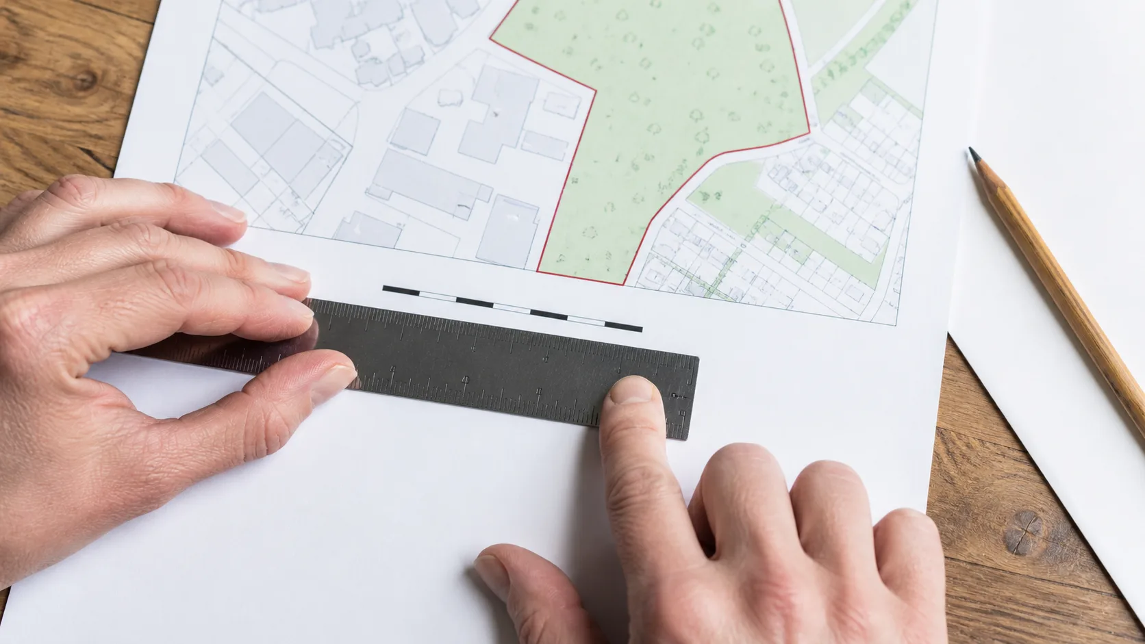
Checking the printed scale bar is a quick way to confirm that a planning map has not been resized.
Check the ordered paper size
Start with the document itself. Look for the paper size in the title block, order details or PDF properties. A plan prepared as 1:1250 @ A4 is not the same as a plan prepared as 1:1250 @ A3: the ratio is the same, but the sheet covers a different amount of ground.
Do not use the paper size selected in your printer dialog as a substitute for the paper size ordered. The PDF page and the physical sheet need to match.
Use the correct print settings
When the PDF print window opens, choose:
- Paper size matching the ordered plan.
- Actual Size, 100% or an equivalent setting.
- The correct page orientation.
- The complete page, not a selected area or screenshot.
Turn off settings with names such as:
- Fit to Page.
- Scale to Fit.
- Fit to Printable Area.
- Shrink Oversized Pages.
- Custom Scale.
The wording varies between Adobe Acrobat, browser PDF viewers and operating-system print dialogs. The important setting is the scale percentage, which should be 100 unless the supplier has instructed you otherwise.
Measure the scale bar
The most useful check is the graphic scale bar printed on the plan. If the bar states 0–50 metres, measure it with a ruler after printing. The exact physical length depends on the plan scale and the document layout, so compare the result with the interval indicated on the bar rather than guessing from the page dimensions.
If it does not match, do not edit the map image manually. Check the following in order:
- The PDF was printed rather than a browser screenshot.
- The print percentage is 100.
- The printer paper size matches the PDF.
- No borderless or automatic enlargement option is enabled.
- The PDF viewer has not rotated or scaled the page to fit the printer margins.
What about digital submission?
Uploading the original PDF avoids the physical printer changing the scale, but the file still needs to be prepared at the correct page size. Do not save a screenshot of the preview and do not export the map through software that changes the page dimensions.
If a council asks for a paper copy later, print the same original PDF at Actual Size. Keep the untouched electronic file with your application records.
A quick final check
Before submitting, confirm:
- The complete red application boundary is visible.
- The north point and scale bar are present.
- The stated scale and paper size are readable.
- The map has not been cropped at the edge.
- The printed scale bar measures correctly.
If you are unsure which map or paper size to order, use the planning map scale chooser or order an OS planning map pack with coordinated outputs.
The safest rule is simple: preserve the original PDF, match its paper size, print at 100%, and measure the scale bar before relying on the physical copy.
Screen review versus paper review
Use both checks when the map is going into a paper submission or a meeting. On screen, zoom to the property and inspect fine labels, boundary lines and the proposal area. On paper, check that the whole page fits the intended sheet and that the reader can still orientate themselves without excessive magnification.
These are different tests. A PDF may look sharp on screen but be reduced by a printer driver. A page may print at the correct size but have labels that are too small for practical use. If the map is part of a larger drawing set, keep its page orientation consistent with the other sheets where possible.
What to do when the map does not fit
Do not solve a coverage problem by stretching the map. Instead, revisit the map extent, sheet size and scale. A rural site may need a wider location view, while the detailed plan can stay focused on the building and immediate access. A compact urban plot may need a more detailed sheet so that boundaries and neighbouring structures remain readable.
If a designer is combining the map with annotations, ask them to place the plan on a page without changing its proportions. Any added title block should sit outside the map content or clearly state the resulting scale. Keep the original supplied PDF as the reference version.
Quick measurement example
Suppose a plan is labelled 1:1250. A 10-metre distance should measure 8 millimetres on the correctly printed sheet. If it measures 6 millimetres, the page has been reduced to roughly 75 percent. That may look harmless, but distances, site relationships and any drawn proposal are no longer at the stated scale.
The scale bar is the quickest practical test because it checks the final output rather than trusting a print dialogue setting.
Understand the four settings that change scale
Print dialogues use different wording, but the risky controls are consistent.
| Setting | Correct approach for a true-scale print |
|---|---|
| Page scaling | Choose 100% or Actual Size |
| Paper size | Match the size stated in the PDF, such as A4 or A3 |
| Orientation | Use the document’s intended portrait or landscape orientation |
| Borderless/driver scaling | Disable automatic enlargement or reduction |
“Fit”, “Shrink oversized pages” and “Scale to printable area” deliberately alter the page. Even a small change means the printed drawing is no longer at the scale printed in its title block.
Calculate a scale-bar check
Use the labelled bar rather than an arbitrary building, because the building may not have a known ground dimension. At 1:500, a 20 m scale-bar segment should measure 40 mm on paper. At 1:200 it should measure 100 mm. At 1:1250, 50 m should measure 40 mm.
The formula is:
printed length in millimetres = ground length in millimetres ÷ scale denominator
Measure with a dependable ruler after printing. Allow for ordinary printer tolerances, but investigate a clear discrepancy rather than assuming the label overrides the physical sheet.
Large-format and office-printer pitfalls
Some printers cannot image to the edge of standard paper and silently reduce the page. Others select US Letter when A4 is unavailable, tile an A3 sheet over two pages or rotate the document. Check the driver summary before pressing Print and inspect the first copy before producing a set.
If you need A3 but have only an A4 printer, do not shrink the drawing and continue calling it 1:500. Use an A3 printer or obtain a correctly scaled print. If you intentionally produce a reduced reference copy, mark it “not to scale” so it cannot be mistaken for the formal drawing.
Why digital files still need a scale bar
On screen, physical centimetres vary with display size and zoom, so measuring the monitor is meaningless. The declared scale relates to the PDF’s page dimensions and its correct print output. A graphical scale bar remains useful because it enlarges and reduces with the drawing and reveals accidental rescaling.
The Planning Portal’s map guidance expects identified standard metric scales for location and site plans. Its more detailed location-plan criteria also refer to standard A4 or A3 document sizes. Preserve those properties in the original PDF even when the application itself is submitted digitally.
Keep one authoritative original
Store the downloaded or issued PDF unchanged. Create separately named print or compressed derivatives only when necessary, and compare them with the original. This prevents a convenient email attachment or reduced office copy from gradually becoming the project’s supposed master.
A correct print is therefore easy to explain: right source file, right paper, no scaling, verified scale bar. If any of those four is uncertain, solve it before relying on a ruler measurement from the page.
When a drawing is deliberately “not to scale”
Reference copies can be reduced for meetings or email, but label them clearly and never use them for measurement. Keep the drawing number and revision visible so comments can still be transferred to the authoritative sheet.
If annotations are added to a reduced copy, reapply or verify them on the true-scale original before issue. A handwritten dimension does not restore the scale of the rest of the page. The safest record always preserves both the unaltered master PDF and the correctly measured print.
The Mathematics of Scale: Scale Rulers Explained
Case officers and building inspectors do not rely on rough estimates; they use calibrated Triangular Metric Scale Rulers (typically compliant with BS 6320):
| Map Scale | Paper Measurement | Real-World Ground Distance | Scale Ruler Sense Check |
|---|---|---|---|
| 1:1250 (Location Plan) | 8.0 mm | 10.0 metres | 80mm measures exactly 100m on the ground |
| 1:2500 (Rural Location) | 4.0 mm | 10.0 metres | 40mm measures exactly 100m on the ground |
| 1:500 (Block Plan) | 20.0 mm (2.0 cm) | 10.0 metres | 100mm measures exactly 50m on the ground |
| 1:200 (Detailed Site Plan) | 50.0 mm (5.0 cm) | 10.0 metres | 100mm measures exactly 20m on the ground |
| 1:100 (Floor Plan) | 100.0 mm (10.0 cm) | 10.0 metres | 10mm measures exactly 1m on the ground |
If you place a standard metric ruler against a 1:1250 plan and measure a 50-metre graphic scale bar, the distance between the "0" and "50m" markings on paper must measure exactly 40.0 millimetres. If it measures 37.5mm or 42mm, the print scale is corrupted.
The "Fit to Printable Area" Trap: Why 94% Shrinkage Invalidates Plans
Most home and office desktop printers cannot print right to the edge of the paper due to physical paper-feed rollers. They impose a mechanical margin of 4mm to 6mm:
- The Silent Auto-Shrink: When you leave default printer settings enabled, software like Adobe Acrobat or Apple Preview automatically toggles "Fit to Printable Area" or "Shrink Oversized Pages".
- The 94% Error: To force the page inside the printer's roller margins, the driver scales the entire document down to approximately 94% to 96% of its true size.
- The Real-World Consequence:
- A proposed 3.0-metre rear extension now prints at 2.82 metres on paper.
- A 1.0-metre boundary clearance now measures only 0.94 metres.
- When the planning officer audits separation distances to neighbouring habitable windows, your proposal appears to violate daylight and privacy policies, leading to an unfair refusal or invalidation notice.
The "Do Not Scale" Disclaimer: The Fatal Planning Submission Error
Many architectural practices automatically stamp their drawings with the standard legal disclaimer: "Do Not Scale — Work to Figured Dimensions Only":
- Why Architects Use It: To protect themselves against contractor liability during physical construction if a builder cuts a timber beam based on a scaled drawing rather than written structural dimensions.
- Why Planning Authorities Reject It: Local planning authorities are legally tasked with evaluating the physical spatial relationships of proposed development under the DMPO 2015. Case officers must be entitled to scale drawings.
- The Invalidation Rule: If your site location plan, block plan, or elevations bear a "Do Not Scale" stamp without an overriding clause (such as "Do not scale for construction purposes; planning authority may scale for planning assessment"), council validation technicians are instructed to reject the application immediately.
Digital Measurement Calibration (Adobe Acrobat Pro & Bluebeam Revu)
In modern paperless planning departments, officers rarely print paper copies; they evaluate digital PDFs directly on dual-monitor workstations:
- The Measure Tool: Case officers open the PDF in Adobe Acrobat Pro or Bluebeam Revu and select the digital "Measuring Tool".
- Calibration Against the Graphic Scale Bar: The officer zooms to 400% on the graphic scale bar, snaps digital measurement crosshairs from the 0m mark to the 50m mark, and enters "50 metres" into the calibration box.
- Auditing the Plan: Once calibrated, the software dynamically displays exact ground dimensions as the officer traces distances from your proposed extension to the flank fence. If your PDF has unflattened margins or stretched coordinate vectors, the digital calibration fails, triggering an instant invalidation notice.