
Whether you are extending your home, installing a new driveway, or addressing an overgrown garden, trees can fundamentally alter what you can build. In the UK, mature trees are fiercely protected by environmental statutes, local planning policies, and criminal law.
Felling or damaging a tree protected by a Tree Preservation Order (TPO) or standing within a Conservation Area without formal council consent is a criminal offence carrying unlimited financial penalties.
Before picking up a chainsaw or submitting an architectural planning package, you must know how to inspect council TPO maps, understand the legal classifications of tree protection, and produce an Ordnance Survey map that passes council validation for tree works applications.
Need a site location plan for planning permission?
Buy an OS-compliant 1:1250 location plan online with instant PDF or CAD download for planning applications, lawful development certificates, and validation-stage checks.
- 1:1250 planning map
- Instant PDF or CAD download
- Council-ready OS mapping
Usually paired with Block Plan
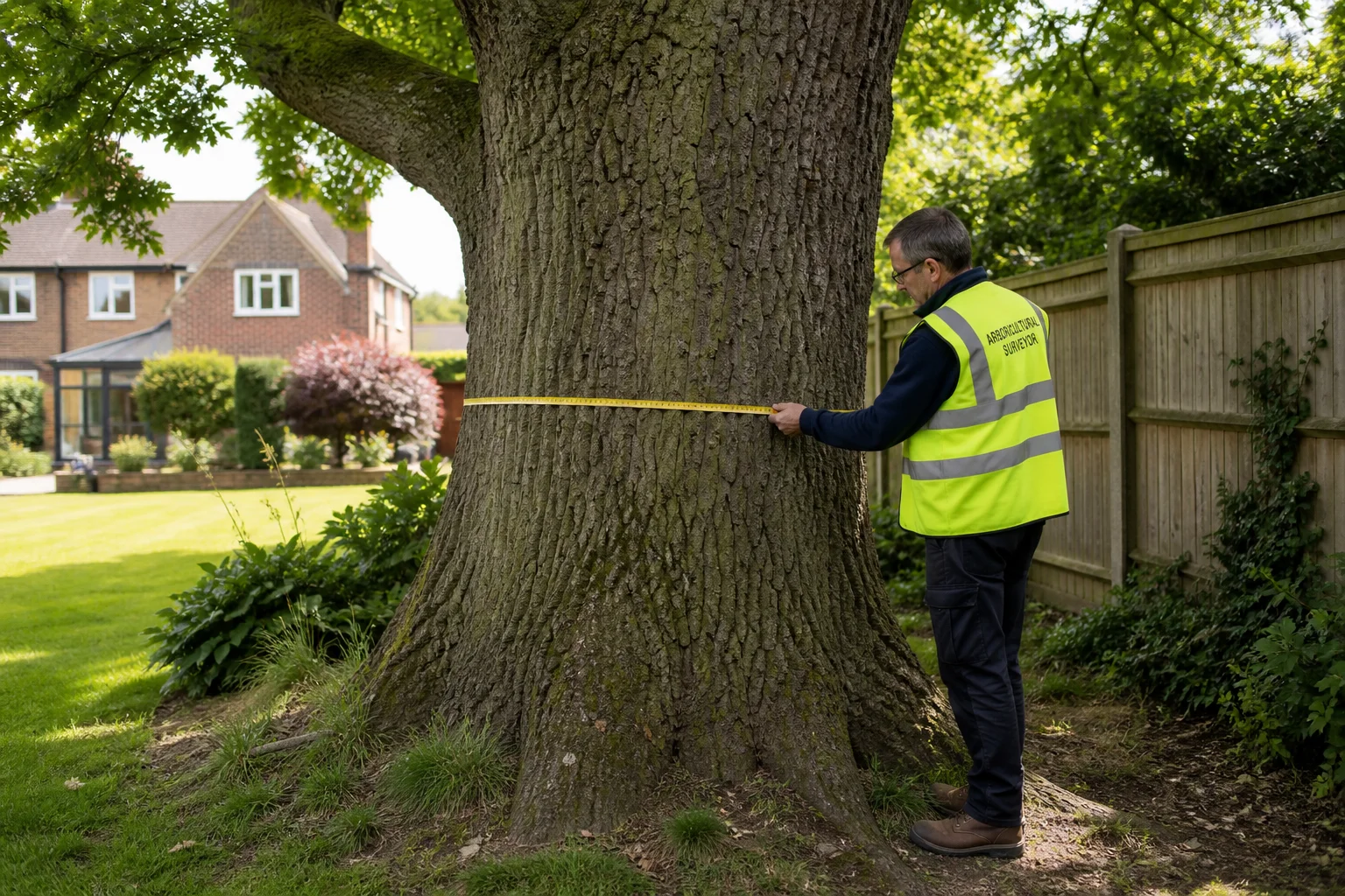
A professional arboricultural surveyor measuring a mature tree to establish root protection areas and TPO compliance.
What Is a Tree Preservation Order (TPO)?
A Tree Preservation Order (TPO) is a statutory order made by a local planning authority (LPA) in England, Wales, or Scotland to protect specific trees, groups of trees, or woodlands under the Town and Country Planning Act 1990 and the Town and Country Planning (Tree Preservation) (England) Regulations 2012.
The primary purpose of a TPO is to protect trees that provide significant public visual amenity. In practical terms, this means the tree must contribute noticeably to the character of the street scene, skyline, or local landscape as viewed from a public place (such as a public highway, park, or public right of way).
A TPO makes it a statutory offence to cut down, top, lop, uproot, wilfully damage, or wilfully destroy any protected tree without first obtaining formal written consent from the local authority.
How to Check If Your Tree Has a TPO: Online Council Maps
Before starting any building work or tree surgery, check the tree's legal status:
1. Interactive Council Online GIS Maps
Almost all local councils in the UK now provide interactive web-based GIS mapping systems (often called My Property, Planning Public Access, or Local View):
- Navigate to your council's planning or environmental health portal.
- Search by postcode, street address, or Unique Property Reference Number (UPRN).
- Toggle on the Environmental Constraints, Trees & Woodlands, or Conservation map layers.
- If a tree or boundary is highlighted in green, magenta, or hatched polygons, an active TPO or Conservation Area designation applies.
2. Formal Local Land Charges Search (Form LLC1)
If you are purchasing a property, your conveyancing solicitor will submit a standard LLC1 (Local Land Charge) search. Any confirmed TPO is registered as a legal charge against the property title that binds all subsequent owners.
3. Direct Written Confirmation with Council Tree Officers
Because online GIS web maps can occasionally lag behind recent emergency orders, always email the council's arboricultural team or local planning service with your property address and a marked plan if you plan to carry out significant earthworks or felling.
The Four Legal Categories of Tree Preservation Orders
When you inspect an official TPO document and its statutory map schedule, protected trees will be classified into one of four distinct legal categories:
| TPO Category | Schedule Reference | Description & Planning Implications |
|---|---|---|
| Individual Trees | T1, T2, T3... | Protects a specific, identified tree of a stated species (e.g. T1: English Oak). The order protects the entire organism, including its trunk, branch canopy, and subterranean root system. |
| Groups of Trees | G1, G2... | Protects a designated group of trees whose collective visual impact forms an amenity feature (e.g. G1: Group consisting of 3 Silver Birches and 2 Scots Pines). Every individual tree within the specified group is protected. |
| Woodlands | W1, W2... | Protects an entire forested or wooded parcel. Uniquely, a woodland TPO protects all trees of whatever size or species, including saplings and self-seeded natural regeneration that grow after the order is made. |
| Area Orders | A1, A2... | An older statutory mechanism used to protect all trees standing within a broad geometric boundary at the time the order was served. The government strongly discourages new Area Orders because they create legal ambiguity. |
Trees in Conservation Areas: Section 211 Notices
Even if a tree does not appear on your council's TPO register, it may still enjoy automatic statutory protection if your property sits within a designated Conservation Area.
Under Section 211 of the Town and Country Planning Act 1990, all trees in a Conservation Area that have a stem diameter greater than 75 millimetres (measured at 1.5 metres above ground level) are protected by law. If the works involve thinning or felling to promote the growth of other trees, the diameter threshold increases to 100 millimetres.
The 6-Week Notice Rule (Section 211 Notice)
Before undertaking any works to trees in a Conservation Area, you must submit a formal Section 211 Notice to the local planning authority.
Once submitted:
- The council has an 8-week statutory window (known colloquially as the 6-week notice period) to inspect the tree and evaluate the proposed works.
- The council has three choices:
- Raise no objection and allow you to proceed with the specified tree surgery.
- Negotiate an agreed scope of pruning with your arboricultural contractor.
- Make a formal Tree Preservation Order (TPO) if they determine the tree has high public amenity value and should not be felled.
- If the council fails to respond within the statutory 6-week period, you are legally entitled to proceed with the exact works detailed in your original notice.
What Map Do You Need for a Tree Works Application?
When you submit an application to carry out works on a protected tree (Standard Planning Form 1APP Tree Works Application), the local planning authority will reject your submission if your supporting plan is ambiguous.
Under statutory national validation requirements, you must provide a clear tree works location and sketch plan:
+-------------------------------------------------------------+
|               HIGH STREET (Adopted Highway)                 |
+-------------------------------------------------------------+
               |                  |
           [Driveway]         [Pedestrian Gate]
               |                  |
   +-----------+------------------+-----------------------+
   |                                                      |
   |   (T1) Mature Oak                 (T2) Beech         |
   |   [Stem: 650mm]                   [Stem: 400mm]      |
   |   *Crown reduction by 2.0m*       *Fell due to rot*  |
   |                                                      |
   |            +-----------------------+                 |
   |            |                       |                 |
   |            |  NO. 24 THE ORCHARD   |                 |
   |            |  (Application Site)   |                 |
   |            |                       |                 |
   |            +-----------------------+                 |
   |                                                      |
   |                                 Rear Garden Boundary |
   +------------------------------------------------------+
Key Requirements for a Valid Tree Works Map:
- Licensed Ordnance Survey Base: Start with a licensed OS MasterMap extract at 1:1250 (for wider location context) or 1:500 (for the immediate garden plot). Avoid uncalibrated screenshots or free web maps that distort spatial positioning.
- Clear Application Site Boundary: Outline your property boundary in a solid, continuous red line.
- Individual Tree Numbering: Label each affected tree with the precise alphanumeric identifier referenced in your application form (
T1,T2,T3for individual trees;G1for groups). - Species Identification: Note the tree species beside each label (e.g.
T1 - English Oak,T2 - Common Beech). - Exact Stem Location & Crown Spread: Mark the physical centre of the tree trunk and sketch the approximate outer perimeter of the canopy spread.
- Key Reference Distances: Measure the distance from the trunk to permanent physical features, such as the corner of the house, a garage, or the boundary fence.
- Surrounding Roads & North Point: Show at least two named streets and a standard True North orientation marker so council tree officers can locate the site on their physical inspection visit.
You can instantly create a compliant, scaled 1:500 block plan or 1:1250 site location plan on PlanningMapsUK and annotate your tree positions directly onto official Ordnance Survey vector data.
Tree Root Protection Areas (RPAs) Under BS 5837:2012
If you are applying for building extensions, outbuildings, or new housing on a site with trees, the tree's branches are only half the battle. Planning officers and municipal arborists evaluate tree impacts using British Standard BS 5837:2012 (Trees in relation to design, demolition and construction - Recommendations).
The subterranean root system of a mature tree often extends well beyond its visible canopy drip-line. Damage to these feeder roots during foundation trenching is the leading cause of post-construction tree decline.
The Mathematical Formula for Root Protection Area (RPA)
The Root Protection Area (RPA) is the minimum layout area around a tree deemed necessary to sustain its viability. For a single-stem tree, case officers and tree consultants calculate the radial distance from the centre of the stem using this formula:
$$\text{RPA Radius (m)} = \text{Stem Diameter at 1.5m (m)} \times 12$$
For example:
- A mature oak with a trunk diameter of 0.6 metres (600mm) requires an RPA radial exclusion zone of: $$0.6\text{ m} \times 12 = \mathbf{7.2\text{ metres}}$$
- This means an uninterrupted protective circle with a 7.2-metre radius (covering approximately 163 square metres of ground area) must be plotted onto your 1:500 proposed block plan.
Construction Exclusion Zones (CEZ)
Within this circular Root Protection Area:
- No mechanical excavation or foundation trenching is permitted without specialist engineering.
- Ground levels cannot be raised or stripped.
- No building materials, chemicals, diesel, or spoil heaps can be stored.
- Heavy plant machinery cannot traverse the ground unless supported by specialist ground protection mats.
- Temporary protective fencing (weld-mesh panels clamped to driven scaffold poles complying with Figure 2 of BS 5837) must be erected before any demolition or construction begins.
If building works must take place within an RPA, your planning application must include a specialist Arboricultural Impact Assessment (AIA) and Arboricultural Method Statement (AMS) specifying engineered solutions, such as three-dimensional cellular confinement systems (Cellweb) for driveways or hand-augered pile-and-beam foundations.
The Severe Penalties: Criminal Law and Section 210 TCPA 1990
Tree preservation legislation is backed by criminal sanctions. Under Section 210 of the Town and Country Planning Act 1990:
- Unauthorised Felling, Uprooting, or Destruction: Any person who cuts down, uproots, or wilfully destroys a protected tree, or damages it in such a way as is likely to destroy it, is guilty of an offence.
- Magistrates' Court: Fines of up to £20,000 per tree were historically standard; today, the statutory cap has been removed, meaning the Magistrates' Court can impose an unlimited fine.
- Crown Court: On indictment, the Crown Court regularly hands down severe criminal fines running into tens of thousands of pounds.
- The Proceeds of Crime Act 2002 (POCA): Where a developer deliberately cuts down a protected tree to improve views, enhance land values, or make room for an extra house, courts have successfully confiscated the financial uplift gained from the breach under POCA confiscation orders.
- Liability Extends to Contractors: Liability is not restricted to the landowner. The tree surgeon, builder, machine operator, or project manager who physically carries out the felling or directs the digger is equally guilty of the criminal offence.
Statutory Exemptions: When Can You Work on a Tree Without Permission?
Under Regulation 14 of the Town and Country Planning (Tree Preservation) (England) Regulations 2012, there are narrow statutory exemptions where formal prior application is not required:
1. Imminent Danger and Safety (5-Day Notice Rule)
If a tree or heavy limb poses an immediate risk of serious harm or injury (for example, a storm-split trunk hanging over a public footpath or primary school boundary), you may carry out the minimum work necessary to remove the danger.
- The Mandatory Procedure: You must notify the local planning authority in writing at least 5 working days before doing the work, accompanied by clear, dated photographs proving the immediate hazard.
- If the emergency is so acute that 5 days' notice is impossible, you must take extensive photo evidence and notify the tree officer immediately afterwards.
2. Dead Trees and Branches
Removing completely dead trees or pruning dead wood does not require a full 8-week application. However, you must give the council 5 days' prior written notice so they can inspect the site and confirm the tree is truly dead rather than dormant or suffering from seasonal stress.
3. Tree Works Required by an Act of Parliament
Work required to comply with a statutory obligation (such as cutting branches back from overhead rail lines or high-voltage electricity cables under the Electricity Act) is exempt.
4. Statutory Duty to Plant a Replacement Tree (Section 206)
Removing an exempt dead or dangerous tree does not give you a blank cheque to clear the land permanently. Under Section 206 of the 1990 Act, the landowner is placed under an automatic statutory duty to plant a replacement tree of an appropriate size and species at the same place as soon as reasonably possible. That replacement tree automatically inherits the legal protection of the original TPO!
Pre-Submission Tree Works Map Checklist
Before uploading your tree works application to the Planning Portal or submitting it to your council:
- Accurate Base Map: Is your plan prepared on an official, metric-scaled Ordnance Survey MasterMap base (1:500 or 1:1250)?
- Alphanumeric References: Does every protected tree have a distinct identifier (
T1,T2) that matches your written application form exactly? - Species and Stem Positions: Have you identified the tree species and positioned the trunk accurately relative to site boundaries?
- Proposed Works Described: Have you clearly specified the proposed works for each tree (e.g. "Crown lift by 3.5m over driveway", "Crown thin by 15%", "Fell to ground level due to honey fungus decay")?
- Orientation and Highway Names: Does the map include a True North point, graphic scale bar, and at least two named public distributor roads?
- Photographic Evidence Attached: Have you included close-up photographs of the tree, its canopy, and any structural defects (fungal brackets, splits, basal rot)?
Summary
Navigating tree protection laws requires a clear understanding of the statutory framework and meticulous cartographic presentation:
- Always run a formal TPO check on your council's GIS portal or consult a tree officer before planning building works.
- In Conservation Areas, submit a statutory Section 211 Notice 6 weeks before pruning or felling any tree over 75mm stem diameter.
- Calculate Root Protection Areas (Stem Diameter × 12) on a 1:500 block plan to ensure proposed foundations will not trigger planning rejection.
- Never fell or prune a protected tree without written consent; criminal penalties are unlimited.
Generate your council-compliant 1:500 block plan or 1:1250 site location plan on PlanningMapsUK today to annotate your tree works clearly and ensure your application passes validation on the first attempt.