
Choosing between 1:500 and 1:200 is not about picking the more impressive number. It is about deciding how much detail the drawing needs while keeping the whole site, access and surrounding features on the page.
The two scales are commonly used for the closer plan in a planning application. The location plan normally provides the wider context at 1:1250 or 1:2500. The detailed plan then shows what exists and what is changing on the plot.
Use the site-plan builder to choose 1:200 or 1:500, use the dedicated block-plan tool when the checklist specifically asks for a block plan, or compare the options in the scale chooser.
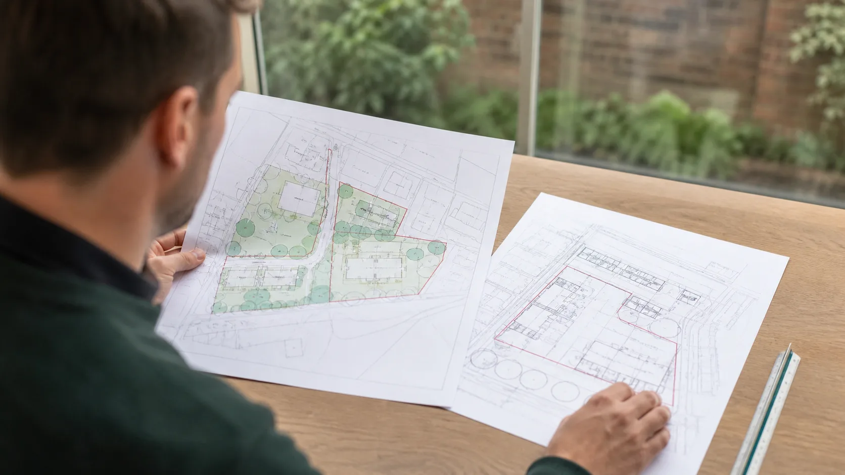
The most useful detailed scale is the one that keeps the proposal and its key relationships readable.
The practical difference
| Scale | 1 cm on paper represents | Typical use |
|---|---|---|
| 1:500 | 5 metres | General block or site plan |
| 1:200 | 2 metres | Closer detail on a compact or complex site |
At 1:200, a wall, narrow access strip or small gap occupies more space on the drawing. That can make relationships easier to understand. But a long garden, rural access or neighbouring context may no longer fit on the same sheet.
When 1:500 is usually suitable
A 1:500 plan is often appropriate when the council asks for a block plan or site plan and the property has a conventional domestic layout. It can usually show:
- The existing house and outbuildings.
- The proposed extension or structure.
- The plot boundary and access.
- Nearby buildings.
- Driveways, parking and hardstanding.
- Relevant trees, walls, hedges or fences.
It gives the planning officer a readable relationship between the proposal and the rest of the site without zooming so closely that the wider plot disappears.
When 1:200 may be better
Consider 1:200 where:
- The plot is compact but contains several features.
- The extension is close to a boundary.
- Access, parking or visibility needs careful explanation.
- The council specifically asks for a 1:200 site plan.
- The designer needs a closer base for annotations.
The smaller ground coverage is the main limitation. If the plan cuts off the site, road access or relevant neighbouring structures, the extra detail is not helping.
Read the council wording carefully
Authorities do not always use the same label. A checklist may ask for a “block plan”, “site plan”, “site layout plan” or “existing and proposed site plan”. The description underneath the heading matters more than the title alone.
Look for clues about:
- Required scale.
- Paper size.
- Existing and proposed information.
- Access and parking.
- Trees, landscaping or boundary treatment.
- Whether a separate location plan is also required.
If the checklist names 1:200, use that instruction. If it gives a choice, use the scale that keeps the proposal and the relevant site context legible.
What the closer plan should show
The exact drawing content depends on the proposal, but a useful detailed plan commonly includes:
- Existing building footprints.
- Proposed work clearly distinguished from existing features.
- Site boundaries and relevant ownership boundaries.
- Access, driveways, parking and turning areas.
- Adjacent buildings where they help explain the relationship.
- Trees, walls, fences, hedges or other features requested by the authority.
- North point and scale bar.
- The stated scale and paper size.
A map base does not replace architectural information. It gives the proposal a measured geographic foundation; the designer remains responsible for the proposed dimensions and construction detail.
Do not force one plan to do both jobs
A 1:1250 location plan needs surrounding streets and landmarks. A 1:500 or 1:200 site plan needs local detail. Combining the two jobs into a single compromise scale often produces a sheet that is neither easy to locate nor easy to assess.
For most householder work, the practical combination is:
| Document | Purpose |
|---|---|
| 1:1250 location plan | Locate the property in the surrounding area |
| 1:500 block plan | Show the proposal and plot relationship |
| 1:200 plan, where needed | Show closer detail on a compact or complex site |
Order the maps through the same planning-map workflow where possible so the address and red boundary remain consistent.
Final check before submission
Whichever scale you choose, open the final file and ask:
- Is the entire proposal visible?
- Can the officer see its relationship to the boundary?
- Is the access clear?
- Are important neighbouring features included?
- Is the scale stated and supported by a scale bar?
- Does the paper size match the PDF?
A 1:200 plan is not automatically more compliant than a 1:500 plan. The correct drawing is the one that follows the council's request and communicates the proposal without crowding or unnecessary empty space.
A measured comparison
The scale number tells you how much real-world distance is compressed onto the page. At 1:200, 1 cm represents 2 m; at 1:500, it represents 5 m. A 20 m garden therefore occupies 100 mm at 1:200 but only 40 mm at 1:500. That extra room can make annotations and small offsets easier to read, but it also reduces the surrounding context that fits on the sheet.
| Design question | 1:200 often helps when… | 1:500 often helps when… |
|---|---|---|
| Small clearances | tight relationships need to remain legible | dimensions on a separate drawing carry the detail |
| Whole-plot context | the site is compact | the garden, drive and neighbours need one view |
| Parking and turning | the manoeuvre area is small and annotated | several spaces or a larger yard must be shown |
| Boundaries and trees | individual features are close together | the overall relationship matters more |
The Planning Portal comparison of location and site plans describes 1:200 and 1:500 as typical site-plan scales. Its supporting guidance also expects relevant buildings, streets and boundaries to be shown. It does not create a rule that every small proposal must use 1:200 or every house must use 1:500.
Run a legibility test, not a zoom test
Digital viewers make almost any PDF look detailed because the user can zoom. Validation drawings still need a declared scale and a sensible sheet. Test the plan at its intended page size and ask whether the proposal, site edge and adjoining features can be read together.
If 1:200 clips the end of a drive or removes the neighbouring building that explains the design, moving closer has made the drawing less informative. If 1:500 compresses labels into a knot around a tiny courtyard, the wider view is also failing. Choose the smallest scale number that adds useful detail without losing the context needed to assess the proposal.
What the base map cannot prove
A detailed OS map is a dependable spatial base, but it is not a measured topographical survey and it does not establish the exact legal boundary. Features may have changed since the mapping update, and fine level differences will not appear on a conventional block plan. Verify critical dimensions on site and commission the appropriate survey where design or legal risk depends on centimetres.
HM Land Registry makes the related ownership point clearly: most title plans show general rather than exact boundaries. Do not scale a title plan to settle a fence-line disagreement, and do not present a planning block plan as evidence that it has done so.
A defensible scale note
For professional submissions, record why the chosen scale works: for example, “1:500 selected to show the full access, proposed extension and both neighbouring buildings on A3; detailed setting-out dimensions are provided on drawing A-102.” That one sentence shows deliberate coordination and helps the reviewer understand which document answers which question.
For a homeowner, the same reasoning can stay informal. Preview both scales, compare what disappears, read the council’s current validation list and keep the scale bar visible. The correct choice should be explainable in plain English.
Worked choice: a rear extension on a long plot
At 1:200, the house and proposed extension may be beautifully clear, but the bottom of a long garden and the access from a side lane could fall off the sheet. At 1:500, the whole plot and neighbours fit comfortably, although small offsets around the extension become harder to annotate.
The answer may be a 1:500 proposed site plan plus dimensioned 1:100 or 1:50 architectural plans—not forcing the block plan to do every job. If the authority specifically requests a 1:200 site plan, use a larger sheet or a carefully defined companion view so the lost context is still available.
Ask what a reviewer needs to measure from each document. Boundaries, access and overall site relationships belong on the site plan. Wall thicknesses, openings and construction dimensions belong on the architectural drawings. Critical existing features may require a measured survey.
Questions about mixed scales
It is acceptable for a coordinated pack to contain different scales when every sheet declares its own scale and purpose. Problems arise when a detail is enlarged without relabelling, when a PDF is resized after export or when two drawings show inconsistent geometry.
Keep a graphical scale bar on mapping outputs and issue the original PDF at its intended paper size. If you add an inset, label the inset scale separately. This small discipline prevents a closer diagram from being mistaken for the scale of the whole page.
The Mathematics of Ground Coverage: A4 vs A3 at 1:500 and 1:200
To avoid ordering the wrong map size, you can calculate the exact maximum ground footprint that will fit on your chosen paper size after deducting title block and margin allowances:
| Paper Size & Scale | Usable Map Window | Maximum Ground Dimensions | Total Ground Area Covered | Typical Best Fit |
|---|---|---|---|---|
| A4 at 1:500 | 190mm × 220mm | 95m × 110m | ~1.04 hectares (2.5 acres) | Suburban semi or detached plot with full garden and street frontage |
| A4 at 1:200 | 190mm × 220mm | 38m × 44m | ~0.17 hectares (1,672 m²) | Compact terraced plot or tight courtyard extension |
| A3 at 1:500 | 270mm × 340mm | 135m × 170m | ~2.29 hectares (5.6 acres) | Large residential plot, multiple dwellings, or rural building group |
| A3 at 1:200 | 270mm × 340mm | 54m × 68m | ~0.37 hectares (3,672 m²) | Complex suburban plot where 1:200 is mandatory but plot exceeds 40m |
The 40-Metre Plot Warning
If your domestic property has a 10m front drive, a 12m house depth, and a 25m rear garden, your total plot depth is 47 metres.
- If you order an A4 1:200 site plan (maximum depth 44m), your rear boundary or front highway connection will be cropped off the page.
- You must either select 1:500 on A4 or upgrade to 1:200 on A3 to maintain compliance.
When Local Councils Mandate 1:200 Scale
While 1:500 is accepted across 90% of UK local planning authorities for standard domestic applications, councils' Local Validation Checklists (LVC) invoke mandatory 1:200 scale under specific circumstances:
- Sub-1-Metre Boundary Clearances: If a proposed side extension or two-storey flank wall is situated within 1,000mm (1.0m) of a neighbouring curtilage boundary, case officers cannot reliably verify building separation or foundation overhangs on a 1:500 map. A 1:200 plan is demanded to display exact millimetre clearances.
- Vehicular Visibility Splays and Highway Crossings: Where an application involves a new vehicle crossover onto a classified road, highway engineers require 1:200 plans to plot sightline triangles (e.g., $2.4\text{m} \times 43\text{m}$ splays under Manual for Streets). At 1:500, a 2.4m "X-distance" measures less than 5mm on paper, making sightline audits imprecise.
- Heritage and Conservation Areas: Alterations to listed buildings, shopfront replacements, or historic courtyard infills where architectural relationships to adjacent historic party walls must be recorded in fine detail.
CAD Lineweights and Text Scaling Rules (ISO 128)
When preparing or printing 1:500 and 1:200 site plans in architectural CAD software (AutoCAD, Vectorworks, or Revit), scaling errors frequently ruin drawing legibility:
- Text Height Scaling: Text intended to be 2.5mm high when printed must be drawn at 1,250mm in model space for a 1:500 drawing, but at 500mm for a 1:200 drawing. If you reuse annotations between scales without annotative scaling, text will either appear gigantic or shrink into unreadable specks.
- Lineweight Standards: Follow ISO 128 drafting standards. Property boundaries should use a 0.50mm or 0.70mm pen weight, existing building lines 0.35mm, and hatching/dimension lines 0.18mm. On a 1:500 plan, heavy lineweights can bleed together, obscuring narrow 300mm wall cavities.
The Coordinated Hybrid Strategy
For challenging sites, the most effective professional solution is a Coordinated Dual-Scale Submission:
- Submit an overall 1:500 Block Plan that captures the entire property curtilage, long private access drive, septic tank soakaway, and highway junction.
- Provide a secondary 1:200 Detailed Inset (or standalone Drawing Sheet PL-002) focusing exclusively on the proposed extension footprint, showing exact dimensioned offsets from the flank boundary and adjacent protected trees.
This hybrid approach satisfies the validation officer's need for full legal plot context while giving the case officer the fine-grained clarity needed to assess daylight and boundary impacts.