
A garden room, home office, garage or other outbuilding may be physically small, but the planning map still needs to show how it sits within the property. The authority needs to identify the site, understand access and assess the relationship between the new structure, the house and neighbouring boundaries.
For many applications, the useful combination is a site location plan and a detailed block plan.
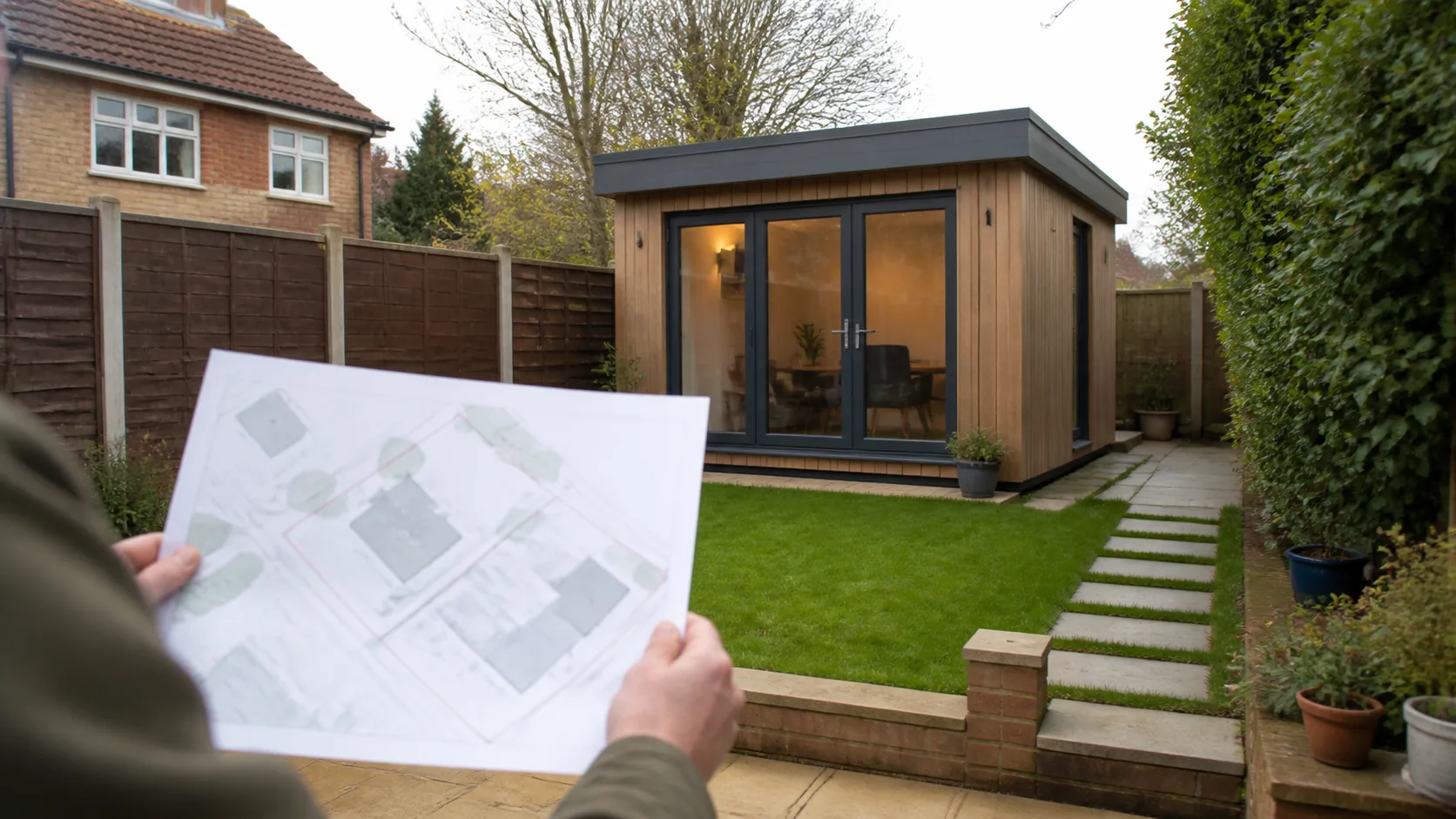
A detailed plan helps show how an outbuilding sits in relation to the house, garden and boundaries.
Start with the whole application site
Do not automatically draw the red line around the new building alone. For a typical domestic application, the application site may include the house, garden, driveway and access connected with the proposal.
Ask whether the application also concerns:
- A new path or driveway.
- Parking or turning changes.
- Drainage or utility work.
- A shared access route.
- Landscaping, fencing or boundary treatment.
- Removal of an existing garage or structure.
The red line should describe the land to which the proposal relates. Make it consistent across the form, location plan, block plan and drawings.
What the location plan does
The wider location plan, commonly at 1:1250, places the property among surrounding roads and buildings. It should make the correct house or plot easy to identify, particularly where several properties have similar layouts.
Check the address, road names, north point, scale bar and licence information. If the property is rural or access is long, use a wider view where necessary while keeping the site and route legible.
What the block plan does
The detailed block plan, commonly at 1:500, shows the outbuilding in relation to:
- The existing house.
- Plot boundaries.
- Garden areas.
- Driveway and access.
- Nearby buildings.
- Trees, walls, fences and hedges.
- Parking and turning areas.
The proposed dimensions, elevations and construction details normally belong on the architectural drawings. The block plan gives those drawings a clear site context.
Permitted development and planning permission
Some outbuildings may fall within permitted-development rules, while others require planning permission or a Lawful Development Certificate. The mapping requirement depends on the route and the authority's checklist.
Do not assume that a small building needs no location information. A certificate or application still needs to identify the site and show the proposal accurately.
Common mistakes
- Drawing the red line only around the garden room.
- Forgetting the access or parking area.
- Showing the outbuilding in a different position on the block plan and elevations.
- Using a title plan or free screenshot as the planning map.
- Selecting 1:1250 when the detailed site relationship is unreadable.
- Printing the map at Fit to Page.
Review the council's requirements before ordering and use the scale chooser if the plot is unusually compact.
Final check
Make sure the property address, red boundary, outbuilding position and access agree across the complete drawing pack. If you need both map views, order them through the same planning map pack workflow so the starting site information remains aligned.
Choosing the useful level of detail
The right map is not necessarily the one with the largest amount of land on the page. For a garden office close to the rear boundary, the detailed relationship between the walls, fences, trees and neighbouring buildings matters most. For a garage reached by a side driveway, the route from the highway, gate and parking arrangement may be more important than distant context.
Consider the proposal in three layers:
- Identity: the location plan proves which property is involved.
- Relationship: the block plan shows the house, outbuilding, boundaries and access together.
- Design: the architectural drawings explain dimensions, materials and appearance.
Keeping those jobs separate makes the pack easier to read. Do not force every dimension onto the map when the drawing set already provides it, but do not omit site features that explain how the building will be used.
Examples of different outbuilding sites
A detached garden room behind a terraced house may need a compact block plan showing the rear garden, shared boundaries and access through the house or side passage. A detached garage on a corner plot may need the street frontage, vehicle entrance, visibility and parking arrangement. A rural workshop may involve a larger red line, an access track and operational yard.
The building label can be simple and factual. Use “proposed garden room” or “existing detached garage” rather than turning the map into a sales illustration. The authority should be able to compare the map with the submitted drawings without translating promotional language.
Before you upload
Ask someone who knows nothing about the project to point to the house, proposal, access and boundary. If they cannot do so quickly, improve the map or add the appropriate companion plan. Then compare the final PDF with the latest site layout and elevations, not an earlier design version.
Check the planning route before drawing conclusions
Some domestic outbuildings may benefit from permitted development rights, but the rules contain limits and conditions and can be restricted by location, building status, previous permissions or an Article 4 direction. Scotland, Wales and Northern Ireland have their own planning systems. For a project in England, start with the Government’s householder permitted-development technical guidance and verify the current position with the local planning authority or a qualified adviser.
A map should not be labelled “permitted development plan” merely because a garden room sounds modest. Decide whether the submission is a planning application, lawful development certificate or another process, then tailor the plan title and evidence to that purpose.
Map the constraints that actually affect the design
| Site condition | Why it matters to the drawing set |
|---|---|
| Corner plot | Two street relationships, access and visibility may need context |
| Listed building or designated land | Separate heritage controls or tighter rights may apply |
| Tree or preservation constraint | Canopy, stem position and root information may need specialist evidence |
| Sloping garden | Height relationships need levels and sections, not just a flat base map |
| Shared access | The application boundary, rights and construction route need coordination |
| Watercourse or flood risk | Additional official data and drainage evidence may be relevant |
Do not crowd all of this onto a generic location plan. Use the detailed plan, survey and supporting documents that match the real constraint.
Describe the outbuilding precisely
“Garden room” can mean a home office, gym, guest room, studio or a building used for a business. The planning implications may turn on the nature and intensity of the use, not the marketing name. Keep the map label factual and make the application description consistent across the form, plans and supporting statement.
For a proposed building, coordinate its footprint with elevations and sections. Check its shortest distance to each relevant boundary, its relationship to the main house and the position of any platform, steps, path, services or altered access that forms part of the proposal.
Know what the base map cannot answer
An OS planning map gives valuable current context, but small sheds, fences or recent landscaping may not be represented exactly as found on site. Verify existing conditions. If the proposal depends on a narrow clearance, do not measure from a title-plan line: HM Land Registry explains that title plans usually show general, not exact, boundaries.
The final test is evidence-led: can the authority identify the land, understand the proposed use and dimensions, and compare the proposal with the relevant planning rules? If the answer depends on a guess, add the right survey, drawing or explanation rather than another decorative annotation.
A small-project worked check
Take a garden office proposed in the rear corner of a semi-detached plot. The block plan should show the main house, proposed footprint, boundaries and nearby buildings at a readable scale. The elevations and section should state the height from the relevant ground level; the site plan alone cannot communicate that accurately on a sloping garden.
Next, confirm the intended use. Occasional home working by an occupier may present a different planning question from staff attending daily, customer visits, deliveries or a separately let commercial workspace. The building name should not hide the actual activity.
Finally, walk the construction and operational route on paper. Does access pass through a shared drive or neighbour’s land? Are trees, drainage or a retained shed affected? Does the red line include all land genuinely forming the application site without swallowing unrelated ownership? These checks often reveal more than choosing between “garden room” and “outbuilding” in the drawing title.
Questions to answer on the final issue
- Are all external dimensions and heights on the proper proposed drawings?
- Is existing ground level clear where height is important?
- Do the floor plan, roof plan, elevations and block plan show the same handedness?
- Is the proposed use described consistently in the form and statement?
- Have site-specific restrictions been checked rather than assumed?
- Can a reviewer distinguish surveyed features from base-map context?
A well-prepared small application should feel proportionate. It needs enough reliable information to answer the real planning question, not the drawing volume of a major project.
The Class E Statutory Rulebook: Avoiding Enforcement Action
The vast majority of garden rooms, pods, and outbuildings are intended to be built under Schedule 2, Part 1, Class E of the Town and Country Planning (General Permitted Development) (England) Order 2015 (GPDO). To qualify, your 1:500 block plan must demonstrate strict compliance with every statutory restriction:
1. The 2.5-Metre Height Trap Within 2 Metres of a Boundary
Under Paragraph E.1(e), if any part of the outbuilding sits within 2.0 metres of any boundary of the curtilage of the dwellinghouse, the maximum overall height of the building cannot exceed 2.5 metres above natural ground level:
- This is the single most common cause of council planning enforcement notices for garden rooms.
- Many pre-fabricated garden office kits are sold at 2.6m or 2.8m external height. If you place one within 2 metres of a rear or side fence, it is unlawful without full planning permission.
- Over 2 Metres Away: If positioned more than 2.0 metres from every boundary, maximum height rises to 4.0 metres for a dual-pitched roof, or 3.0 metres for a flat roof.
2. The 50% Curtilage Coverage Limit
Under Paragraph E.1(b), outbuildings, sheds, and extensions combined cannot cover more than 50% of the total curtilage of the dwellinghouse (excluding the ground area of the original house as it stood on 1 July 1948 or when first built). Your 1:500 block plan should include a site coverage calculation table demonstrating the remaining open garden area.
3. Siting Forward of the Principal Elevation
No outbuilding can be situated on land forward of a wall forming the principal elevation of the original dwellinghouse. If you have a corner plot with two frontages facing roads, outbuildings cannot sit in the front or side garden fronting the highway without full planning permission.
The Legal "Incidental" Test: When an Office Becomes an Annexe
Class E permits buildings required for a purpose "incidental to the enjoyment of the dwellinghouse as such":
- Lawful Incidental Uses: Home gym, home office/study, hobby room, garden tool store, summerhouse, art studio, or sauna.
- Unlawful Under Class E (Primary Living Accommodation): If a garden building contains a separate bedroom, kitchen, and bathroom enabling independent sleeping and living, it ceases to be "incidental" and becomes "primary living accommodation" (or an independent dwelling). Under established case law (Whitehead v Secretary of State for the Environment 1992), primary living spaces cannot be built under Class E and require full planning permission.
Measuring Heights on Sloping Ground on the Block Plan
Where a garden slopes downward toward a rear fence:
- Statutory Datum: Under the GPDO, height is measured from the highest level of the natural ground surface immediately adjacent to the building walls.
- Decking and Raised Platforms: Under Paragraph E.1(h), no veranda, balcony, or raised platform can exceed 300 millimetres (0.3 metres) in height above ground level. If you build a timber deck platform 0.5m off the ground to level out a slope before installing your garden pod, the entire structure becomes unlawful under Permitted Development.
- The Block Plan Requirement: Always indicate existing ground levels and proposed slab/deck levels on your 1:500 plan to confirm that platforms remain within the 300mm statutory limit.